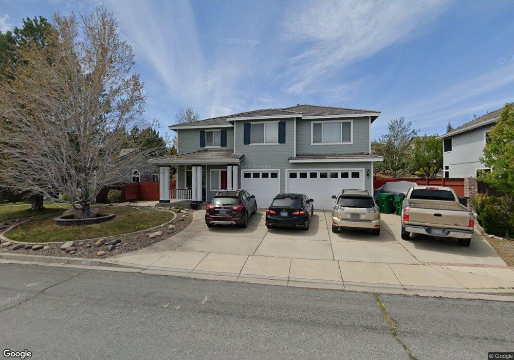
3689 Bozeman Dr Reno, NV 89511
Summit Sierra NeighborhoodEstimated Value: $872,175 - $999,000
5
Beds
3
Baths
2,956
Sq Ft
$322/Sq Ft
Est. Value
About This Home
This home is located at 3689 Bozeman Dr, Reno, NV 89511 and is currently estimated at $952,794, approximately $322 per square foot. 3689 Bozeman Dr is a home located in Washoe County with nearby schools including Ted Hunsburger Elementary School, Marce Herz Middle School, and Galena High School.
Ownership History
Date
Name
Owned For
Owner Type
Purchase Details
Closed on
Nov 10, 2020
Sold by
Mcallester Peter G
Bought by
Mcallester Peter G and Pettie Tina L
Current Estimated Value
Purchase Details
Closed on
Nov 14, 1996
Sold by
Lewis Homes Of Nevada
Bought by
Mcallester Peter G
Home Financials for this Owner
Home Financials are based on the most recent Mortgage that was taken out on this home.
Original Mortgage
$175,400
Interest Rate
8.06%
Create a Home Valuation Report for This Property
The Home Valuation Report is an in-depth analysis detailing your home's value as well as a comparison with similar homes in the area
Home Values in the Area
Average Home Value in this Area
Purchase History
| Date | Buyer | Sale Price | Title Company |
|---|---|---|---|
| Mcallester Peter G | -- | None Available | |
| Mcallester Peter G | $219,500 | Stewart Title |
Source: Public Records
Mortgage History
| Date | Status | Borrower | Loan Amount |
|---|---|---|---|
| Closed | Mcallester Peter G | $175,400 |
Source: Public Records
Tax History
| Year | Tax Paid | Tax Assessment Tax Assessment Total Assessment is a certain percentage of the fair market value that is determined by local assessors to be the total taxable value of land and additions on the property. | Land | Improvement |
|---|---|---|---|---|
| 2026 | -- | $157,201 | $64,960 | $92,241 |
| 2024 | $3,707 | $146,609 | $51,310 | $95,299 |
| 2023 | $3,599 | $147,567 | $57,015 | $90,552 |
| 2022 | $3,495 | $123,302 | $47,635 | $75,667 |
| 2021 | $3,393 | $115,479 | $40,005 | $75,474 |
| 2020 | $3,292 | $112,332 | $36,575 | $75,757 |
| 2019 | $3,196 | $107,311 | $33,740 | $73,571 |
| 2018 | $3,104 | $98,065 | $26,075 | $71,990 |
| 2017 | $3,010 | $98,322 | $26,075 | $72,247 |
| 2016 | $2,934 | $96,807 | $22,785 | $74,022 |
| 2015 | $2,928 | $96,122 | $22,505 | $73,617 |
| 2014 | $2,843 | $90,256 | $19,670 | $70,586 |
| 2013 | -- | $85,173 | $15,680 | $69,493 |
Source: Public Records
Map
Nearby Homes
- 4447 White Fish Dr
- 1770 Kodiak Cir
- 409 Solitude Ct
- 3640 Aspen Hollow
- 14535 S Quiet Meadow Dr
- 735 Summer Star Place
- 15509 Quicksilver Dr
- 2220 Whites Creek Ln
- 17000 Wedge Pkwy Unit 1722
- 17000 Wedge Pkwy Unit 1911
- 17000 Wedge Pkwy Unit 425
- 17000 Wedge Pkwy Unit 2625
- 14240 Bandolier Ct
- 14330 E Windriver Ln
- 14275 Black Eagle Ct
- 1200 Springer Ct
- 14315 W Windriver Ln
- 4750 S Saddlehorn Dr Unit 11
- 16070 River Oaks Ct
- 14255 Black Eagle Ct
- 3691 Bozeman Dr
- 3693 Bozeman Dr
- 3685 Bozeman Dr
- 465 Fort Collins Dr
- 3686 Bozeman Dr
- 3714 Calgary Dr
- 3716 Calgary Dr Unit 1
- 3684 Bozeman Dr
- 452 Calgary Ct
- 3688 Bozeman Dr
- 467 Fort Collins Dr
- 3683 Bozeman Dr
- 3682 Bozeman Dr
- 3690 Bozeman Dr
- 448 Calgary Ct Unit 1
- 469 Fort Collins Dr
- 3695 Bozeman Dr
- 3680 Bozeman Dr
- 3692 Bozeman Dr
- 3681 Bozeman Dr
Your Personal Tour Guide
Ask me questions while you tour the home.