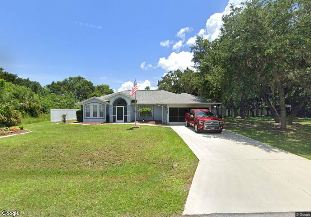
3689 Lothair Ave North Port, FL 34287
Estimated Value: $295,000 - $335,000
3
Beds
2
Baths
1,429
Sq Ft
$223/Sq Ft
Est. Value
About This Home
This home is located at 3689 Lothair Ave, North Port, FL 34287 and is currently estimated at $318,560, approximately $222 per square foot. 3689 Lothair Ave is a home located in Sarasota County with nearby schools including North Port High School, Cranberry Elementary School, and Heron Creek Middle School.
Ownership History
Date
Name
Owned For
Owner Type
Purchase Details
Closed on
Aug 28, 2008
Sold by
Holton Mary and Holton William E
Bought by
Mello Edward and Aiello Joyce
Current Estimated Value
Purchase Details
Closed on
Apr 30, 1999
Sold by
Anfinson Christian F and Anfinson Karin L
Bought by
Mello Edward and Aiello Joyce
Home Financials for this Owner
Home Financials are based on the most recent Mortgage that was taken out on this home.
Original Mortgage
$85,050
Interest Rate
7.06%
Purchase Details
Closed on
Nov 28, 1995
Sold by
Allstate Bldr Sw Fl and Cumming Curtis D
Bought by
Anfinson Christian F
Home Financials for this Owner
Home Financials are based on the most recent Mortgage that was taken out on this home.
Original Mortgage
$82,924
Interest Rate
7.31%
Mortgage Type
FHA
Purchase Details
Closed on
Aug 4, 1993
Sold by
Dart Homes Inc
Bought by
Manatee Land Group Inc
Create a Home Valuation Report for This Property
The Home Valuation Report is an in-depth analysis detailing your home's value as well as a comparison with similar homes in the area
Home Values in the Area
Average Home Value in this Area
Purchase History
| Date | Buyer | Sale Price | Title Company |
|---|---|---|---|
| Mello Edward | $13,500 | Sunbelt Title Agency | |
| Mello Edward | $94,500 | -- | |
| Mello Edward | $94,500 | -- | |
| Anfinson Christian F | $83,000 | -- | |
| Manatee Land Group Inc | $4,000 | -- |
Source: Public Records
Mortgage History
| Date | Status | Borrower | Loan Amount |
|---|---|---|---|
| Previous Owner | Mello Edward | $85,050 | |
| Previous Owner | Anfinson Christian F | $82,924 |
Source: Public Records
Tax History Compared to Growth
Tax History
| Year | Tax Paid | Tax Assessment Tax Assessment Total Assessment is a certain percentage of the fair market value that is determined by local assessors to be the total taxable value of land and additions on the property. | Land | Improvement |
|---|---|---|---|---|
| 2024 | $1,660 | $106,297 | -- | -- |
| 2023 | $1,660 | $103,201 | $0 | $0 |
| 2022 | $1,647 | $100,195 | $0 | $0 |
| 2021 | $1,628 | $97,277 | $0 | $0 |
| 2020 | $1,597 | $95,934 | $0 | $0 |
| 2019 | $1,543 | $93,777 | $0 | $0 |
| 2018 | $1,422 | $92,028 | $0 | $0 |
| 2017 | $1,392 | $90,135 | $0 | $0 |
| 2016 | $1,379 | $134,100 | $10,400 | $123,700 |
| 2015 | $1,389 | $114,300 | $8,200 | $106,100 |
| 2014 | $1,366 | $85,686 | $0 | $0 |
Source: Public Records
Map
Nearby Homes
- 3714 Lothair Ave
- 2903 Pope St
- 0 Tonkin Dr Unit O6075861
- 2576 Pecan St
- 0 Nimbus Dr Unit MFRC7513303
- 3956 Fairchild Ave
- 0 Wooley Ave Unit A4539985
- 0 Wooley Ave Unit A4539983
- 3300 S Salford Blvd
- 0 Channing Ave Unit MFRA4640604
- 0 Town Terrace Unit A4486690
- 0 Walmsley Ave Unit MFRA4629289
- 0 Walmsley Ave Unit MFRC7507061
- 3680 Walmsley Ave
- 3005 Briant St
- 2173 Cloras St
- LOT 18 BLK 284 Wooley Ave
- 2273 S Salford Blvd
- 0 Yeadon Terrace
- lot 16BLK 285 Houston Ln
- 3728 Champagne Ave
- 0 Lothair Ave
- 3714 Avenue
- 3772 Champagne Ave
- 3662 Lothair Ave
- 3740 Lothair Ave
- Lothair Ave
- 3636 Lothair Ave
- 3766 Lothair Ave
- 3729 Champagne Ave
- Tonkin Dr
- Tonkin Dr
- Tonkin Dr
- Champagne Ave
- Champagne Ave
- 3707 Champagne Ave
- 3793 Lothair Ave
- 3773 Champagne Ave
- 3068 Tonkin Dr
- 3050 Tonkin Dr