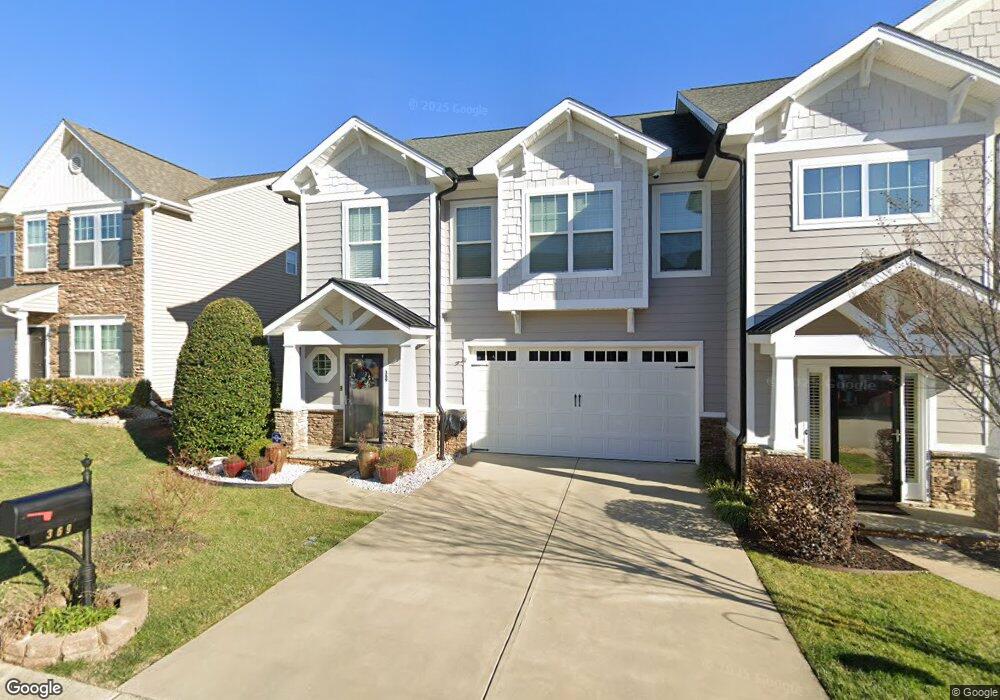
369 Battery Cir Clover, SC 29710
Estimated Value: $404,476 - $422,000
3
Beds
4
Baths
2,716
Sq Ft
$152/Sq Ft
Est. Value
About This Home
This home is located at 369 Battery Cir, Clover, SC 29710 and is currently estimated at $412,619, approximately $151 per square foot. 369 Battery Cir is a home located in York County with nearby schools including Crowders Creek Elementary School, Oakridge Middle School, and Clover High School.
Ownership History
Date
Name
Owned For
Owner Type
Purchase Details
Closed on
Jun 18, 2019
Sold by
Hardin Paul and Hardin Linda
Bought by
Szasz Stella
Current Estimated Value
Purchase Details
Closed on
Feb 8, 2012
Sold by
Jones Robert J and Jones Mary K
Bought by
Hardin Paul and Hardin Linda
Home Financials for this Owner
Home Financials are based on the most recent Mortgage that was taken out on this home.
Original Mortgage
$130,000
Interest Rate
3.75%
Mortgage Type
New Conventional
Create a Home Valuation Report for This Property
The Home Valuation Report is an in-depth analysis detailing your home's value as well as a comparison with similar homes in the area
Home Values in the Area
Average Home Value in this Area
Purchase History
| Date | Buyer | Sale Price | Title Company |
|---|---|---|---|
| Szasz Stella | $265,000 | None Available | |
| Hardin Paul | $200,000 | -- |
Source: Public Records
Mortgage History
| Date | Status | Borrower | Loan Amount |
|---|---|---|---|
| Previous Owner | Hardin Paul | $130,000 |
Source: Public Records
Tax History
| Year | Tax Paid | Tax Assessment Tax Assessment Total Assessment is a certain percentage of the fair market value that is determined by local assessors to be the total taxable value of land and additions on the property. | Land | Improvement |
|---|---|---|---|---|
| 2025 | $1,278 | $11,333 | $1,508 | $9,825 |
| 2024 | $1,110 | $9,855 | $1,600 | $8,255 |
| 2023 | $1,136 | $9,842 | $1,600 | $8,242 |
| 2022 | $1,175 | $9,842 | $1,600 | $8,242 |
| 2021 | -- | $9,842 | $1,600 | $8,242 |
| 2020 | $1,114 | $9,842 | $0 | $0 |
| 2019 | $0 | $10,120 | $0 | $0 |
| 2018 | $0 | $0 | $0 | $0 |
| 2017 | -- | $0 | $0 | $0 |
| 2016 | -- | $0 | $0 | $0 |
| 2014 | $3,558 | $0 | $0 | $0 |
| 2013 | $3,558 | $0 | $0 | $0 |
Source: Public Records
Map
Nearby Homes
- 431 Battery Cir
- 370 Battery Cir Unit 20
- 444 Battery Cir
- 5349 Charlotte Hwy
- 294 Carroll Cove
- 335 Carroll Cove
- 162 Misty Woods Dr
- 1715 Curtis Dr
- 1911 Marlin Dr
- 319 Inland Cove Ct
- 447 Leaf Arbor Ct
- 126 Misty Woods Dr
- 121 Misty Woods Dr
- 2678 Landing Pointe Dr
- 5165 Sapp Cir
- 2129 Salem Dr Unit 5
- 2180 Shady Pond Dr
- 1656 Beleek Ridge Ln
- 1727 Mineral Springs Rd
- 256 Boxelder Rd
- 369 Battery Cir Unit 35
- 371 Battery Cir
- 373 Battery Cir
- 373 Battery Cir Unit 373
- 373 Battery Cir Unit 33
- 363 Battery Cir Unit 37
- 375 Battery Cir
- 375 Battery Cir Unit 32
- 383 Battery Cir
- 361 Battery Cir
- 391 Battery Cir
- 370 Battery Cir
- 372 Battery Cir Unit 6
- 372 Battery Cir Unit 6
- 372 Battery Cir
- 368 Battery Cir
- 368 Battery Cir Unit 368
- 368 Battery Cir Unit 1006D
- 393 Battery Cir
- 393 Battery Cir Unit 71
Your Personal Tour Guide
Ask me questions while you tour the home.