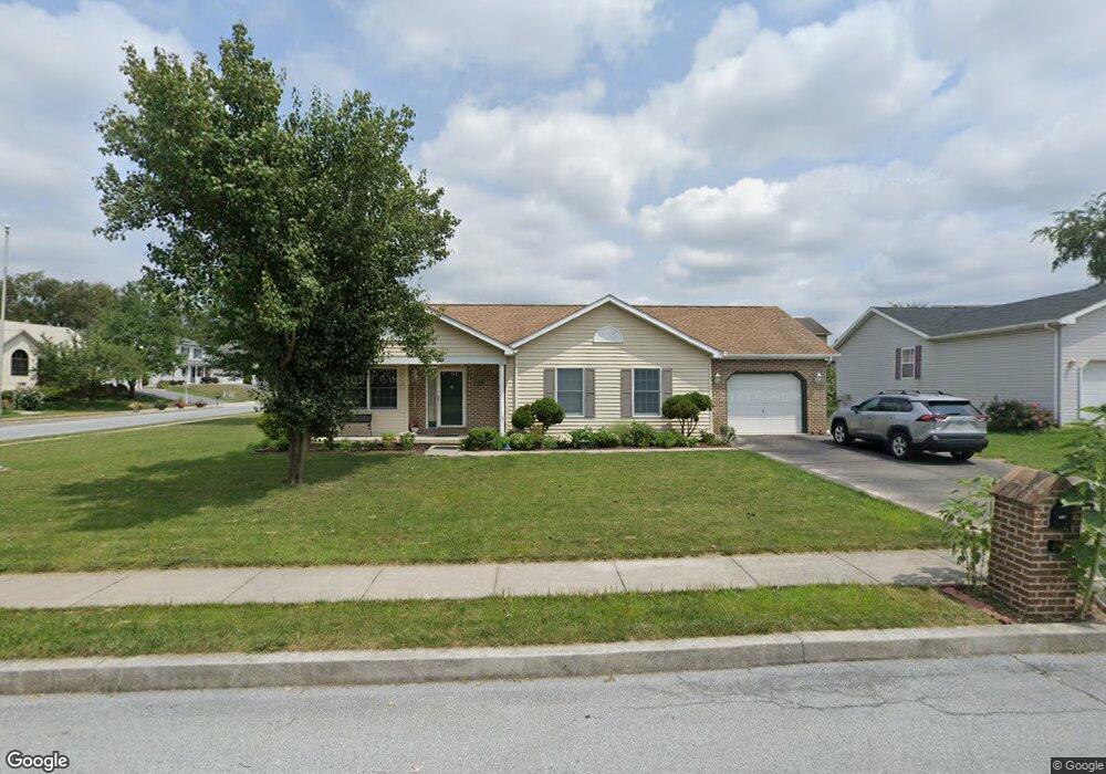
369 Carlton Ave Harrisburg, PA 17111
Estimated Value: $305,349 - $323,000
3
Beds
2
Baths
1,330
Sq Ft
$237/Sq Ft
Est. Value
About This Home
This home is located at 369 Carlton Ave, Harrisburg, PA 17111 and is currently estimated at $314,837, approximately $236 per square foot. 369 Carlton Ave is a home located in Dauphin County with nearby schools including Lawnton Elementary School, Swatara Middle School, and Central Dauphin East Senior High School.
Ownership History
Date
Name
Owned For
Owner Type
Purchase Details
Closed on
Dec 28, 2016
Sold by
Stahl Timothy L
Bought by
Dahal Dharmendra and Dahal Ganga M
Current Estimated Value
Home Financials for this Owner
Home Financials are based on the most recent Mortgage that was taken out on this home.
Original Mortgage
$119,000
Outstanding Balance
$97,559
Interest Rate
3.94%
Mortgage Type
New Conventional
Estimated Equity
$217,278
Create a Home Valuation Report for This Property
The Home Valuation Report is an in-depth analysis detailing your home's value as well as a comparison with similar homes in the area
Home Values in the Area
Average Home Value in this Area
Purchase History
| Date | Buyer | Sale Price | Title Company |
|---|---|---|---|
| Dahal Dharmendra | $191,500 | Attorney |
Source: Public Records
Mortgage History
| Date | Status | Borrower | Loan Amount |
|---|---|---|---|
| Open | Dahal Dharmendra | $119,000 |
Source: Public Records
Tax History Compared to Growth
Tax History
| Year | Tax Paid | Tax Assessment Tax Assessment Total Assessment is a certain percentage of the fair market value that is determined by local assessors to be the total taxable value of land and additions on the property. | Land | Improvement |
|---|---|---|---|---|
| 2025 | $3,867 | $129,600 | $14,700 | $114,900 |
| 2024 | $3,673 | $129,600 | $14,700 | $114,900 |
| 2023 | $3,673 | $129,600 | $14,700 | $114,900 |
| 2022 | $3,673 | $129,600 | $14,700 | $114,900 |
| 2021 | $3,594 | $129,600 | $14,700 | $114,900 |
| 2020 | $3,556 | $129,600 | $14,700 | $114,900 |
| 2019 | $3,571 | $129,600 | $14,700 | $114,900 |
| 2018 | $3,513 | $129,600 | $14,700 | $114,900 |
| 2017 | $3,397 | $129,600 | $14,700 | $114,900 |
| 2016 | $0 | $129,600 | $14,700 | $114,900 |
| 2015 | -- | $129,600 | $14,700 | $114,900 |
| 2014 | -- | $129,600 | $14,700 | $114,900 |
Source: Public Records
Map
Nearby Homes
- 314 Lincoln Ave
- 191 Chartwood Dr
- 364 Hivner Rd
- 69 Delmont Ave
- 730 Harvest Dr
- 0 N 50th St
- 4800 E Circle Dr
- 4917 Lancaster St
- 130 Leonard Ln
- 6321 Huntingdon St
- 6341 Somerset St
- 4818 Derry St
- 1099 Dowhower Rd
- 6436 Ann St
- 5505 Partridge Ct
- 5504 Partridge Ct
- 4610 Derry St
- 5504 Grouse Dr
- 6100 Hocker Dr
- 6520 Derry St
- 359 Carlton Ave
- 370 Harford Ave
- 360 Harford Ave
- 5614 Blakeslee Ave
- 5602 Blakeslee Ave
- 349 Carlton Ave
- 5626 Blakeslee Ave
- 5590 Blakeslee Ave
- 350 Harford Ave
- 5638 Blakeslee Ave
- 5578 Blakeslee Ave
- 358 Carlton Ave
- 358 Carlton Ave
- 379 Harford Ave
- 340 Harford Ave
- 5580 Fulcroft Ave
- 5650 Blakeslee Ave
- 369 Harford Ave
- 359 Harford Ave
- 5559 Blakeslee Ave