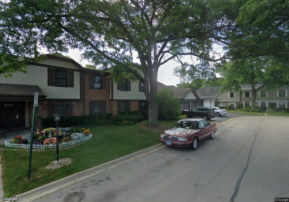
369 Greystone Ct Unit 5167RD Schaumburg, IL 60193
East Schaumburg NeighborhoodEstimated Value: $269,000 - $289,000
2
Beds
--
Bath
1,500
Sq Ft
$187/Sq Ft
Est. Value
About This Home
This home is located at 369 Greystone Ct Unit 5167RD, Schaumburg, IL 60193 and is currently estimated at $280,062, approximately $186 per square foot. 369 Greystone Ct Unit 5167RD is a home located in Cook County with nearby schools including Michael Collins Elementary School, Margaret Mead Junior High School, and J B Conant High School.
Ownership History
Date
Name
Owned For
Owner Type
Purchase Details
Closed on
Oct 14, 2005
Sold by
Kornacki Dolores E and Dolores E Kornacki Trust
Bought by
Wudtke David L and Wudtke Maya D
Current Estimated Value
Home Financials for this Owner
Home Financials are based on the most recent Mortgage that was taken out on this home.
Original Mortgage
$142,100
Interest Rate
6.17%
Mortgage Type
Fannie Mae Freddie Mac
Purchase Details
Closed on
Jun 18, 2002
Sold by
Kornacki Dolores
Bought by
Kornacki Dolores E and Dolores E Kornacki Trust
Create a Home Valuation Report for This Property
The Home Valuation Report is an in-depth analysis detailing your home's value as well as a comparison with similar homes in the area
Home Values in the Area
Average Home Value in this Area
Purchase History
| Date | Buyer | Sale Price | Title Company |
|---|---|---|---|
| Wudtke David L | $189,500 | Pntn | |
| Kornacki Dolores E | -- | -- |
Source: Public Records
Mortgage History
| Date | Status | Borrower | Loan Amount |
|---|---|---|---|
| Previous Owner | Wudtke David L | $142,100 |
Source: Public Records
Tax History Compared to Growth
Tax History
| Year | Tax Paid | Tax Assessment Tax Assessment Total Assessment is a certain percentage of the fair market value that is determined by local assessors to be the total taxable value of land and additions on the property. | Land | Improvement |
|---|---|---|---|---|
| 2024 | $4,413 | $19,069 | $4,639 | $14,430 |
| 2023 | $4,251 | $19,069 | $4,639 | $14,430 |
| 2022 | $4,251 | $19,069 | $4,639 | $14,430 |
| 2021 | $3,644 | $15,354 | $5,943 | $9,411 |
| 2020 | $3,649 | $15,354 | $5,943 | $9,411 |
| 2019 | $3,656 | $17,070 | $5,943 | $11,127 |
| 2018 | $2,511 | $11,802 | $5,001 | $6,801 |
| 2017 | $2,489 | $11,802 | $5,001 | $6,801 |
| 2016 | $2,570 | $11,802 | $5,001 | $6,801 |
| 2015 | $2,234 | $10,091 | $4,349 | $5,742 |
| 2014 | $2,226 | $10,091 | $4,349 | $5,742 |
| 2013 | $2,151 | $10,091 | $4,349 | $5,742 |
Source: Public Records
Map
Nearby Homes
- 1386 Scarboro Rd Unit 1102
- 1385 Scarboro Rd Unit 204
- 274 Buckingham Ct Unit D2
- 1254 Plum Tree Ct Unit A2
- 373 Southbury Ct Unit D-1
- 1264 Williamsburg Dr Unit D2
- 391 Thornhill Ct Unit B1
- 327 Wildberry Ct Unit D2
- 1301 Timberwood Ct Unit D1
- 151 Brookston Dr Unit A2
- 1257 Rosewood Ct Unit D1
- 263 Driftwood Ln Unit 2D
- 1300 Woodside Ct Unit B1
- 15 Bar Harbour Rd Unit 4F
- 26 Egg Harbour Ct
- 307 University Ln Unit A
- 251 University Ln
- 263 Doral Ct Unit 1
- 1771 Vermont Dr
- 1871 Fox Run Dr Unit A
- 369 Greystone Ct Unit 5167RC
- 369 Greystone Ct Unit 5167RC
- 369 Greystone Ct Unit 5167RD
- 369 Greystone Ct Unit C-2
- 369 Greystone Ct Unit C1
- 367 Greystone Ct Unit B2
- 367 Greystone Ct Unit A1
- 367 Greystone Ct Unit B1
- 367 Greystone Ct Unit 5167LB
- 367 Greystone Ct Unit 5167LA
- 367 Greystone Ct Unit 5167LA
- 367 Greystone Ct Unit 5167LB
- 374 Greystone Ct Unit 5169LB
- 374 Greystone Ct Unit 5169LD
- 374 Greystone Ct Unit 5169LD
- 374 Greystone Ct Unit 5169LB
- 374 Greystone Ct Unit D2
- 374 Greystone Ct Unit 1B
- 374 Greystone Ct Unit D-1
- 374 Greystone Ct Unit B1