Estimated Value: $430,634 - $698,000
--
Bed
--
Bath
--
Sq Ft
6,098
Sq Ft Lot
About This Home
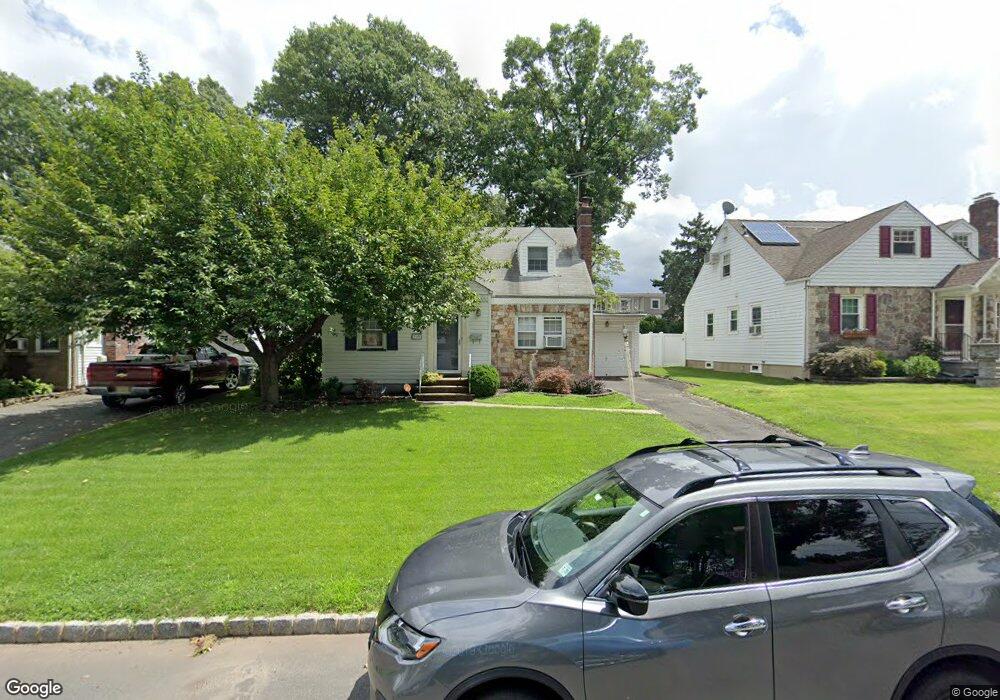
This home is located at 369 Huntington Rd, Union, NJ 07083 and is currently estimated at $562,159. 369 Huntington Rd is a home located in Union County with nearby schools including Washington Elementary School and Union High School.
Ownership History
Date
Name
Owned For
Owner Type
Purchase Details
Closed on
May 25, 2003
Sold by
Nick Jeffrey
Bought by
Smith Michael and Smith Donna Gilleece
Current Estimated Value
Home Financials for this Owner
Home Financials are based on the most recent Mortgage that was taken out on this home.
Original Mortgage
$288,000
Outstanding Balance
$122,797
Interest Rate
5.53%
Estimated Equity
$439,362
Purchase Details
Closed on
May 23, 1997
Sold by
Tropeano Joseph and Tropeano Margaret M
Bought by
Nick Jeffrey and Nick Monica
Create a Home Valuation Report for This Property
The Home Valuation Report is an in-depth analysis detailing your home's value as well as a comparison with similar homes in the area
Home Values in the Area
Average Home Value in this Area
Purchase History
| Date | Buyer | Sale Price | Title Company |
|---|---|---|---|
| Smith Michael | $320,000 | -- | |
| Nick Jeffrey | $190,000 | Congress Title Corp |
Source: Public Records
Mortgage History
| Date | Status | Borrower | Loan Amount |
|---|---|---|---|
| Open | Smith Michael | $288,000 |
Source: Public Records
Tax History Compared to Growth
Tax History
| Year | Tax Paid | Tax Assessment Tax Assessment Total Assessment is a certain percentage of the fair market value that is determined by local assessors to be the total taxable value of land and additions on the property. | Land | Improvement |
|---|---|---|---|---|
| 2025 | $11,667 | $52,200 | $21,000 | $31,200 |
| 2024 | $11,311 | $52,200 | $21,000 | $31,200 |
| 2023 | $11,311 | $52,200 | $21,000 | $31,200 |
| 2022 | $10,918 | $52,200 | $21,000 | $31,200 |
| 2021 | $10,654 | $52,200 | $21,000 | $31,200 |
| 2020 | $10,441 | $52,200 | $21,000 | $31,200 |
| 2019 | $10,301 | $52,200 | $21,000 | $31,200 |
| 2018 | $10,125 | $52,200 | $21,000 | $31,200 |
| 2017 | $9,975 | $52,200 | $21,000 | $31,200 |
| 2016 | $9,732 | $52,200 | $21,000 | $31,200 |
| 2015 | $9,571 | $52,200 | $21,000 | $31,200 |
| 2014 | $9,356 | $52,200 | $21,000 | $31,200 |
Source: Public Records
Map
Nearby Homes
- 403 Foxwood Rd
- 321 Salem Rd
- 536 Lehigh Ave
- 341 Trotting Rd
- 819 Greenwich Ln
- 277 Newark Ave
- 686 Gates Terrace
- 619 Spruce St
- 578 Winchester Ave
- 201 E Lincoln Ave
- 255 Tucker Ave Unit 233
- 255 Tucker Ave Unit 204
- 233 Monticello St
- 504 E Lincoln Ave
- 173 E Webster Ave
- 275 Clermont Terrace
- 45 E Webster Ave
- 38 W Colfax Ave
- 214 Washington Ave
- 825 Elm St
- 363 Huntington Rd
- 373 Huntington Rd
- 366 Martin Rd
- 360 Martin Rd
- 377 Huntington Rd
- 370 Martin Rd
- 359 Huntington Rd
- 366 Huntington Rd
- 356 Martin Rd
- 370 Huntington Rd
- 362 Huntington Rd
- 372 Martin Rd
- 383 Huntington Rd
- 376 Huntington Rd
- 358 Huntington Rd
- 352 Martin Rd
- 382 Martin Rd
- 351 Huntington Rd
- 382 Huntington Rd
- 352 Huntington Rd