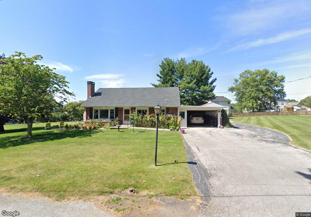
369 Martin Dr Hanover, PA 17331
Estimated Value: $266,000 - $295,000
3
Beds
2
Baths
1,296
Sq Ft
$217/Sq Ft
Est. Value
About This Home
This home is located at 369 Martin Dr, Hanover, PA 17331 and is currently estimated at $281,447, approximately $217 per square foot. 369 Martin Dr is a home located in York County with nearby schools including South Western Senior High School and Hope Christian School Of Hanover.
Ownership History
Date
Name
Owned For
Owner Type
Purchase Details
Closed on
Mar 10, 2022
Sold by
Martin Drive Llc
Bought by
Morris Judith K
Current Estimated Value
Home Financials for this Owner
Home Financials are based on the most recent Mortgage that was taken out on this home.
Original Mortgage
$180,000
Outstanding Balance
$168,178
Interest Rate
3.92%
Mortgage Type
New Conventional
Estimated Equity
$113,269
Purchase Details
Closed on
Dec 1, 2004
Sold by
Estate Of Levere F Sheaffer and Sheaffer Douglas
Bought by
Martin Drive Llc
Create a Home Valuation Report for This Property
The Home Valuation Report is an in-depth analysis detailing your home's value as well as a comparison with similar homes in the area
Home Values in the Area
Average Home Value in this Area
Purchase History
| Date | Buyer | Sale Price | Title Company |
|---|---|---|---|
| Morris Judith K | $225,000 | None Listed On Document | |
| Martin Drive Llc | $155,000 | -- |
Source: Public Records
Mortgage History
| Date | Status | Borrower | Loan Amount |
|---|---|---|---|
| Open | Morris Judith K | $180,000 |
Source: Public Records
Tax History Compared to Growth
Tax History
| Year | Tax Paid | Tax Assessment Tax Assessment Total Assessment is a certain percentage of the fair market value that is determined by local assessors to be the total taxable value of land and additions on the property. | Land | Improvement |
|---|---|---|---|---|
| 2025 | $5,249 | $155,770 | $36,850 | $118,920 |
| 2024 | $5,249 | $155,770 | $36,850 | $118,920 |
| 2023 | $5,156 | $155,770 | $36,850 | $118,920 |
| 2022 | $5,045 | $155,770 | $36,850 | $118,920 |
| 2021 | $4,770 | $155,770 | $36,850 | $118,920 |
| 2020 | $4,770 | $155,770 | $36,850 | $118,920 |
| 2019 | $4,678 | $155,770 | $36,850 | $118,920 |
| 2018 | $4,616 | $155,770 | $36,850 | $118,920 |
| 2017 | $4,510 | $155,770 | $36,850 | $118,920 |
| 2016 | $0 | $155,770 | $36,850 | $118,920 |
| 2015 | -- | $155,770 | $36,850 | $118,920 |
| 2014 | -- | $155,770 | $36,850 | $118,920 |
Source: Public Records
Map
Nearby Homes
- 345 Jasmine Dr
- 366 Jasmine Dr
- 113 Timber Ln
- 2287 Grandview Rd
- 2 Astoria Dr
- 6 Amanda Ave
- 758 Bankert Rd
- 265 Breezewood Dr
- 125 Northview Dr
- 36 Overlook Dr
- 1120 Hoff Rd
- 1010 Marietta Ave
- 3021 Grandview Rd
- 381 Sonny St
- 103 Overlook Dr
- 18 Quail Ridge Rd
- 208 Overlook Dr
- 501 Charles Ave
- 408 Wirt Ave
- 920 Baltimore St
- 359 Martin Dr
- 379 Martin Dr
- 353 Jasmine Dr
- 357 Jasmine Dr
- 349 Jasmine Dr
- 370 Martin Dr
- 380 Martin Dr
- 361 Jasmine Dr
- 360 Martin Dr
- 2111 Grandview Rd
- 2123 Grandview Rd
- 354 Jasmine Dr
- 8 Graybill Ct
- 6 Graybill Ct
- 348 Jasmine Dr
- 365 Jasmine Dr
- 360 Jasmine Dr
- 2137 Grandview Rd
- 10 Graybill Ct
- 341 Jasmine Dr