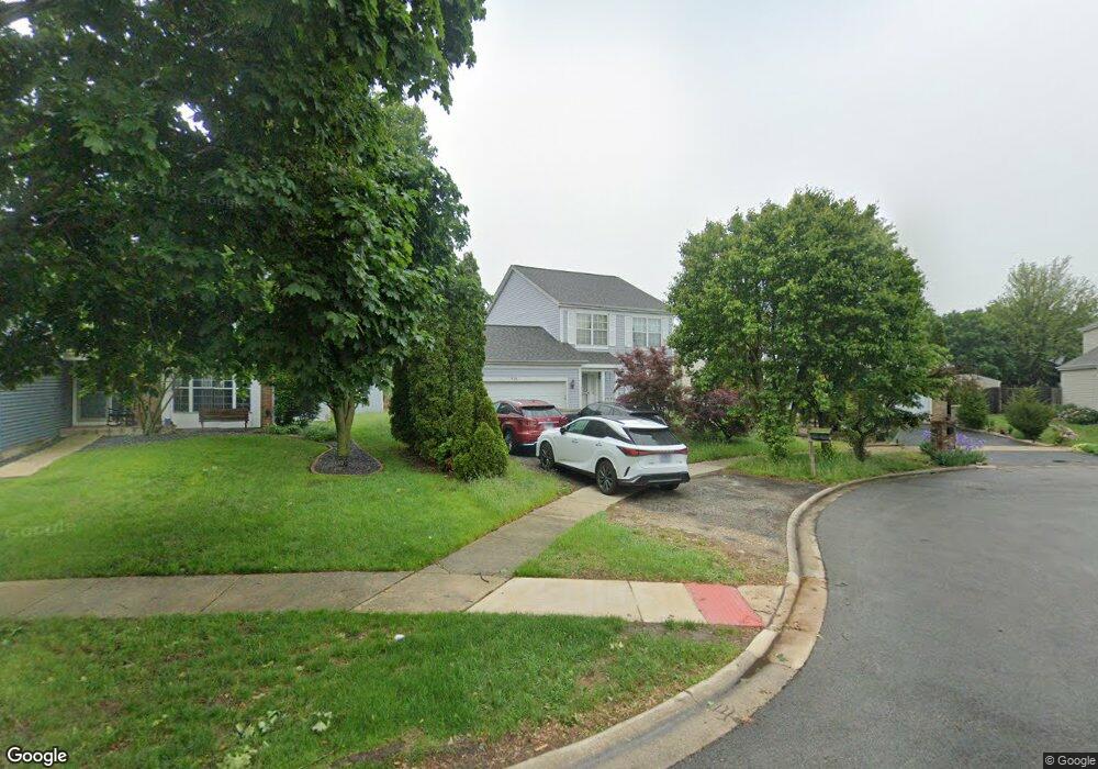
369 Meadowlark Dr Unit 2 Bolingbrook, IL 60440
East Bolingbrook NeighborhoodEstimated Value: $339,535 - $368,000
3
Beds
2
Baths
1,438
Sq Ft
$247/Sq Ft
Est. Value
About This Home
This home is located at 369 Meadowlark Dr Unit 2, Bolingbrook, IL 60440 and is currently estimated at $355,634, approximately $247 per square foot. 369 Meadowlark Dr Unit 2 is a home located in Will County with nearby schools including Independence Elementary School, Jane Addams Middle School, and Bolingbrook High School.
Ownership History
Date
Name
Owned For
Owner Type
Purchase Details
Closed on
Apr 25, 2002
Sold by
Manio Nestor T and Manio Yolanda M
Bought by
Sandiego Tristan M and Sandiego Carmen M
Current Estimated Value
Home Financials for this Owner
Home Financials are based on the most recent Mortgage that was taken out on this home.
Original Mortgage
$172,296
Outstanding Balance
$72,749
Interest Rate
7.07%
Mortgage Type
FHA
Estimated Equity
$282,885
Purchase Details
Closed on
Oct 27, 1995
Sold by
Oak Brook Bank
Bought by
Manio Nestor T and Manio Yolanda M
Home Financials for this Owner
Home Financials are based on the most recent Mortgage that was taken out on this home.
Original Mortgage
$120,655
Interest Rate
7.44%
Mortgage Type
FHA
Create a Home Valuation Report for This Property
The Home Valuation Report is an in-depth analysis detailing your home's value as well as a comparison with similar homes in the area
Home Values in the Area
Average Home Value in this Area
Purchase History
| Date | Buyer | Sale Price | Title Company |
|---|---|---|---|
| Sandiego Tristan M | $175,000 | -- | |
| Manio Nestor T | $127,500 | -- |
Source: Public Records
Mortgage History
| Date | Status | Borrower | Loan Amount |
|---|---|---|---|
| Open | Sandiego Tristan M | $172,296 | |
| Previous Owner | Manio Nestor T | $120,655 |
Source: Public Records
Tax History Compared to Growth
Tax History
| Year | Tax Paid | Tax Assessment Tax Assessment Total Assessment is a certain percentage of the fair market value that is determined by local assessors to be the total taxable value of land and additions on the property. | Land | Improvement |
|---|---|---|---|---|
| 2024 | $7,772 | $92,158 | $18,896 | $73,262 |
| 2023 | $7,772 | $82,921 | $17,002 | $65,919 |
| 2022 | $7,268 | $74,757 | $15,328 | $59,429 |
| 2021 | $6,433 | $69,899 | $14,332 | $55,567 |
| 2020 | $6,231 | $67,601 | $13,861 | $53,740 |
| 2019 | $6,024 | $64,382 | $13,201 | $51,181 |
| 2018 | $5,777 | $61,621 | $12,635 | $48,986 |
| 2017 | $5,493 | $58,408 | $11,976 | $46,432 |
| 2016 | $5,327 | $55,600 | $11,400 | $44,200 |
| 2015 | $5,083 | $53,300 | $10,900 | $42,400 |
| 2014 | $5,083 | $51,800 | $10,600 | $41,200 |
| 2013 | $5,083 | $57,600 | $11,800 | $45,800 |
Source: Public Records
Map
Nearby Homes
- 465 Bloomfield Dr Unit 1
- 528 Alcott Ln
- 545 Old Stone Rd
- 210 Mill Stream Dr
- 321 Whispering Ct Unit 331
- 577 Greystone Ln
- 531 Hillcrest Dr
- 308 Fieldstone Ct Unit 1
- 321 Candlelight Ct Unit 111
- 372 Windsong Ct Unit 4110
- 164 Galewood Dr
- 2V Fernwood Dr
- 207 Hampdon Ct
- 508 Foxborough Trail
- 129 Galewood Dr
- 135 Springleaf Dr
- 5 Fernwood Dr
- 6 Fernwood Dr Unit 6
- 10 Fernwood Dr Unit L
- 14 Fernwood Dr Unit B
- 375 Meadowlark Dr
- 363 Meadowlark Dr Unit 2
- 381 Meadowlark Dr
- 357 Meadowlark Dr
- 351 Meadowlark Dr
- 387 Meadowlark Dr Unit 2
- 374 Meadowlark Dr
- 380 Meadowlark Dr
- 345 Meadowlark Dr Unit 2
- 393 Meadowlark Dr Unit 2
- 386 Meadowlark Dr
- 501 Bloomfield Dr Unit 1
- 368 Meadowlark Dr
- 497 Bloomfield Dr
- 493 Bloomfield Dr
- 339 Meadowlark Dr
- 470 Monarch Ln
- 399 Meadowlark Dr
- 362 Meadowlark Dr
- 489 Bloomfield Dr Unit 1