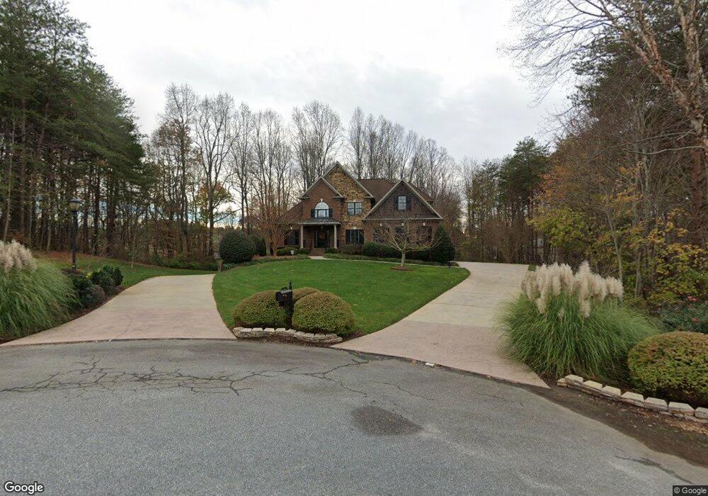
369 Mossy Oak Dr Winston Salem, NC 27127
Estimated Value: $646,000 - $903,000
3
Beds
3
Baths
6,610
Sq Ft
$116/Sq Ft
Est. Value
About This Home
This home is located at 369 Mossy Oak Dr, Winston Salem, NC 27127 and is currently estimated at $767,538, approximately $116 per square foot. 369 Mossy Oak Dr is a home located in Davidson County with nearby schools including Friedberg Elementary School, Oak Grove Middle School, and Oak Grove High School.
Ownership History
Date
Name
Owned For
Owner Type
Purchase Details
Closed on
Dec 13, 2006
Sold by
Landplus Inc
Bought by
Waite Rita S and Rita S Waite Revocable Trust
Current Estimated Value
Purchase Details
Closed on
Jul 19, 2006
Sold by
Scott Isenhour Building Co Inc
Bought by
Waite Rita S and Rita S Waite Revocable Trust
Purchase Details
Closed on
Jun 8, 2005
Sold by
Landplus Inc
Bought by
Scott Isenhour Building Co Inc
Home Financials for this Owner
Home Financials are based on the most recent Mortgage that was taken out on this home.
Original Mortgage
$312,000
Interest Rate
5.66%
Mortgage Type
Construction
Create a Home Valuation Report for This Property
The Home Valuation Report is an in-depth analysis detailing your home's value as well as a comparison with similar homes in the area
Home Values in the Area
Average Home Value in this Area
Purchase History
| Date | Buyer | Sale Price | Title Company |
|---|---|---|---|
| Waite Rita S | $51,000 | None Available | |
| Waite Rita S | $475,000 | None Available | |
| Scott Isenhour Building Co Inc | $59,000 | Chicago Title Insurance Co |
Source: Public Records
Mortgage History
| Date | Status | Borrower | Loan Amount |
|---|---|---|---|
| Previous Owner | Scott Isenhour Building Co Inc | $312,000 |
Source: Public Records
Tax History Compared to Growth
Tax History
| Year | Tax Paid | Tax Assessment Tax Assessment Total Assessment is a certain percentage of the fair market value that is determined by local assessors to be the total taxable value of land and additions on the property. | Land | Improvement |
|---|---|---|---|---|
| 2025 | $3,683 | $558,020 | $0 | $0 |
| 2024 | $3,683 | $558,020 | $0 | $0 |
| 2023 | $3,683 | $558,020 | $0 | $0 |
| 2022 | $3,560 | $558,020 | $0 | $0 |
| 2021 | $3,560 | $558,020 | $0 | $0 |
| 2020 | $3,726 | $584,000 | $0 | $0 |
| 2019 | $3,783 | $584,000 | $0 | $0 |
| 2018 | $3,783 | $584,000 | $0 | $0 |
| 2017 | $3,783 | $584,000 | $0 | $0 |
| 2016 | $3,750 | $579,000 | $0 | $0 |
| 2015 | $3,750 | $579,000 | $0 | $0 |
| 2014 | $3,153 | $492,600 | $0 | $0 |
Source: Public Records
Map
Nearby Homes
- 184 Cale Bradley Ct
- 000 Hickory Tree Rd
- 618 Widaustin Dr
- 748 Widaustin Dr
- 162 Midpines Dr
- 395 Widaustin Dr
- 389 Christine Ct
- 429 Mendenhall Dr
- 245 Christine Ct
- 156 Sentry Ct
- 333 Chandler Dr
- 281 Collingswood Dr
- 1710 S Union Grove Rd
- 1682 S Union Grove Rd
- 411 Falcon Ln
- 418 Falcon Ln
- 403 Falcon Ln
- 400 Falcon Ln
- 397 Falcon Ln
- 382 Falcon Ln