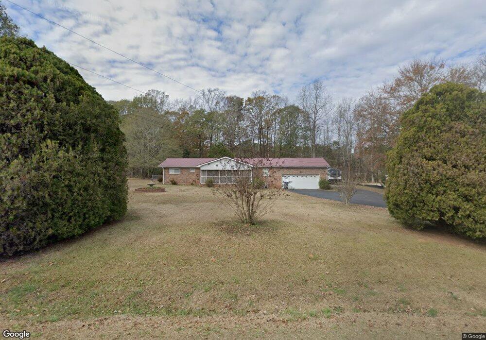
369 N Burson Ave Bogart, GA 30622
Estimated Value: $251,123 - $304,000
--
Bed
--
Bath
1,525
Sq Ft
$177/Sq Ft
Est. Value
About This Home
This home is located at 369 N Burson Ave, Bogart, GA 30622 and is currently estimated at $270,281, approximately $177 per square foot. 369 N Burson Ave is a home located in Clarke County with nearby schools including Cleveland Road Elementary School, Burney-Harris-Lyons Middle School, and Clarke Central High School.
Ownership History
Date
Name
Owned For
Owner Type
Purchase Details
Closed on
Jan 28, 2022
Sold by
Poulnott Ruby M
Bought by
Ebel Travis and Ebel Katie
Current Estimated Value
Home Financials for this Owner
Home Financials are based on the most recent Mortgage that was taken out on this home.
Original Mortgage
$156,000
Outstanding Balance
$144,875
Interest Rate
3.56%
Mortgage Type
VA
Estimated Equity
$125,406
Purchase Details
Closed on
Dec 11, 2007
Sold by
Poulnott Thomas B and Poulnott Ruby M
Bought by
Poulnott Ruby M
Create a Home Valuation Report for This Property
The Home Valuation Report is an in-depth analysis detailing your home's value as well as a comparison with similar homes in the area
Home Values in the Area
Average Home Value in this Area
Purchase History
| Date | Buyer | Sale Price | Title Company |
|---|---|---|---|
| Ebel Travis | $156,000 | -- | |
| Poulnott Ruby M | -- | -- |
Source: Public Records
Mortgage History
| Date | Status | Borrower | Loan Amount |
|---|---|---|---|
| Open | Ebel Travis | $156,000 |
Source: Public Records
Tax History Compared to Growth
Tax History
| Year | Tax Paid | Tax Assessment Tax Assessment Total Assessment is a certain percentage of the fair market value that is determined by local assessors to be the total taxable value of land and additions on the property. | Land | Improvement |
|---|---|---|---|---|
| 2024 | $1,775 | $68,470 | $12,000 | $56,470 |
| 2023 | $972 | $63,872 | $10,400 | $53,472 |
| 2022 | $0 | $51,755 | $10,400 | $41,355 |
| 2021 | $1,492 | $43,958 | $8,800 | $35,158 |
| 2020 | $1,441 | $42,448 | $8,800 | $33,648 |
| 2019 | $1,442 | $41,618 | $8,800 | $32,818 |
| 2018 | $0 | $39,768 | $8,800 | $30,968 |
| 2017 | $1,350 | $39,762 | $8,800 | $30,962 |
| 2016 | $0 | $36,464 | $8,800 | $27,664 |
| 2015 | -- | $36,844 | $8,800 | $28,044 |
| 2014 | -- | $36,810 | $8,800 | $28,010 |
Source: Public Records
Map
Nearby Homes
- 119 S Church St
- 140 Ingobert Place
- 145 S Arcadia Dr
- 350 Huff Lake Rd
- 0 S Burson Ave Unit 1021231
- 0 S Burson Ave Unit 10370338
- 150 Buttercup Ln
- 105 S Arcadia Dr
- 179 St Thomas Place
- 1050 Aiken Rd
- 2157 Day Dr
- 2188 Day Dr
- 1920 Atlanta Hwy
- 1846 Savage Rd
- 1851 McNutt Creek Rd
- 267 Bear Creek Meadows Dr
- 136 Evergreen Ridge Ct
- 105 Tall Tree Rd
- 381 N Burson Ave
- 372 N Burson Ave
- 382 N Burson Ave
- 354 N Burson Ave
- 421 Fowler Mill Rd
- 405 N Burson Ave
- 344 N Burson Ave
- 340 N Burson Ave
- 180 Bernice Dr
- 0 N Burson Ave Unit 1007994
- 0 N Burson Ave Unit 1007993
- 0 N Burson Ave Unit 1007992
- 0 N Burson Ave Unit 3158719
- 0 N Burson Ave Unit 7495301
- 150 Deerwood Ct
- 332 N Burson Ave
- 160 Deerwood Ct
- 227 Fowler Mill Rd
- 100 Hidden Cove Dr