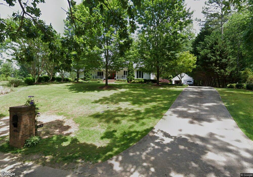
369 Robin Cir Toccoa, GA 30577
Estimated Value: $304,000 - $355,000
3
Beds
3
Baths
2,077
Sq Ft
$157/Sq Ft
Est. Value
About This Home
This home is located at 369 Robin Cir, Toccoa, GA 30577 and is currently estimated at $325,764, approximately $156 per square foot. 369 Robin Cir is a home located in Stephens County with nearby schools including Stephens County High School.
Ownership History
Date
Name
Owned For
Owner Type
Purchase Details
Closed on
Nov 13, 2012
Sold by
Meeks Kathryn
Bought by
Mccurley Kathryn Meeks
Current Estimated Value
Purchase Details
Closed on
Apr 24, 2006
Sold by
Federal National Mortgage Association
Bought by
Meeks Kathryn
Purchase Details
Closed on
Mar 7, 2006
Sold by
Gmac Mtg Corp
Bought by
Federal National Mtg Associati
Purchase Details
Closed on
Mar 4, 2004
Bought by
<Buyer Info Not Present>
Purchase Details
Closed on
Feb 1, 1999
Bought by
<Buyer Info Not Present>
Purchase Details
Closed on
Dec 1, 1993
Bought by
<Buyer Info Not Present>
Create a Home Valuation Report for This Property
The Home Valuation Report is an in-depth analysis detailing your home's value as well as a comparison with similar homes in the area
Purchase History
| Date | Buyer | Sale Price | Title Company |
|---|---|---|---|
| Mccurley Kathryn Meeks | -- | -- | |
| Meeks Kathryn | $150,000 | -- | |
| Federal National Mtg Associati | -- | -- | |
| Gmac Mtg Corp | -- | -- | |
| <Buyer Info Not Present> | -- | -- | |
| <Buyer Info Not Present> | $12,000 | -- | |
| <Buyer Info Not Present> | -- | -- |
Source: Public Records
Tax History
| Year | Tax Paid | Tax Assessment Tax Assessment Total Assessment is a certain percentage of the fair market value that is determined by local assessors to be the total taxable value of land and additions on the property. | Land | Improvement |
|---|---|---|---|---|
| 2025 | $1,608 | $111,489 | $9,030 | $102,459 |
| 2024 | $1,256 | $76,304 | $9,030 | $67,274 |
| 2023 | $1,086 | $71,362 | $9,030 | $62,332 |
| 2022 | $974 | $67,608 | $9,030 | $58,578 |
| 2021 | $892 | $63,428 | $9,030 | $54,398 |
| 2020 | $913 | $63,796 | $9,030 | $54,766 |
| 2019 | $917 | $63,796 | $9,030 | $54,766 |
| 2018 | $917 | $63,796 | $9,030 | $54,766 |
| 2017 | $932 | $63,796 | $9,030 | $54,766 |
| 2016 | $923 | $63,796 | $9,029 | $54,766 |
| 2015 | $968 | $63,817 | $9,029 | $54,788 |
| 2014 | $983 | $63,818 | $9,030 | $54,788 |
| 2013 | -- | $61,429 | $9,029 | $52,400 |
Source: Public Records
Map
Nearby Homes
- 0 Brookhaven Cir Unit 10616964
- 337 Rock Creek Rd
- 1292 Fernside Dr
- 81 Boulder Dr
- 297 Ayers Creek Dr
- 327 Ayers Creek Dr
- 668 Brookdale Rd
- 110 Valley Rd
- 0 E Currahee St Unit 10544607
- 43 Sycamore Dr
- 156 White Pine Rd
- 104-110 White Pine Rd
- 321 Quail Forest Cir
- 28 Memorial Dr
- 148 Moreland Dr
- 551 P S Rd
- 704 Skyline Dr
- 122 King St
- 926 Skyline Dr
- 545 Shady Ln
- 0 Raven Ct Lakeland Unit LT 5M 3067566
- 365 Robin Cir
- 439 Robin Cir
- 349 Robin Cir
- 309 Robin Cir
- 629 Oak Valley Rd
- 319 Oak Valley Rd
- 510 Oak Valley Rd
- 478 Oak Valley Rd
- 261 Oak Valley Rd
- 576 Oak Valley Rd
- 400 Oak Valley Rd
- 681 Oak Valley Rd
- 8 Oak Valley Rd
- 2577 Oak Valley Rd
- 867 Oak Valley Rd
- 2538 Oak Valley Rd
- 35 Robin Cir
- 606 Oak Valley Rd
- 685 Oak Valley Rd
Your Personal Tour Guide
Ask me questions while you tour the home.