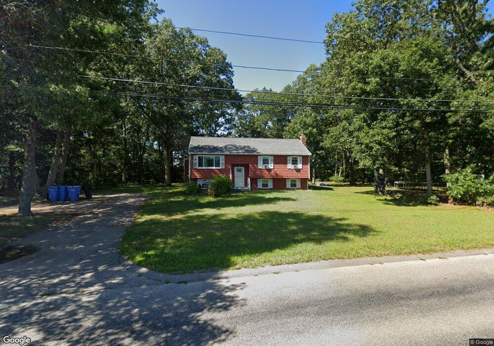
369 Shears St Wrentham, MA 02093
Estimated Value: $579,000 - $675,000
4
Beds
2
Baths
2,008
Sq Ft
$307/Sq Ft
Est. Value
About This Home
This home is located at 369 Shears St, Wrentham, MA 02093 and is currently estimated at $617,237, approximately $307 per square foot. 369 Shears St is a home located in Norfolk County with nearby schools including Delaney Elementary School and Charles E Roderick.
Ownership History
Date
Name
Owned For
Owner Type
Purchase Details
Closed on
Jul 30, 2007
Sold by
Twitchell Susan and Twitchell Ross
Bought by
Bergman Richard A and Bergman Marie
Current Estimated Value
Home Financials for this Owner
Home Financials are based on the most recent Mortgage that was taken out on this home.
Original Mortgage
$231,750
Interest Rate
6.78%
Mortgage Type
Purchase Money Mortgage
Purchase Details
Closed on
May 24, 1999
Sold by
Twitchell Frank H and Twitchell Roberta
Bought by
Twitchell Susan
Create a Home Valuation Report for This Property
The Home Valuation Report is an in-depth analysis detailing your home's value as well as a comparison with similar homes in the area
Purchase History
| Date | Buyer | Sale Price | Title Company |
|---|---|---|---|
| Bergman Richard A | $309,000 | -- | |
| Twitchell Susan | $182,000 | -- |
Source: Public Records
Mortgage History
| Date | Status | Borrower | Loan Amount |
|---|---|---|---|
| Open | Twitchell Susan | $230,395 | |
| Closed | Bergman Richard A | $231,750 | |
| Closed | Bergman Richard A | $77,250 | |
| Previous Owner | Twitchell Susan | $177,000 |
Source: Public Records
Tax History
| Year | Tax Paid | Tax Assessment Tax Assessment Total Assessment is a certain percentage of the fair market value that is determined by local assessors to be the total taxable value of land and additions on the property. | Land | Improvement |
|---|---|---|---|---|
| 2025 | $6,235 | $538,000 | $294,200 | $243,800 |
| 2024 | $5,956 | $496,300 | $294,200 | $202,100 |
| 2023 | $5,608 | $444,400 | $267,400 | $177,000 |
| 2022 | $5,057 | $369,900 | $212,600 | $157,300 |
| 2021 | $4,222 | $300,100 | $180,100 | $120,000 |
| 2020 | $4,493 | $315,300 | $149,000 | $166,300 |
| 2019 | $4,311 | $305,300 | $149,000 | $156,300 |
| 2018 | $4,184 | $293,800 | $149,200 | $144,600 |
| 2017 | $3,953 | $277,400 | $146,300 | $131,100 |
| 2016 | $3,866 | $270,700 | $142,100 | $128,600 |
| 2015 | $3,738 | $249,500 | $136,600 | $112,900 |
| 2014 | $3,696 | $241,400 | $131,300 | $110,100 |
Source: Public Records
Map
Nearby Homes
- 246 Forest Grove Ave
- 0 W Birch Rd
- 8 Ridgefield Rd
- 11 Weber Farm Rd Unit 11
- 8 Weber Farm Rd Unit 8
- 30 Weber Farm Rd Unit 30
- 576 Dedham St
- 11 Sharon Ave
- 9 Sharon Ave
- 45 Joshua Rd
- 287 Park St
- 50 Reed Fulton Ave Unit Lot 61
- 10 Nature View Dr
- 15 Nature View Dr
- 500 Franklin St
- 23 Fredrickson Rd
- 7 Hill St Unit 12
- 7 Hill St Unit 16
- 25 Foxboro Rd
- 75 Foxboro Rd
Your Personal Tour Guide
Ask me questions while you tour the home.