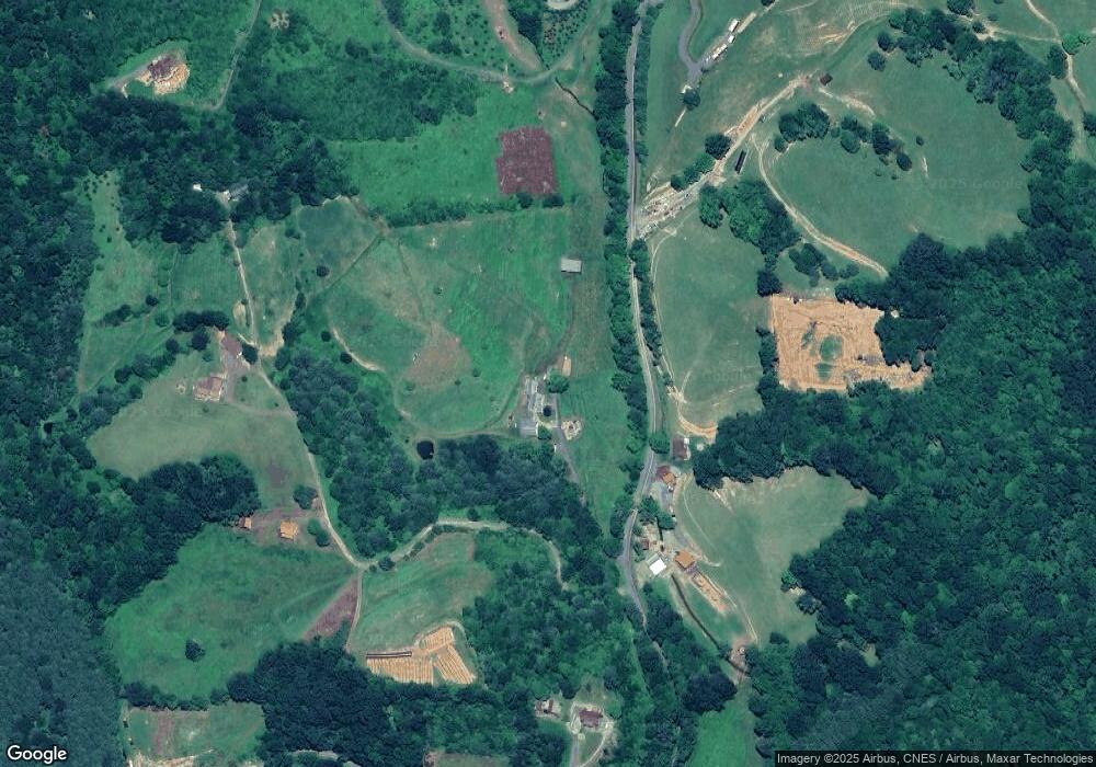
369 Spencer Branch Rd Lansing, NC 28643
Estimated Value: $603,269 - $702,000
--
Bed
--
Bath
3,326
Sq Ft
$195/Sq Ft
Est. Value
About This Home
This home is located at 369 Spencer Branch Rd, Lansing, NC 28643 and is currently estimated at $649,817, approximately $195 per square foot. 369 Spencer Branch Rd is a home with nearby schools including Ashe County High School.
Ownership History
Date
Name
Owned For
Owner Type
Purchase Details
Closed on
Apr 15, 2024
Sold by
Caffey Phyllis Ann and Caffey Billy Gene
Bought by
Caffey Phyllis Ann
Current Estimated Value
Purchase Details
Closed on
Jul 28, 2006
Sold by
Nichlos Robert W and Nichlos Robert W
Bought by
Caffey Billy Gene and Caffey Phyllis Ann
Home Financials for this Owner
Home Financials are based on the most recent Mortgage that was taken out on this home.
Original Mortgage
$280,250
Interest Rate
6.68%
Mortgage Type
New Conventional
Create a Home Valuation Report for This Property
The Home Valuation Report is an in-depth analysis detailing your home's value as well as a comparison with similar homes in the area
Home Values in the Area
Average Home Value in this Area
Purchase History
| Date | Buyer | Sale Price | Title Company |
|---|---|---|---|
| Caffey Phyllis Ann | -- | None Listed On Document | |
| Caffey Billy Gene | $295,000 | -- |
Source: Public Records
Mortgage History
| Date | Status | Borrower | Loan Amount |
|---|---|---|---|
| Previous Owner | Caffey Billy Gene | $280,250 |
Source: Public Records
Tax History Compared to Growth
Tax History
| Year | Tax Paid | Tax Assessment Tax Assessment Total Assessment is a certain percentage of the fair market value that is determined by local assessors to be the total taxable value of land and additions on the property. | Land | Improvement |
|---|---|---|---|---|
| 2025 | $2,338 | $446,100 | $0 | $0 |
| 2024 | $2,248 | $446,100 | $0 | $0 |
| 2023 | $2,589 | $513,700 | $132,500 | $381,200 |
| 2022 | $2,140 | $349,100 | $112,900 | $236,200 |
| 2021 | $2,140 | $349,100 | $112,900 | $236,200 |
| 2020 | $1,906 | $349,100 | $112,900 | $236,200 |
| 2019 | $1,868 | $349,100 | $112,900 | $236,200 |
| 2018 | $1,879 | $355,300 | $112,900 | $242,400 |
| 2016 | $1,763 | $345,300 | $112,900 | $232,400 |
| 2015 | $1,408 | $345,300 | $112,900 | $232,400 |
| 2014 | $1,408 | $362,300 | $112,900 | $249,400 |
Source: Public Records
Map
Nearby Homes
- 1294 Spencer Branch Rd
- 15957 N Carolina 194
- TBD Ray Davis Rd
- 16215 N Carolina 194
- 13296 Nc Highway 194 N
- TBD Parsons Hill Rd
- 4934 Silas Creek Rd
- 11444 Nc Highway 194 N
- 782 Bear Wallow Rd
- 1369 Anderson Hill Rd
- 125 Fees Ridge Ln
- 3323 Rugby Rd
- 660 Big Windfall Rd
- 4704 Old Field Creek Rd
- 3186 Silas Creek Rd
- 10892 N Carolina Highway 16
- TBD Big Helton Rd
- TBD N Carolina Highway 16
- 4271 Old Field Creek Rd
- 0 Big Windfall Rd
- TBD Pete's Hill Dr
- 344 Spencer Branch Rd
- 317 Pete's Hill Rd
- 127 Spencer Branch Rd
- 206 Joe Thomas Rd
- 161 Joe Thomas Rd
- 407 Petes Hill Rd
- 420 Petes Hill Rd
- 14799 Nc Highway 194 N
- 817 Spencer Branch Rd
- 140 Spencer Branch Rd
- 15005 Nc Highway 194 N
- 630 Spencer Branch Rd
- 14625 Nc Highway 194 N
- 798 Spencer Branch Rd
- 904 Spencer Branch Rd
- 14505 Nc Highway 194 N
- 933 Spencer Branch Rd
- 14501 Nc Highway 194 N
- 15301 Nc Highway 194 N
