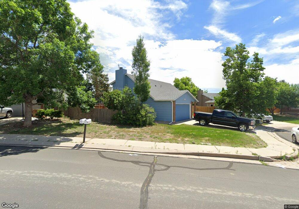
3693 Brisbane Dr Colorado Springs, CO 80920
Briargate NeighborhoodEstimated Value: $410,000 - $436,000
3
Beds
2
Baths
1,469
Sq Ft
$287/Sq Ft
Est. Value
About This Home
This home is located at 3693 Brisbane Dr, Colorado Springs, CO 80920 and is currently estimated at $421,152, approximately $286 per square foot. 3693 Brisbane Dr is a home located in El Paso County with nearby schools including Frontier Elementary School, Mountain Ridge Middle School, and Rampart High School.
Ownership History
Date
Name
Owned For
Owner Type
Purchase Details
Closed on
Mar 4, 2005
Sold by
Hamilton Daniel R
Bought by
Cram Ryan
Current Estimated Value
Home Financials for this Owner
Home Financials are based on the most recent Mortgage that was taken out on this home.
Original Mortgage
$132,000
Outstanding Balance
$64,200
Interest Rate
5%
Mortgage Type
Unknown
Estimated Equity
$356,952
Purchase Details
Closed on
May 29, 1998
Sold by
Kearney Larry L and Kearney Beverly J
Bought by
Hamilton Daniel R
Home Financials for this Owner
Home Financials are based on the most recent Mortgage that was taken out on this home.
Original Mortgage
$93,600
Interest Rate
6.75%
Purchase Details
Closed on
Feb 1, 1983
Bought by
Cram Ryan
Create a Home Valuation Report for This Property
The Home Valuation Report is an in-depth analysis detailing your home's value as well as a comparison with similar homes in the area
Home Values in the Area
Average Home Value in this Area
Purchase History
| Date | Buyer | Sale Price | Title Company |
|---|---|---|---|
| Cram Ryan | $165,000 | -- | |
| Hamilton Daniel R | $117,000 | Land Title | |
| Cram Ryan | -- | -- |
Source: Public Records
Mortgage History
| Date | Status | Borrower | Loan Amount |
|---|---|---|---|
| Open | Cram Ryan | $132,000 | |
| Previous Owner | Hamilton Daniel R | $93,600 |
Source: Public Records
Tax History Compared to Growth
Tax History
| Year | Tax Paid | Tax Assessment Tax Assessment Total Assessment is a certain percentage of the fair market value that is determined by local assessors to be the total taxable value of land and additions on the property. | Land | Improvement |
|---|---|---|---|---|
| 2025 | $1,627 | $28,070 | -- | -- |
| 2024 | $1,576 | $29,220 | $4,690 | $24,530 |
| 2023 | $1,576 | $29,220 | $4,690 | $24,530 |
| 2022 | $1,409 | $19,960 | $3,790 | $16,170 |
| 2021 | $1,468 | $20,540 | $3,900 | $16,640 |
| 2020 | $1,394 | $18,110 | $3,250 | $14,860 |
| 2019 | $1,379 | $18,110 | $3,250 | $14,860 |
| 2018 | $1,101 | $14,210 | $2,520 | $11,690 |
| 2017 | $1,097 | $14,210 | $2,520 | $11,690 |
| 2016 | $1,025 | $13,260 | $2,560 | $10,700 |
| 2015 | $1,023 | $13,260 | $2,560 | $10,700 |
| 2014 | $957 | $12,390 | $2,560 | $9,830 |
Source: Public Records
Map
Nearby Homes
- 3755 Brisbane Dr
- 3906 Smoke Tree Dr
- 3920 Smoke Tree Dr
- 3915 Smoke Tree Dr
- 3909 Smoke Tree Dr
- 3510 Sydney Terrace
- 3460 Fair Dawn Dr
- 7612 Clover Hill Dr
- 3755 Misty Meadows Dr
- 3455 Sun River Place
- 3329 Misty Meadows Dr
- 7644 Lexington Manor Dr
- 7866 Brandy Cir
- 3845 Beltana Dr
- 3895 Beltana Dr
- Peregrine Elite Plan at Heights at Cottonwood Creek
- Coulson Plan at Heights at Cottonwood Creek
- Skycrest Plan at Heights at Cottonwood Creek
- Ruxton Plan at Heights at Cottonwood Creek
- Coulson Elite Plan at Heights at Cottonwood Creek
- 3695 Brisbane Dr
- 3691 Brisbane Dr
- 3705 Brisbane Dr
- 3689 Brisbane Dr
- 3690 Brisbane Dr
- 3680 Brisbane Dr
- 3687 Brisbane Dr
- 3715 Brisbane Dr
- 3685 Brisbane Dr
- 3670 Brisbane Dr
- 3725 Brisbane Dr
- 3645 Queensland Place
- 3710 Brisbane Dr
- 3675 Brisbane Dr
- 3660 Queensland Place
- 3660 Brisbane Dr
- 3635 Queensland Place
- 3665 Brisbane Dr
- 3650 Queensland Place
- 3665 Ian Point Terrace