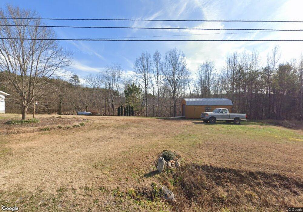
3693 Us Highway 64 90 W Taylorsville, NC 28681
Estimated Value: $95,891 - $747,000
--
Bed
--
Bath
--
Sq Ft
0.5
Acres
About This Home
This home is located at 3693 Us Highway 64 90 W, Taylorsville, NC 28681 and is currently estimated at $295,473. 3693 Us Highway 64 90 W is a home with nearby schools including Ellendale Elementary School, West Alexander Middle School, and Alexander Central High School.
Ownership History
Date
Name
Owned For
Owner Type
Purchase Details
Closed on
Sep 28, 2005
Sold by
Robinette David Lee and Robinette Lisa K
Bought by
Robinette David Lee and Robinette Lisa K
Current Estimated Value
Home Financials for this Owner
Home Financials are based on the most recent Mortgage that was taken out on this home.
Original Mortgage
$106,150
Interest Rate
5.25%
Mortgage Type
Construction
Create a Home Valuation Report for This Property
The Home Valuation Report is an in-depth analysis detailing your home's value as well as a comparison with similar homes in the area
Home Values in the Area
Average Home Value in this Area
Purchase History
| Date | Buyer | Sale Price | Title Company |
|---|---|---|---|
| Robinette David Lee | -- | -- |
Source: Public Records
Mortgage History
| Date | Status | Borrower | Loan Amount |
|---|---|---|---|
| Closed | Robinette David Lee | $106,150 |
Source: Public Records
Tax History Compared to Growth
Tax History
| Year | Tax Paid | Tax Assessment Tax Assessment Total Assessment is a certain percentage of the fair market value that is determined by local assessors to be the total taxable value of land and additions on the property. | Land | Improvement |
|---|---|---|---|---|
| 2025 | $116 | $13,736 | $13,736 | $0 |
| 2024 | $100 | $13,736 | $13,736 | $0 |
| 2023 | $117 | $13,736 | $13,736 | $0 |
| 2022 | $129 | $12,937 | $12,487 | $450 |
| 2021 | $130 | $12,937 | $12,487 | $450 |
| 2020 | $110 | $12,937 | $12,487 | $450 |
| 2019 | $110 | $12,937 | $12,487 | $450 |
| 2018 | $108 | $12,937 | $12,487 | $450 |
| 2017 | $108 | $12,937 | $12,487 | $450 |
| 2016 | $132 | $12,937 | $12,487 | $450 |
| 2015 | $108 | $12,937 | $12,487 | $450 |
| 2014 | $108 | $16,023 | $15,375 | $648 |
| 2012 | -- | $16,023 | $15,375 | $648 |
Source: Public Records
Map
Nearby Homes
- TBD D G Echerd Rd Unit 2
- TBD Ridge Creek Dr Unit 6,4,7
- 1770 N Carolina 90
- 169 Little Egypt Ln
- 356 Barrett Mountain Rd
- 139 Wanderless Ln
- 225 Frye Heights Ln
- 85 Cornerstone Dr
- 764 Old Nc 90
- 76 Eastview St NW
- Tbd Mountain Ridge Church Rd
- 269 Green Meadows Dr
- 1040 N Carolina 90
- 9B & 9C Main Ave W
- 35 Caldwell Dr
- 119 Sunset Dr
- 271 Nc Highway 16 N
- 271 N Carolina 16
- 91 N Hwy 16 Hwy
- 00 School Dr
- 3707 Us Highway 64 90 W
- 3674 Us Highway 64 90 W
- 3734 Us Highway 64 90 W
- 49 Michael Echerd Rd
- 3583 Us Highway 64 90 W
- 3770 Us Highway 64 90 W
- 3695 Us Highway 64 90 W
- 3554 Us Highway 64 90 W
- 139 Michael Echerd Rd
- 194 Ellendale Ln
- 55 Ellendale Ln
- 0 Liberty Grove Church Rd Unit Vacant Land Off Libe
- 0 Liberty Grove Church Rd Unit 947407
- 0 Liberty Grove Church Rd Unit 9557368
- 0 Liberty Grove Church Rd Unit 9562328
- 0 Liberty Grove Church Rd Unit 9569237
- 0 Liberty Grove Church Rd Unit 2143684
- 0 Liberty Grove Church Rd Unit 9574320
- 0 Liberty Grove Church Rd Unit 2208095
- 65 Mooney Dr