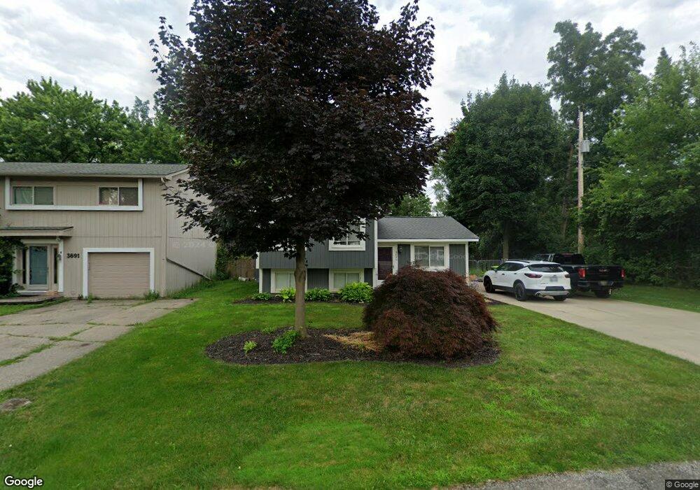
3695 Walnut West Bloomfield, MI 48324
Estimated Value: $243,000 - $345,000
3
Beds
2
Baths
1,316
Sq Ft
$224/Sq Ft
Est. Value
About This Home
This home is located at 3695 Walnut, West Bloomfield, MI 48324 and is currently estimated at $295,021, approximately $224 per square foot. 3695 Walnut is a home located in Oakland County with nearby schools including Our Lady Of Refuge School and St Mary's Preparatory School.
Ownership History
Date
Name
Owned For
Owner Type
Purchase Details
Closed on
Aug 7, 2006
Sold by
Federal Home Loan Mortgage Corporation
Bought by
Sells Ted P
Current Estimated Value
Purchase Details
Closed on
Apr 5, 2005
Sold by
How William H and How Jean D
Bought by
Federal Home Loan Mortgage Corporation
Purchase Details
Closed on
May 20, 1997
Sold by
Gilewski David
Bought by
How William H
Home Financials for this Owner
Home Financials are based on the most recent Mortgage that was taken out on this home.
Original Mortgage
$140,100
Interest Rate
8.17%
Create a Home Valuation Report for This Property
The Home Valuation Report is an in-depth analysis detailing your home's value as well as a comparison with similar homes in the area
Home Values in the Area
Average Home Value in this Area
Purchase History
| Date | Buyer | Sale Price | Title Company |
|---|---|---|---|
| Sells Ted P | $143,000 | Attorneys Title Agency Llc | |
| Federal Home Loan Mortgage Corporation | $134,960 | -- | |
| How William H | $147,500 | -- |
Source: Public Records
Mortgage History
| Date | Status | Borrower | Loan Amount |
|---|---|---|---|
| Previous Owner | How William H | $140,100 |
Source: Public Records
Tax History Compared to Growth
Tax History
| Year | Tax Paid | Tax Assessment Tax Assessment Total Assessment is a certain percentage of the fair market value that is determined by local assessors to be the total taxable value of land and additions on the property. | Land | Improvement |
|---|---|---|---|---|
| 2024 | $1,569 | $106,440 | $0 | $0 |
| 2022 | $1,710 | $88,770 | $18,560 | $70,210 |
| 2021 | $3,319 | $85,290 | $0 | $0 |
| 2020 | $1,607 | $83,470 | $18,560 | $64,910 |
| 2018 | $3,143 | $74,660 | $15,510 | $59,150 |
| 2015 | -- | $59,830 | $0 | $0 |
| 2014 | -- | $53,320 | $0 | $0 |
| 2011 | -- | $45,160 | $0 | $0 |
Source: Public Records
Map
Nearby Homes
- 6768 Buckland Ave
- 3641 Green Lake Rd
- 3950 Bradmore Ave
- 3965 Carrick Ave
- 3632 Fieldview Ave
- 3991 Fieldview Ave
- 6903 Dandison Blvd
- 0000 Langtoft
- 4066 Green Lake Rd
- 6675 Langtoft St
- 6707 Heatherwood Dr
- 3701 Northwood
- 6978 Colony Dr
- 6420 Commerce Rd
- 7146 Arrowood Dr
- 4442 Borland St
- 4245 Bunker Ave
- 7369 Sweetbriar
- 4335 Crestdale Ave
- 4540 Rolling Pine Ct
- 3691 Walnut
- 6671 Meadowfield St
- 6590 Buckland Ave
- 3683 Walnut
- 6580 Buckland Ave
- 6608 Buckland Ave
- 6570 Buckland Ave
- 3671 Walnut
- 6622 Buckland Ave
- 6683 Meadowfield St
- 6560 Buckland Ave
- 3680 Walnut
- 3690 Green Lake Rd
- 00 Meadowfield St
- 0 Meadowfield Unit 4915550
- 0 Meadowfield Unit 213117589
- 6611 Buckland Ave
- 3680 Green Lake Rd
- 6585 Buckland Ave
- 3666 Walnut