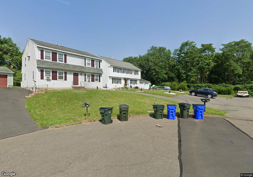
37 Alison Ln Unit 39 Wethersfield, CT 06109
Estimated Value: $498,000 - $557,148
6
Beds
4
Baths
2,648
Sq Ft
$199/Sq Ft
Est. Value
About This Home
This home is located at 37 Alison Ln Unit 39, Wethersfield, CT 06109 and is currently estimated at $527,787, approximately $199 per square foot. 37 Alison Ln Unit 39 is a home located in Hartford County with nearby schools including Alfred W. Hanmer School, Silas Deane Middle School, and Wethersfield High School.
Ownership History
Date
Name
Owned For
Owner Type
Purchase Details
Closed on
Dec 30, 1994
Sold by
Mckenna Gloria D
Bought by
Moryl Stanislaw and Moryl Wanda
Current Estimated Value
Home Financials for this Owner
Home Financials are based on the most recent Mortgage that was taken out on this home.
Original Mortgage
$137,600
Interest Rate
9.2%
Mortgage Type
Unknown
Create a Home Valuation Report for This Property
The Home Valuation Report is an in-depth analysis detailing your home's value as well as a comparison with similar homes in the area
Home Values in the Area
Average Home Value in this Area
Purchase History
| Date | Buyer | Sale Price | Title Company |
|---|---|---|---|
| Moryl Stanislaw | $172,000 | -- |
Source: Public Records
Mortgage History
| Date | Status | Borrower | Loan Amount |
|---|---|---|---|
| Open | Moryl Stanislaw | $100,000 | |
| Closed | Moryl Stanislaw | $129,400 | |
| Closed | Moryl Stanislaw | $137,600 |
Source: Public Records
Tax History
| Year | Tax Paid | Tax Assessment Tax Assessment Total Assessment is a certain percentage of the fair market value that is determined by local assessors to be the total taxable value of land and additions on the property. | Land | Improvement |
|---|---|---|---|---|
| 2025 | $14,045 | $340,730 | $84,250 | $256,480 |
| 2024 | $8,989 | $207,980 | $65,750 | $142,230 |
| 2023 | $8,689 | $207,980 | $65,750 | $142,230 |
| 2022 | $8,544 | $207,980 | $65,750 | $142,230 |
| 2021 | $8,459 | $207,980 | $65,750 | $142,230 |
| 2020 | $8,410 | $206,680 | $65,760 | $140,920 |
| 2019 | $8,465 | $207,780 | $65,760 | $142,020 |
| 2018 | $8,609 | $211,100 | $63,400 | $147,700 |
| 2017 | $8,395 | $211,100 | $63,400 | $147,700 |
| 2016 | $8,136 | $211,100 | $63,400 | $147,700 |
| 2015 | $8,062 | $211,100 | $63,400 | $147,700 |
| 2014 | $7,756 | $211,100 | $63,400 | $147,700 |
Source: Public Records
Map
Nearby Homes
- 195 Middletown Ave
- 147 Spring St
- 31 Ox Yoke Dr
- 11 Charter Rd
- 108 Chamberlain Rd
- 35 Stillwold Dr
- 38 Wheeler Rd
- 91 Somerset St
- 87 Somerset St
- 250 Edward St
- 137 Dale Rd
- 89 Merriman Rd
- 25 Sutton Rd
- 455 Brimfield Rd
- 1 Fernwood St
- 72 Concord Dr
- 50 Concord Dr Unit 50
- 317 Garden St Unit 319
- 116 Wells Farm Dr
- 1610 Silas Deane Hwy
- 36 Alison Ln Unit 38
- 33 Alison Ln Unit 35
- 27 Alison Ln Unit 29
- 38 Alison Ln
- 32 Alison Ln Unit 34
- 26-28 Alison Ln
- 26 Alison Ln Unit 28
- 217 Middletown Ave Unit 219
- 217 Middletown Ave Unit 217
- 23 Alison Ln Unit 25
- 225 Middletown Ave
- 19 Alison Ln
- 12 Alison Ln Unit 14
- 219 Middletown Ave Unit 219
- 17 Alison Ln Unit 19
- 235 Middletown Ave Unit 237
- 229 Middletown Ave Unit 231
- 241 Middletown Ave Unit 241-243
- 241 Middletown Ave Unit 243
- 241 Middletown Ave Unit 1ST
Your Personal Tour Guide
Ask me questions while you tour the home.