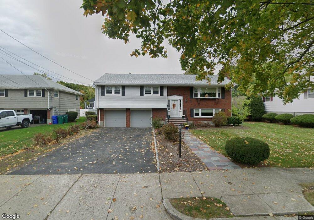
37 Anthony Rd Newtonville, MA 02460
Nonantum NeighborhoodEstimated Value: $1,269,285 - $1,381,000
3
Beds
4
Baths
1,880
Sq Ft
$703/Sq Ft
Est. Value
About This Home
This home is located at 37 Anthony Rd, Newtonville, MA 02460 and is currently estimated at $1,322,321, approximately $703 per square foot. 37 Anthony Rd is a home located in Middlesex County with nearby schools including Horace Mann Elementary School, F.A. Day Middle School, and Newton North High School.
Create a Home Valuation Report for This Property
The Home Valuation Report is an in-depth analysis detailing your home's value as well as a comparison with similar homes in the area
Home Values in the Area
Average Home Value in this Area
Tax History Compared to Growth
Tax History
| Year | Tax Paid | Tax Assessment Tax Assessment Total Assessment is a certain percentage of the fair market value that is determined by local assessors to be the total taxable value of land and additions on the property. | Land | Improvement |
|---|---|---|---|---|
| 2025 | $9,889 | $1,009,100 | $834,300 | $174,800 |
| 2024 | $9,562 | $979,700 | $810,000 | $169,700 |
| 2023 | $9,097 | $893,600 | $615,600 | $278,000 |
| 2022 | $8,704 | $827,400 | $570,000 | $257,400 |
| 2021 | $8,399 | $780,600 | $537,700 | $242,900 |
| 2020 | $8,149 | $780,600 | $537,700 | $242,900 |
| 2019 | $7,920 | $757,900 | $522,000 | $235,900 |
| 2018 | $7,604 | $702,800 | $472,900 | $229,900 |
| 2017 | $7,373 | $663,000 | $446,100 | $216,900 |
| 2016 | $6,902 | $606,500 | $416,900 | $189,600 |
| 2015 | $6,581 | $566,800 | $389,600 | $177,200 |
Source: Public Records
Map
Nearby Homes
- 1 Farwell Cir
- 177 Nevada St
- 3 Repton Cir Unit 3204
- 76 Harding St
- 76 Taft Ave Unit 1
- 76 Taft Ave
- 76 Taft Ave Unit 2
- 191 Linwood Ave
- 57 Walnut St
- 354 Linwood Ave Unit 1
- 286 Nevada St Unit 286
- 282 Nevada St Unit 282
- 10 Naviens Ln Unit 2
- 321 Albemarle Rd
- 176 River St
- 75 Cherry St
- 611 Watertown St Unit 14
- 135 Grove St Unit 135
- 164 Grove St
- 32-34 Rossmere St