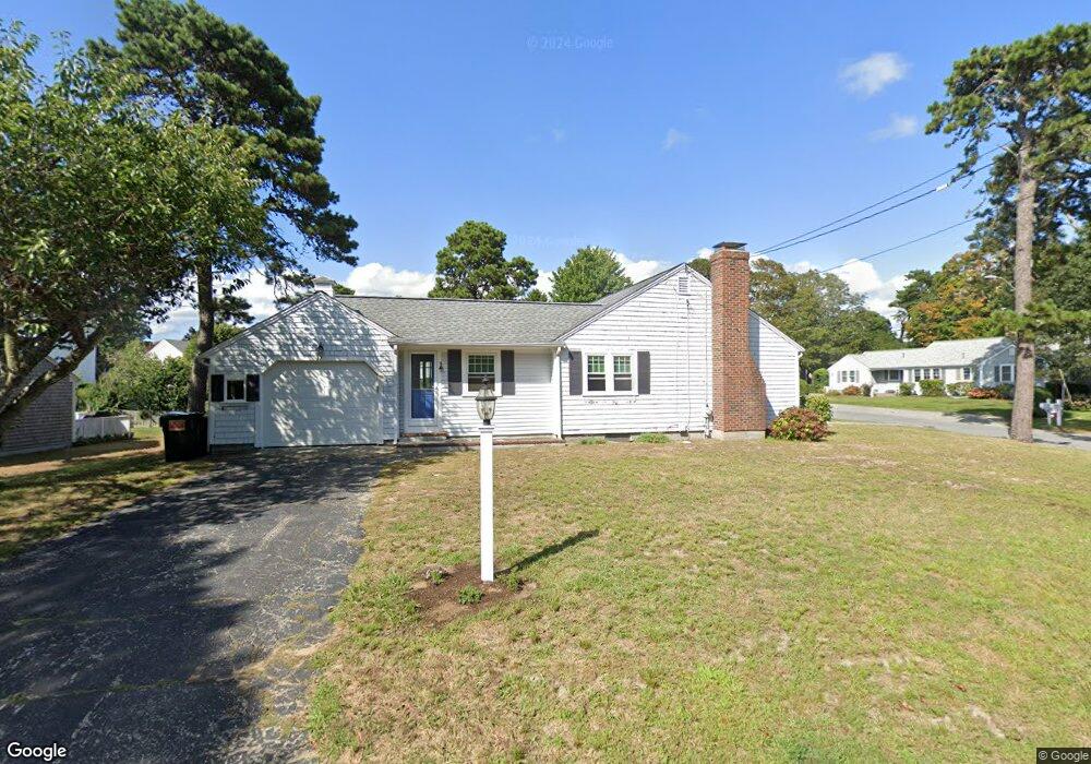
37 Arrowhead Dr West Dennis, MA 02670
West Dennis NeighborhoodEstimated Value: $683,302 - $720,000
3
Beds
2
Baths
1,201
Sq Ft
$583/Sq Ft
Est. Value
About This Home
This home is located at 37 Arrowhead Dr, West Dennis, MA 02670 and is currently estimated at $700,076, approximately $582 per square foot. 37 Arrowhead Dr is a home located in Barnstable County with nearby schools including Dennis-Yarmouth Regional High School and St. Pius X. School.
Ownership History
Date
Name
Owned For
Owner Type
Purchase Details
Closed on
Jun 24, 2004
Sold by
Seferian Lisa M
Bought by
Lisa M Seferian Ft
Current Estimated Value
Purchase Details
Closed on
Feb 19, 1999
Sold by
Lowell Agnes F and Lowell Paul M
Bought by
Seferian Lisa M
Home Financials for this Owner
Home Financials are based on the most recent Mortgage that was taken out on this home.
Original Mortgage
$122,400
Interest Rate
6.75%
Mortgage Type
Purchase Money Mortgage
Create a Home Valuation Report for This Property
The Home Valuation Report is an in-depth analysis detailing your home's value as well as a comparison with similar homes in the area
Home Values in the Area
Average Home Value in this Area
Purchase History
| Date | Buyer | Sale Price | Title Company |
|---|---|---|---|
| Lisa M Seferian Ft | -- | -- | |
| Seferian Lisa M | $153,000 | -- |
Source: Public Records
Mortgage History
| Date | Status | Borrower | Loan Amount |
|---|---|---|---|
| Previous Owner | Seferian Lisa M | $122,400 |
Source: Public Records
Tax History Compared to Growth
Tax History
| Year | Tax Paid | Tax Assessment Tax Assessment Total Assessment is a certain percentage of the fair market value that is determined by local assessors to be the total taxable value of land and additions on the property. | Land | Improvement |
|---|---|---|---|---|
| 2025 | $2,906 | $671,200 | $227,800 | $443,400 |
| 2024 | $2,781 | $633,400 | $219,100 | $414,300 |
| 2023 | $2,690 | $576,000 | $199,200 | $376,800 |
| 2022 | $2,433 | $434,400 | $155,500 | $278,900 |
| 2021 | $4 | $386,300 | $152,400 | $233,900 |
| 2020 | $2,258 | $370,200 | $164,200 | $206,000 |
| 2019 | $2,226 | $360,700 | $172,500 | $188,200 |
| 2018 | $4 | $324,400 | $153,200 | $171,200 |
| 2017 | $1,962 | $319,000 | $153,200 | $165,800 |
| 2016 | $1,951 | $298,800 | $158,700 | $140,100 |
| 2015 | $1,912 | $298,800 | $158,700 | $140,100 |
| 2014 | $1,897 | $298,800 | $158,700 | $140,100 |
Source: Public Records
Map
Nearby Homes
- 51 Princeton Cir
- 61 Trotters Ln
- 15 Woodside Park Rd
- 6 Elliot Dr
- 62 Teal Cir
- 24 Regan Rd
- 21 Bayberry Ln
- 855 Main St
- 26 Center St
- 102 Cornell Dr
- 5 Polly Fisk Ln Unit 5
- 401 Main St Unit 201
- 401 Main St Unit 101
- 71 Main St
- 26 Willowford Rd
- 19 Ocean Dr Unit 2
- 4 Coffey Ln
- 12 The Other Rd
- 178 School St
- 125 Main St Unit 3
- 48 Arrowhead Dr
- 33 Arrowhead Dr
- 43 Arrowhead Dr
- 50 Salt Meadows Rd
- 34 Arrowhead Dr
- 38 Arrowhead Dr
- 47 Arrowhead Dr
- 6 Tamarack Rd
- 46 Salt Meadows Rd
- 29 Arrowhead Dr
- 2 Tamarack Rd
- 28 Arrowhead Dr
- 12 Tamarack Rd
- 51 Arrowhead Dr
- 42 Salt Meadow Rd
- 31 Princeton Cir
- 42 Salt Meadows Rd
- 21 Trotters Ln
- 23 Trotters Ln
- 27 Princeton Cir