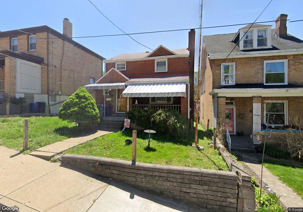
37 Belplain St Pittsburgh, PA 15227
Carrick NeighborhoodEstimated Value: $139,000 - $159,734
About This Home
This home is located at 37 Belplain St, Pittsburgh, PA 15227 and is currently estimated at $145,434, approximately $80 per square foot. 37 Belplain St is a home located in Allegheny County with nearby schools including Pittsburgh Concord K-5, Pittsburgh South Brook, and Pittsburgh Carrick High School.
Ownership History
We collect this data history from publicly available records. To have your information removed, we recommend requesting removal directly through your county’s website.
Purchase Details
Home Values in the Area
Average Home Value in this Area
Purchase History
We collect this data history from publicly available records. To have your information removed, we recommend requesting removal directly through your county’s website.
| Date | Buyer | Sale Price | Title Company |
|---|---|---|---|
| $69,200 | -- |
Tax History
We collect this data history from publicly available records. To have your information removed, we recommend requesting removal directly through your county’s website.
| Year | Tax Paid | Tax Assessment Tax Assessment Total Assessment is a certain percentage of the fair market value that is determined by local assessors to be the total taxable value of land and additions on the property. | Land | Improvement |
|---|---|---|---|---|
| 2026 | $318 | $49,400 | $14,100 | $35,300 |
| 2025 | $1,138 | $49,400 | $14,100 | $35,300 |
| 2024 | $1,138 | $49,400 | $14,100 | $35,300 |
| 2023 | $1,138 | $49,400 | $14,100 | $35,300 |
| 2022 | $1,123 | $49,400 | $14,100 | $35,300 |
| 2021 | $1,123 | $49,400 | $14,100 | $35,300 |
| 2020 | $1,118 | $49,400 | $14,100 | $35,300 |
| 2019 | $1,055 | $46,600 | $14,100 | $32,500 |
| 2018 | $753 | $46,600 | $14,100 | $32,500 |
| 2017 | $1,055 | $46,600 | $14,100 | $32,500 |
| 2016 | $220 | $46,600 | $14,100 | $32,500 |
| 2015 | $220 | $46,600 | $14,100 | $32,500 |
| 2014 | $1,031 | $46,600 | $14,100 | $32,500 |
Map
- 2550 Brownsville Rd
- 2600 Brownsville Rd
- 2600 Bethesda St
- 11 Maytide St
- 110 Kirk Ave
- 230 Maytide St
- 118 Stewart Ave
- 30 Stewart Ave
- 100 Owendale Ave
- 2361 Brownsville Rd
- 2739 Churchview Ave
- 2822 Brentwood Ave
- 2830 Brentwood Ave
- 2923-2925 Brownsville Rd
- 53 Carrick Ave
- 106 Carrick Ave
- 349 Maytide St
- 118 Carrick Ave
- 2914 Glendale Ave
- 2900 Churchview Ave
Ask me questions while you tour the home.