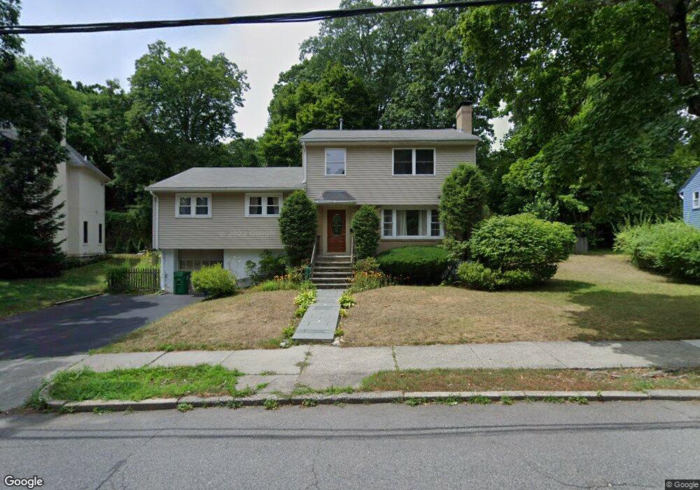
37 Botsford Rd Chestnut Hill, MA 02467
Oak Hill NeighborhoodEstimated Value: $1,435,000 - $1,890,000
4
Beds
3
Baths
2,165
Sq Ft
$756/Sq Ft
Est. Value
About This Home
This home is located at 37 Botsford Rd, Chestnut Hill, MA 02467 and is currently estimated at $1,637,549, approximately $756 per square foot. 37 Botsford Rd is a home located in Middlesex County with nearby schools including Memorial Spaulding Elementary School, Oak Hill Middle School, and Newton South High School.
Ownership History
Date
Name
Owned For
Owner Type
Purchase Details
Closed on
Nov 3, 1987
Sold by
Greenstein Alan I
Bought by
Elman Boris S
Current Estimated Value
Home Financials for this Owner
Home Financials are based on the most recent Mortgage that was taken out on this home.
Original Mortgage
$150,000
Interest Rate
10.97%
Mortgage Type
Purchase Money Mortgage
Create a Home Valuation Report for This Property
The Home Valuation Report is an in-depth analysis detailing your home's value as well as a comparison with similar homes in the area
Home Values in the Area
Average Home Value in this Area
Purchase History
| Date | Buyer | Sale Price | Title Company |
|---|---|---|---|
| Elman Boris S | $280,000 | -- |
Source: Public Records
Mortgage History
| Date | Status | Borrower | Loan Amount |
|---|---|---|---|
| Closed | Elman Boris S | $160,000 | |
| Closed | Elman Boris S | $150,000 |
Source: Public Records
Tax History
| Year | Tax Paid | Tax Assessment Tax Assessment Total Assessment is a certain percentage of the fair market value that is determined by local assessors to be the total taxable value of land and additions on the property. | Land | Improvement |
|---|---|---|---|---|
| 2025 | $12,981 | $1,324,600 | $1,091,100 | $233,500 |
| 2024 | $12,551 | $1,286,000 | $1,059,300 | $226,700 |
| 2023 | $11,847 | $1,163,800 | $814,600 | $349,200 |
| 2022 | $11,336 | $1,077,600 | $754,300 | $323,300 |
| 2021 | $10,939 | $1,016,600 | $711,600 | $305,000 |
| 2020 | $10,613 | $1,016,600 | $711,600 | $305,000 |
| 2019 | $10,314 | $987,000 | $690,900 | $296,100 |
| 2018 | $9,860 | $911,300 | $629,700 | $281,600 |
| 2017 | $9,560 | $859,700 | $594,100 | $265,600 |
| 2016 | $9,144 | $803,500 | $555,200 | $248,300 |
| 2015 | $8,718 | $750,900 | $518,900 | $232,000 |
Source: Public Records
Map
Nearby Homes
- 16 Dorcar Rd
- 66 Brookline St
- 17 Tirrell Crescent
- 459 Dudley Rd
- 63 Drumlin Rd
- 44 Broadlawn Park Unit 22
- 124 Deborah Rd
- 66 Bryon Rd Unit 2
- 64 Bryon Rd Unit 1
- 60 Bryon Rd Unit 1
- 1307 Lagrange St Unit 1307
- 93 Sevland Rd
- 42 Bryon Rd Unit 6
- 21 Lovett Rd
- 56 Cynthia Rd
- 50 Lovett Rd
- 28 Cottonwood Rd
- 134 Rangeley Rd
- 28 Westgate Rd Unit 3
- 135 Hartman Rd
- 31 Botsford Rd
- 43 Botsford Rd
- 147 Brookline St
- 141 Brookline St
- 153 Brookline St
- 155 Brookline St
- 42 Botsford Rd
- 32 Botsford Rd
- 25 Botsford Rd
- 49 Botsford Rd
- 161 Brookline St
- 133 Brookline St
- 161 Brookline St
- 52 Botsford Rd
- 24 Botsford Rd
- 55 Botsford Rd
- 127 Brookline St
- 60 Botsford Rd
- 17 Botsford Rd
- 20 Vine St
Your Personal Tour Guide
Ask me questions while you tour the home.