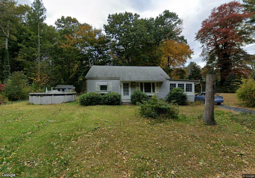
37 Broad Oak Way Hanover, MA 02339
Estimated Value: $465,000 - $661,000
2
Beds
1
Bath
775
Sq Ft
$676/Sq Ft
Est. Value
About This Home
This home is located at 37 Broad Oak Way, Hanover, MA 02339 and is currently estimated at $524,180, approximately $676 per square foot. 37 Broad Oak Way is a home located in Plymouth County with nearby schools including Hanover High School, Cadence Academy Preschool - Hanover, and Cardinal Cushing Centers.
Ownership History
Date
Name
Owned For
Owner Type
Purchase Details
Closed on
May 21, 2008
Sold by
Stenborg Arnold J P and Stenbor Florence V
Bought by
Stenbord Arnold J P and Stenborg Karen
Current Estimated Value
Purchase Details
Closed on
Dec 1, 2006
Sold by
Stenborg Rt
Bought by
Stenborg Arnold J P and Stenborg Karen
Home Financials for this Owner
Home Financials are based on the most recent Mortgage that was taken out on this home.
Original Mortgage
$202,400
Interest Rate
6.36%
Mortgage Type
Purchase Money Mortgage
Create a Home Valuation Report for This Property
The Home Valuation Report is an in-depth analysis detailing your home's value as well as a comparison with similar homes in the area
Home Values in the Area
Average Home Value in this Area
Purchase History
| Date | Buyer | Sale Price | Title Company |
|---|---|---|---|
| Stenbord Arnold J P | -- | -- | |
| Stenborg Arnold J P | $253,000 | -- |
Source: Public Records
Mortgage History
| Date | Status | Borrower | Loan Amount |
|---|---|---|---|
| Open | Stenborg Arnold J P | $240,104 | |
| Closed | Stenborg Arnold J P | $235,966 | |
| Closed | Stenborg Arnold J P | $199,900 | |
| Previous Owner | Stenborg Arnold J P | $202,400 |
Source: Public Records
Tax History Compared to Growth
Tax History
| Year | Tax Paid | Tax Assessment Tax Assessment Total Assessment is a certain percentage of the fair market value that is determined by local assessors to be the total taxable value of land and additions on the property. | Land | Improvement |
|---|---|---|---|---|
| 2025 | $5,373 | $435,100 | $255,900 | $179,200 |
| 2024 | $5,587 | $435,100 | $255,900 | $179,200 |
| 2023 | $5,087 | $377,100 | $232,800 | $144,300 |
| 2022 | $5,087 | $333,600 | $221,100 | $112,500 |
| 2021 | $4,817 | $295,000 | $179,900 | $115,100 |
| 2020 | $4,931 | $302,300 | $190,400 | $111,900 |
| 2019 | $4,747 | $289,300 | $190,400 | $98,900 |
| 2018 | $4,640 | $285,000 | $190,400 | $94,600 |
| 2017 | $4,376 | $264,900 | $182,200 | $82,700 |
| 2016 | $4,186 | $248,300 | $165,600 | $82,700 |
| 2015 | $3,650 | $226,000 | $153,400 | $72,600 |
Source: Public Records
Map
Nearby Homes
- 186 Elm St
- 180 Elm St
- 28 Old Shipyard Ln
- 20 Meadow Brook Rd
- 55 Shipyard Ln
- 26 Church St
- 172 Washington St
- 14 Longwood Ln Unit 14
- 133 Brigantine Cir
- 7 Farmside Dr
- 114 Graham Hill Dr
- 46 Lorna Ave
- 261 Washington St
- 218 Schoosett St
- 265 Silver St
- 250 Center St
- 51 Cervelli Farm Dr
- 37 Dr
- 23 Cervelli Farm Dr
- 38 Cervelli Farm Dr
- 45 Broad Oak Way
- 15 Broad Oak Way
- 280 Broadway
- 22 Broad Oak Way
- 22 Broad Oak Way Unit B
- 22 Broad Oak Way Unit A
- 53 Broad Oak Way
- 7 Broad Oak Way
- 61 Broad Oak Way
- 3 B
- 292 Broadway
- 262 Broadway
- 254 Broadway
- 254 Broadway Unit 1
- 67 Broad Oak Way
- 304 Broadway
- 273 Broadway
- 357 Columbia Rd Unit 2
- 357 Columbia Rd
- 287 Broadway