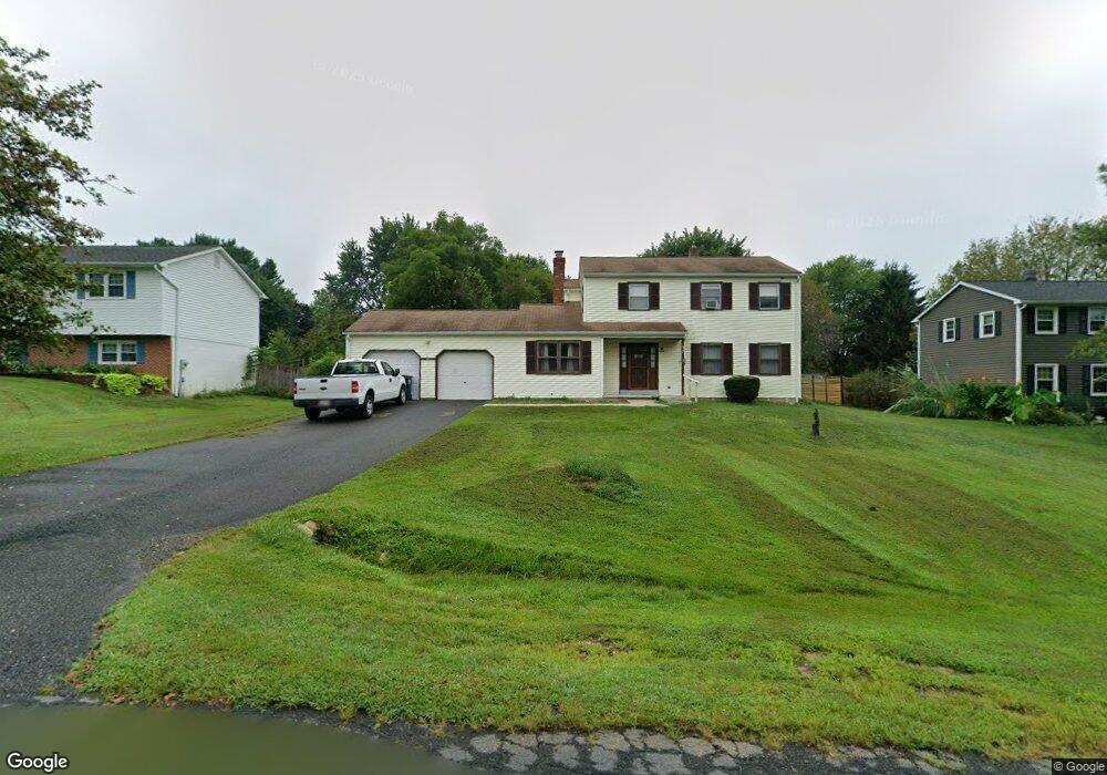
37 Cambridge Rd Elkton, MD 21921
Estimated Value: $358,000 - $410,000
--
Bed
2
Baths
1,806
Sq Ft
$212/Sq Ft
Est. Value
About This Home
This home is located at 37 Cambridge Rd, Elkton, MD 21921 and is currently estimated at $383,312, approximately $212 per square foot. 37 Cambridge Rd is a home located in Cecil County with nearby schools including Kenmore Elementary School, Cherry Hill Middle School, and Rising Sun High School.
Ownership History
Date
Name
Owned For
Owner Type
Purchase Details
Closed on
Feb 12, 1997
Sold by
Adam Mark J and Adam Emily C
Bought by
Hobbs James F Anna Marie
Current Estimated Value
Purchase Details
Closed on
Sep 27, 1985
Sold by
Baker Robert J and Baker Jan M
Bought by
Adam Mark J and Adam Emily C
Home Financials for this Owner
Home Financials are based on the most recent Mortgage that was taken out on this home.
Original Mortgage
$63,662
Interest Rate
12.17%
Purchase Details
Closed on
Jun 4, 1981
Sold by
Biggs Joseph B and Biggs Laura E
Bought by
Baker Robert J and Baker Jan M
Home Financials for this Owner
Home Financials are based on the most recent Mortgage that was taken out on this home.
Original Mortgage
$64,800
Interest Rate
16.8%
Create a Home Valuation Report for This Property
The Home Valuation Report is an in-depth analysis detailing your home's value as well as a comparison with similar homes in the area
Home Values in the Area
Average Home Value in this Area
Purchase History
| Date | Buyer | Sale Price | Title Company |
|---|---|---|---|
| Hobbs James F Anna Marie | $123,375 | -- | |
| Adam Mark J | $84,000 | -- | |
| Baker Robert J | $72,000 | -- |
Source: Public Records
Mortgage History
| Date | Status | Borrower | Loan Amount |
|---|---|---|---|
| Previous Owner | Adam Mark J | $63,662 | |
| Previous Owner | Baker Robert J | $64,800 | |
| Closed | Hobbs James F Anna Marie | -- |
Source: Public Records
Tax History Compared to Growth
Tax History
| Year | Tax Paid | Tax Assessment Tax Assessment Total Assessment is a certain percentage of the fair market value that is determined by local assessors to be the total taxable value of land and additions on the property. | Land | Improvement |
|---|---|---|---|---|
| 2025 | $2,689 | $240,200 | $75,100 | $165,100 |
| 2024 | $2,242 | $234,067 | $0 | $0 |
| 2023 | $1,877 | $227,933 | $0 | $0 |
| 2022 | $2,558 | $221,800 | $75,100 | $146,700 |
| 2021 | $2,507 | $216,067 | $0 | $0 |
| 2020 | $2,486 | $210,333 | $0 | $0 |
| 2019 | $2,420 | $204,600 | $75,100 | $129,500 |
| 2018 | $2,348 | $198,400 | $0 | $0 |
| 2017 | $2,277 | $192,200 | $0 | $0 |
| 2016 | $2,103 | $186,000 | $0 | $0 |
| 2015 | $2,103 | $185,267 | $0 | $0 |
| 2014 | $1,929 | $184,533 | $0 | $0 |
Source: Public Records
Map
Nearby Homes
- Tolchester II Plan at Fletchwood Station
- Aspen Plan at Fletchwood Station
- Augusta – Fletchwood Station Plan at Fletchwood Station
- Hampton II - Fletchwood Station Plan at Fletchwood Station
- 169 Providence Rd
- 672 Training Center Dr
- 4350 Telegraph Rd
- 60 Chase Cir
- 0 Singerly Rd
- 1189 Leeds Rd
- 47 Chase Cir
- 12 Chase Cir
- 11 Red Cloud Loop
- 1003 Jackson Hall School Rd
- 50 Avalon Ave
- 544 Elk Mills Rd
- 141 Kennedy Blvd
- 24 Sunnydell Rd
- 1788 Appleton Rd
- 104 Marlyn Dr
- 29 Cambridge Rd
- 43 Cambridge Rd
- 24 Sandhurst Ln
- 61 Silchester Dr
- 12 Sandhurst Ln
- 75 Silchester Dr
- 34 Cambridge Rd
- 26 Cambridge Rd
- 55 Sandhurst Ln
- 46 Cambridge Rd
- 40 Cambridge Rd
- 51 Sandhurst Ln
- 47 Sandhurst Ln
- 95 Silchester Dr
- 52 Cambridge Rd
- 103 Silchester Dr
- 37 Sandhurst Ln
- 65 Cambridge Rd
- 40 Silchester Dr
- 56 Silchester Dr