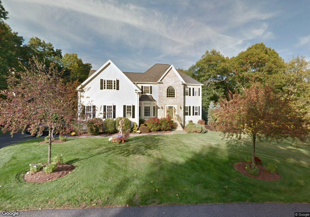
37 Cedar Farm Rd Medway, MA 02053
Estimated Value: $1,074,229 - $1,300,000
4
Beds
3
Baths
3,824
Sq Ft
$317/Sq Ft
Est. Value
About This Home
This home is located at 37 Cedar Farm Rd, Medway, MA 02053 and is currently estimated at $1,212,057, approximately $316 per square foot. 37 Cedar Farm Rd is a home located in Norfolk County with nearby schools including John D. McGovern Elementary School, Burke-Memorial Elementary, and Medway Middle School.
Ownership History
Date
Name
Owned For
Owner Type
Purchase Details
Closed on
Jul 28, 2011
Sold by
Peterson Mark E and Peterson Nancy M
Bought by
Barresi Joseph S and Barresi Hather D
Current Estimated Value
Home Financials for this Owner
Home Financials are based on the most recent Mortgage that was taken out on this home.
Original Mortgage
$493,600
Outstanding Balance
$340,965
Interest Rate
4.52%
Mortgage Type
Purchase Money Mortgage
Estimated Equity
$871,092
Purchase Details
Closed on
Aug 30, 2001
Sold by
Sivas Llc
Bought by
Peterson Mark E and Peterson Nancy M
Home Financials for this Owner
Home Financials are based on the most recent Mortgage that was taken out on this home.
Original Mortgage
$464,000
Interest Rate
7.06%
Mortgage Type
Purchase Money Mortgage
Create a Home Valuation Report for This Property
The Home Valuation Report is an in-depth analysis detailing your home's value as well as a comparison with similar homes in the area
Home Values in the Area
Average Home Value in this Area
Purchase History
| Date | Buyer | Sale Price | Title Company |
|---|---|---|---|
| Barresi Joseph S | $617,000 | -- | |
| Peterson Mark E | $619,900 | -- |
Source: Public Records
Mortgage History
| Date | Status | Borrower | Loan Amount |
|---|---|---|---|
| Open | Barresi Joseph S | $493,600 | |
| Previous Owner | Peterson Mark E | $464,000 |
Source: Public Records
Tax History Compared to Growth
Tax History
| Year | Tax Paid | Tax Assessment Tax Assessment Total Assessment is a certain percentage of the fair market value that is determined by local assessors to be the total taxable value of land and additions on the property. | Land | Improvement |
|---|---|---|---|---|
| 2025 | $13,861 | $972,700 | $375,600 | $597,100 |
| 2024 | $14,007 | $972,700 | $375,600 | $597,100 |
| 2023 | $12,902 | $809,400 | $314,600 | $494,800 |
| 2022 | $11,768 | $695,100 | $229,700 | $465,400 |
| 2021 | $11,773 | $674,300 | $214,400 | $459,900 |
| 2020 | $11,573 | $661,300 | $214,400 | $446,900 |
| 2019 | $11,022 | $649,500 | $205,700 | $443,800 |
| 2018 | $11,350 | $642,700 | $205,700 | $437,000 |
| 2017 | $11,178 | $623,800 | $207,900 | $415,900 |
| 2016 | $11,335 | $625,900 | $218,800 | $407,100 |
| 2015 | $11,294 | $619,200 | $218,800 | $400,400 |
| 2014 | $11,451 | $607,800 | $217,600 | $390,200 |
Source: Public Records
Map
Nearby Homes
- 78 Fisher St
- 85 Fisher St
- 4 Deerfield Rd
- 15 Broad Acres Farm Rd
- 6 Rainbow Dr
- 12 Longmeadow Ln
- 22 Granite St
- 39 West St
- 56 Paul Rd
- 6 Freedom Trail
- 9 Tulip Way
- 5 Fales St
- 220 Main St Unit 220
- 190-194 E Main St
- 176 Main St Unit 3
- 462 Hartford Ave
- 0 Old Log Lane (Farm St) Unit 73416329
- 455 Hartford Ave
- 28 Wellington St
- 116 Winthrop St
- 35 Cedar Farm Rd
- 28 Cedar Farm Rd
- 41 Cedar Farm Rd
- 2 Winterberry Ln
- 38 Cedar Farm Rd
- 4 Winterberry Ln
- 1 Winterberry Ln
- 5 Winterberry Ln
- 3 Winterberry Ln
- 26 Cedar Farm Rd
- 24 Cedar Farm Rd
- 31 Cedar Farm Rd
- 43 Cedar Farm Rd
- 42 Cedar Farm Rd
- 22 Cedar Farm Rd
- 29 Cedar Farm Rd
- 46 Cedar Farm Rd
- 45 Cedar Farm Rd
- 20 Cedar Farm Rd
- 27 Cedar Farm Rd