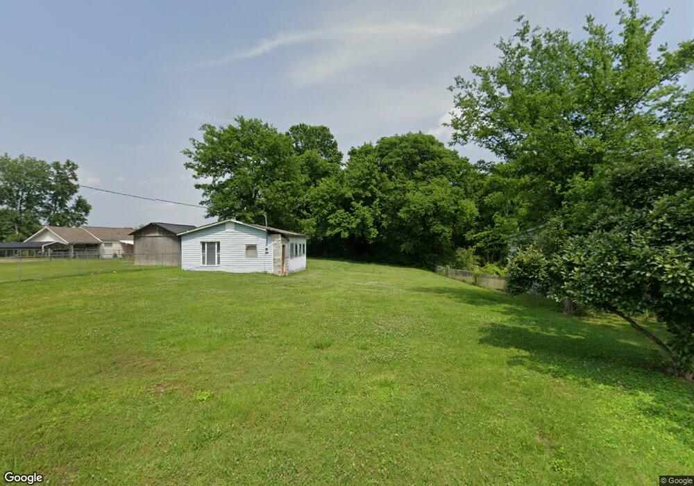
37 Circle Dr Rossville, GA 30741
Estimated Value: $49,966 - $183,000
Studio
1
Bath
--
Sq Ft
14,462
Sq Ft Lot
About This Home
This home is located at 37 Circle Dr, Rossville, GA 30741 and is currently estimated at $110,242. 37 Circle Dr is a home located in Walker County with nearby schools including Stone Creek Elementary School, Rossville Middle School, and Ridgeland High School.
Ownership History
Date
Name
Owned For
Owner Type
Purchase Details
Closed on
Feb 1, 2012
Sold by
Carroll Arthur Todd
Bought by
Hollis Shawn M
Current Estimated Value
Purchase Details
Closed on
May 16, 2005
Sold by
Not Provided
Bought by
Carroll Arthur Todd and June Horton
Purchase Details
Closed on
Nov 5, 1992
Sold by
Pinckard O P
Bought by
Carroll James N and Carroll Patricia
Purchase Details
Closed on
Jul 26, 1973
Sold by
Robert Pickard O and Robert Broyles
Bought by
Pinckard O P
Purchase Details
Closed on
May 14, 1973
Sold by
Arther Frank and Arther Elaine
Bought by
Robert Pickard O and Robert Broyles
Purchase Details
Closed on
Nov 14, 1970
Bought by
Arther Frank and Arther Elaine
Create a Home Valuation Report for This Property
The Home Valuation Report is an in-depth analysis detailing your home's value as well as a comparison with similar homes in the area
Purchase History
| Date | Buyer | Sale Price | Title Company |
|---|---|---|---|
| Hollis Shawn M | $5,000 | -- | |
| Carroll Arthur Todd | -- | -- | |
| Carroll James N | $8,800 | -- | |
| Pinckard O P | -- | -- | |
| Robert Pickard O | -- | -- | |
| Arther Frank | -- | -- |
Source: Public Records
Tax History
| Year | Tax Paid | Tax Assessment Tax Assessment Total Assessment is a certain percentage of the fair market value that is determined by local assessors to be the total taxable value of land and additions on the property. | Land | Improvement |
|---|---|---|---|---|
| 2025 | $189 | $9,668 | $9,542 | $126 |
| 2024 | $113 | $5,579 | $5,453 | $126 |
| 2023 | $59 | $2,852 | $2,726 | $126 |
| 2022 | $66 | $2,852 | $2,726 | $126 |
| 2021 | $38 | $1,489 | $1,363 | $126 |
| 2020 | $40 | $1,489 | $1,363 | $126 |
| 2019 | $41 | $1,489 | $1,363 | $126 |
| 2018 | $39 | $1,489 | $1,363 | $126 |
| 2017 | $44 | $1,489 | $1,363 | $126 |
| 2016 | $36 | $1,489 | $1,363 | $126 |
| 2015 | $45 | $1,746 | $1,620 | $126 |
| 2014 | $44 | $1,746 | $1,620 | $126 |
| 2013 | -- | $1,746 | $1,620 | $126 |
Source: Public Records
Map
Nearby Homes
- 57 Circle Dr
- 323 N Jenkins Rd
- 25 Carolyn Ln
- 45 Virginia Ave
- 13 Travis Rd
- 406 Jenkins Rd
- 0 Mission Ridge Lot 2 Rd Unit 1520986
- 0 Mission Ridge Lot 1 Rd Unit 1520987
- 0 Sunset Cir Unit 1517664
- 0 Sunset Cir Unit 1524868
- 145 Mission Ridge Rd
- 0 Catherine St
- 7 Catherine St
- 0 Mission Ridge Rd Unit 1523146
- 0 Mission Ridge Rd Unit RTC3035902
- 82 Virginia Ave
- 934 Hulana St
- 7 Broadway St
- 843 Schmitt Rd
- 920 Marion St
Your Personal Tour Guide
Ask me questions while you tour the home.