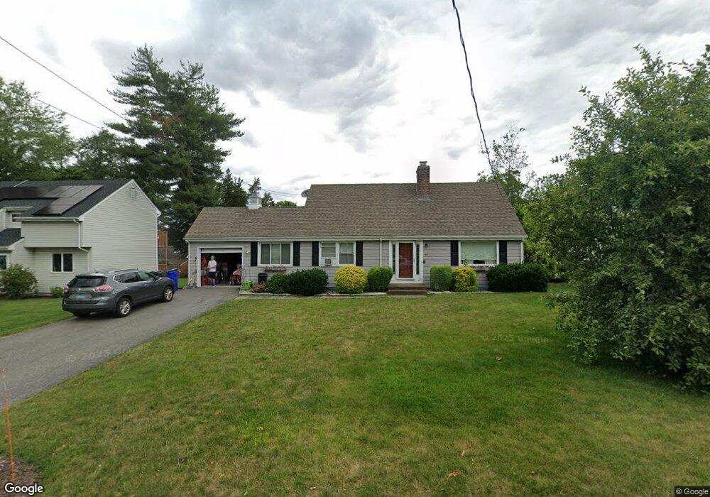
37 Cranston Ave Wethersfield, CT 06109
Estimated Value: $379,000 - $440,000
3
Beds
2
Baths
1,790
Sq Ft
$227/Sq Ft
Est. Value
About This Home
This home is located at 37 Cranston Ave, Wethersfield, CT 06109 and is currently estimated at $405,701, approximately $226 per square foot. 37 Cranston Ave is a home located in Hartford County with nearby schools including Samuel B. Webb Elementary School, Silas Deane Middle School, and Wethersfield High School.
Ownership History
Date
Name
Owned For
Owner Type
Purchase Details
Closed on
Mar 28, 2001
Sold by
Est Levasseur Ameta A and Levasseur Peter
Bought by
Bradbury Stephen F and Bradbury Kimberly N
Current Estimated Value
Home Financials for this Owner
Home Financials are based on the most recent Mortgage that was taken out on this home.
Original Mortgage
$153,000
Interest Rate
6.96%
Create a Home Valuation Report for This Property
The Home Valuation Report is an in-depth analysis detailing your home's value as well as a comparison with similar homes in the area
Home Values in the Area
Average Home Value in this Area
Purchase History
| Date | Buyer | Sale Price | Title Company |
|---|---|---|---|
| Bradbury Stephen F | $150,000 | -- |
Source: Public Records
Mortgage History
| Date | Status | Borrower | Loan Amount |
|---|---|---|---|
| Closed | Bradbury Stephen F | $48,900 | |
| Open | Bradbury Stephen F | $196,000 | |
| Closed | Bradbury Stephen F | $199,750 | |
| Closed | Bradbury Stephen F | $153,000 |
Source: Public Records
Tax History
| Year | Tax Paid | Tax Assessment Tax Assessment Total Assessment is a certain percentage of the fair market value that is determined by local assessors to be the total taxable value of land and additions on the property. | Land | Improvement |
|---|---|---|---|---|
| 2025 | $10,352 | $251,130 | $97,020 | $154,110 |
| 2024 | $6,732 | $155,770 | $65,800 | $89,970 |
| 2023 | $6,508 | $155,770 | $65,800 | $89,970 |
| 2022 | $6,399 | $155,770 | $65,800 | $89,970 |
| 2021 | $6,335 | $155,770 | $65,800 | $89,970 |
| 2020 | $6,338 | $155,770 | $65,800 | $89,970 |
| 2019 | $6,346 | $155,770 | $65,800 | $89,970 |
| 2018 | $6,435 | $157,800 | $63,300 | $94,500 |
| 2017 | $6,276 | $157,800 | $63,300 | $94,500 |
| 2016 | $6,082 | $157,800 | $63,300 | $94,500 |
| 2015 | $6,026 | $157,800 | $63,300 | $94,500 |
| 2014 | $5,798 | $157,800 | $63,300 | $94,500 |
Source: Public Records
Map
Nearby Homes
- 273 Forest Dr
- 173 Timber Trail
- 20 Forest Dr
- 7 Barrington Dr Unit C
- 295 Ridge Rd Unit 8
- 104 Willow St
- 274 Cedarwood Ln
- 116 Wells Farm Dr
- 79 Piper Brook Ave
- 48 Ridge Crest Cir
- 1310 Berlin Turnpike Unit 223
- 82 Millbrook Ct
- 33 Cedar Ridge Rd
- 19 Albert Ave
- 455 Brimfield Rd
- 38 Northwood Rd
- 263 Williamstown Ct
- 62 Harold Dr
- 131 Williamstown Ct Unit 131
- 27 Harding Ave
- 43 Cranston Ave
- 29 Cranston Ave
- 48 Pawtucket Ave
- 40 Pawtucket Ave
- 49 Cranston Ave
- 21 Cranston Ave
- 38 Cranston Ave
- 36 Pawtucket Ave
- 60 Pawtucket Ave
- 63 Cranston Ave
- 48 Cranston Ave
- 34 Cranston Ave
- 50 Cranston Ave
- 4 Providence St
- 22 Cranston Ave
- 10 Providence St
- 43 Kingston St
- 60 Cranston Ave
- 171 Goff Rd
- 35 Kingston St
Your Personal Tour Guide
Ask me questions while you tour the home.