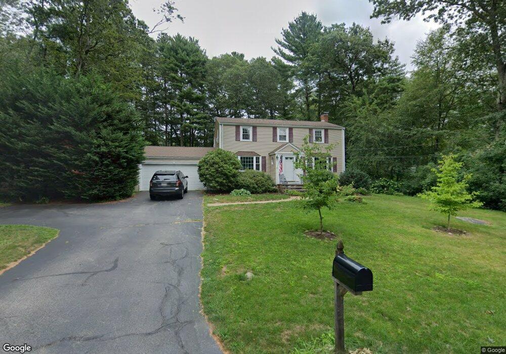
37 Deborah Rd Hanover, MA 02339
Estimated Value: $810,063 - $891,000
4
Beds
2
Baths
1,904
Sq Ft
$446/Sq Ft
Est. Value
About This Home
This home is located at 37 Deborah Rd, Hanover, MA 02339 and is currently estimated at $849,266, approximately $446 per square foot. 37 Deborah Rd is a home located in Plymouth County with nearby schools including Hanover High School, Cadence Academy Preschool - Hanover, and The Master's Academy.
Ownership History
Date
Name
Owned For
Owner Type
Purchase Details
Closed on
Sep 6, 2018
Sold by
Donovan Paul R and Donovan Laura J
Bought by
Martin John E and Martin Magdalena M
Current Estimated Value
Home Financials for this Owner
Home Financials are based on the most recent Mortgage that was taken out on this home.
Original Mortgage
$405,000
Outstanding Balance
$349,519
Interest Rate
4.5%
Mortgage Type
New Conventional
Estimated Equity
$499,747
Purchase Details
Closed on
Oct 26, 1995
Sold by
Durant Susan W and Durant Robert H
Bought by
Donovan Paul R and Donovan Laura J
Purchase Details
Closed on
Oct 1, 1991
Sold by
Aizenstadt Michael S and Aizenstadt Patricia
Bought by
Durant Robert H and Durant Susan W
Create a Home Valuation Report for This Property
The Home Valuation Report is an in-depth analysis detailing your home's value as well as a comparison with similar homes in the area
Home Values in the Area
Average Home Value in this Area
Purchase History
| Date | Buyer | Sale Price | Title Company |
|---|---|---|---|
| Martin John E | $544,000 | -- | |
| Donovan Paul R | $208,000 | -- | |
| Durant Robert H | $218,000 | -- |
Source: Public Records
Mortgage History
| Date | Status | Borrower | Loan Amount |
|---|---|---|---|
| Open | Martin John E | $405,000 | |
| Previous Owner | Durant Robert H | $238,000 | |
| Previous Owner | Durant Robert H | $50,000 |
Source: Public Records
Tax History
| Year | Tax Paid | Tax Assessment Tax Assessment Total Assessment is a certain percentage of the fair market value that is determined by local assessors to be the total taxable value of land and additions on the property. | Land | Improvement |
|---|---|---|---|---|
| 2025 | $8,982 | $727,300 | $323,300 | $404,000 |
| 2024 | $6,819 | $531,100 | $244,900 | $286,200 |
| 2023 | $7,165 | $531,100 | $244,900 | $286,200 |
| 2022 | $8,099 | $531,100 | $244,900 | $286,200 |
| 2021 | $4,197 | $486,700 | $222,600 | $264,100 |
| 2020 | $7,744 | $474,800 | $222,600 | $252,200 |
| 2019 | $9,227 | $458,200 | $222,600 | $235,600 |
| 2018 | $7,074 | $434,500 | $222,600 | $211,900 |
| 2015 | $6,977 | $432,000 | $228,600 | $203,400 |
Source: Public Records
Map
Nearby Homes
- 62 Larchmont Ln
- 53 Chestnut St
- 506 Main St
- 776 Main St
- 68 East St
- 44 Stone Meadow Ln
- 47 Stone Meadow Ln
- 535 Webster St
- 33 1st Parish Ln
- 46 Brookwood Rd
- 36 Grove St
- 250 Center St
- 51 Cervelli Farm Dr
- 37 Dr
- 23 Cervelli Farm Dr
- 38 Cervelli Farm Dr
- 9 Cervelli Farm Dr
- 164 Main St
- 7 Assinippi Ave Unit 205
- 7 Assinippi Ave Unit 306
- 23 Deborah Rd
- 22 Constitution Way
- 38 Deborah Rd
- 32 Constitution Way
- 48 Deborah Rd
- 24 Deborah Rd
- 304 Union St
- 290 Union St
- 64 James Rd
- 58 Deborah Rd
- 268 Union St
- 71 Deborah Rd
- 312 Union St
- 70 Deborah Rd
- 42 Constitution Way
- Lot 9 Broadway-Left of 1395
- Lot 7 Broadway-Right of 1395
- lot 1 Trailside Ln
- Lot 69 Center Street - Right of 720
- lot six Elijahs Path
Your Personal Tour Guide
Ask me questions while you tour the home.