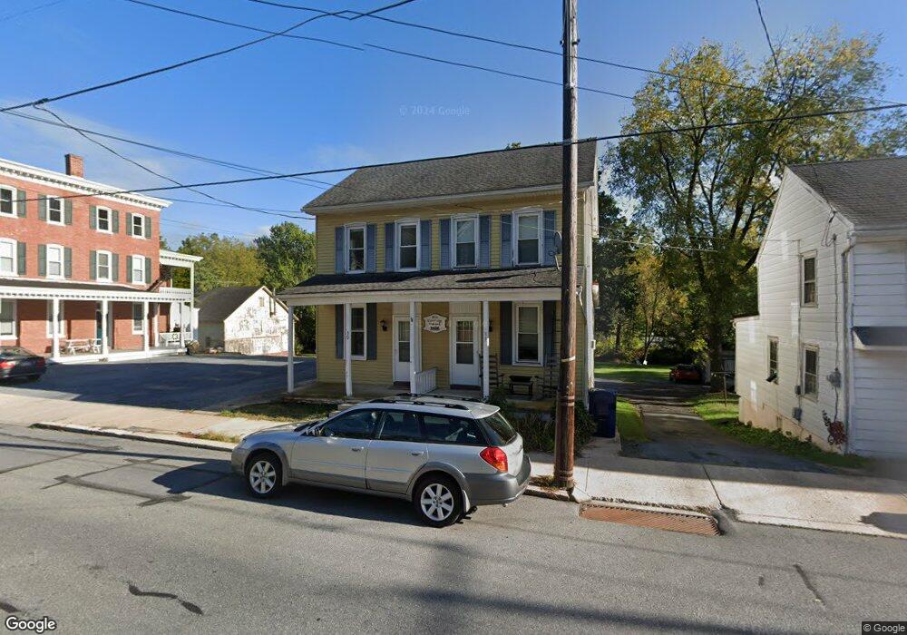
37 E Main St Adamstown, PA 19501
Estimated Value: $272,000 - $315,000
--
Bed
3
Baths
1,736
Sq Ft
$168/Sq Ft
Est. Value
About This Home
This home is located at 37 E Main St, Adamstown, PA 19501 and is currently estimated at $292,331, approximately $168 per square foot. 37 E Main St is a home located in Lancaster County with nearby schools including Cocalico Senior High School, Gehmans Mennonite School, and Trostle Hill School.
Ownership History
Date
Name
Owned For
Owner Type
Purchase Details
Closed on
Apr 2, 2010
Sold by
Brightbill Karen J
Bought by
Schweitzer Mark A and Schweitzer Cindy A
Current Estimated Value
Home Financials for this Owner
Home Financials are based on the most recent Mortgage that was taken out on this home.
Original Mortgage
$130,500
Outstanding Balance
$87,433
Interest Rate
5.12%
Mortgage Type
New Conventional
Estimated Equity
$204,898
Purchase Details
Closed on
Aug 6, 2001
Sold by
Horning Elizabeth K and Sittler Irvin C
Bought by
Brightbill Karen J
Home Financials for this Owner
Home Financials are based on the most recent Mortgage that was taken out on this home.
Original Mortgage
$126,996
Interest Rate
7.21%
Mortgage Type
FHA
Create a Home Valuation Report for This Property
The Home Valuation Report is an in-depth analysis detailing your home's value as well as a comparison with similar homes in the area
Home Values in the Area
Average Home Value in this Area
Purchase History
| Date | Buyer | Sale Price | Title Company |
|---|---|---|---|
| Schweitzer Mark A | $174,000 | None Available | |
| Brightbill Karen J | $128,000 | -- |
Source: Public Records
Mortgage History
| Date | Status | Borrower | Loan Amount |
|---|---|---|---|
| Open | Schweitzer Mark A | $130,500 | |
| Previous Owner | Brightbill Karen J | $126,996 |
Source: Public Records
Tax History Compared to Growth
Tax History
| Year | Tax Paid | Tax Assessment Tax Assessment Total Assessment is a certain percentage of the fair market value that is determined by local assessors to be the total taxable value of land and additions on the property. | Land | Improvement |
|---|---|---|---|---|
| 2025 | $4,182 | $166,300 | $49,900 | $116,400 |
| 2024 | $4,182 | $166,300 | $49,900 | $116,400 |
| 2023 | $3,979 | $166,300 | $49,900 | $116,400 |
| 2022 | $3,979 | $166,300 | $49,900 | $116,400 |
| 2021 | $3,979 | $166,300 | $49,900 | $116,400 |
| 2020 | $3,979 | $166,300 | $49,900 | $116,400 |
| 2019 | $3,932 | $166,300 | $49,900 | $116,400 |
| 2018 | $3,109 | $166,300 | $49,900 | $116,400 |
| 2017 | $3,617 | $124,500 | $23,500 | $101,000 |
| 2016 | $3,617 | $124,500 | $23,500 | $101,000 |
| 2015 | $776 | $124,500 | $23,500 | $101,000 |
| 2014 | $2,779 | $124,500 | $23,500 | $101,000 |
Source: Public Records
Map
Nearby Homes
- 93 E Main St
- 102 Evergreen Rd
- 2145 Old Lancaster Pike
- 122 Witmer Rd
- 303 W Swartzville Rd
- 770 Mohns Hill Rd
- 82 Scenic Dr
- 17 W Kestrel Dr
- 17 Sanderling Dr
- 297 Orchard Rd
- 13 Sanderling Dr
- 44 S Muddy Creek Rd
- 310 Mail Route Rd
- 211 Kocher Rd
- 20 Hill Rd
- 136 Martin Dr
- 270 Gouglersville Rd
- 19 Heatherwood Ln
- 375 Lausch Rd
- 1395 Bowmansville Rd Unit 40