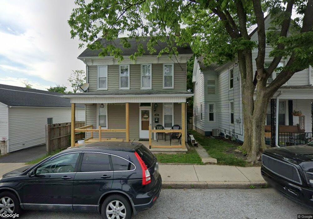
37 E Maple St Dallastown, PA 17313
Estimated Value: $166,000 - $204,000
3
Beds
1
Bath
910
Sq Ft
$193/Sq Ft
Est. Value
About This Home
This home is located at 37 E Maple St, Dallastown, PA 17313 and is currently estimated at $175,685, approximately $193 per square foot. 37 E Maple St is a home located in York County with nearby schools including Dallastown Elementary School, Dallastown Area Middle School, and Dallastown Area High School.
Ownership History
Date
Name
Owned For
Owner Type
Purchase Details
Closed on
May 25, 2018
Sold by
Hammers Rachel and Easter Rachel
Bought by
Lentz Peter D and Lentz Danielle M
Current Estimated Value
Home Financials for this Owner
Home Financials are based on the most recent Mortgage that was taken out on this home.
Original Mortgage
$111,010
Outstanding Balance
$95,583
Interest Rate
4.4%
Mortgage Type
New Conventional
Estimated Equity
$80,102
Purchase Details
Closed on
Apr 22, 2011
Sold by
Hillside Financial Llc
Bought by
Hammers Rachel
Home Financials for this Owner
Home Financials are based on the most recent Mortgage that was taken out on this home.
Original Mortgage
$108,807
Interest Rate
4.76%
Mortgage Type
New Conventional
Purchase Details
Closed on
Apr 13, 2010
Sold by
Secretary Of Housing & Urban Development
Bought by
Hillside Financial Llc
Purchase Details
Closed on
Nov 23, 2009
Sold by
Wells Fargo Bank Na
Bought by
Secretary Of Housing & Urban Development
Purchase Details
Closed on
Nov 10, 2009
Sold by
Stadler Helen and Stadler Stephen
Bought by
Wells Fargo Bank Na
Purchase Details
Closed on
Nov 16, 2006
Sold by
Stadler Helen and Chester Helen B
Bought by
Stadler Stephen and Stadler Helen
Home Financials for this Owner
Home Financials are based on the most recent Mortgage that was taken out on this home.
Original Mortgage
$115,710
Interest Rate
6.31%
Mortgage Type
New Conventional
Purchase Details
Closed on
Jan 21, 2005
Sold by
Kellison Joseph M and Kellison Trisha L
Bought by
Chester Helen B
Home Financials for this Owner
Home Financials are based on the most recent Mortgage that was taken out on this home.
Original Mortgage
$70,200
Interest Rate
5%
Mortgage Type
Fannie Mae Freddie Mac
Purchase Details
Closed on
Mar 16, 2000
Sold by
Bullaj Sadik and Bullaj Tiffany L
Bought by
Kellison Joseph M and Buchmyer Trisha L
Home Financials for this Owner
Home Financials are based on the most recent Mortgage that was taken out on this home.
Original Mortgage
$73,862
Interest Rate
8.31%
Mortgage Type
FHA
Create a Home Valuation Report for This Property
The Home Valuation Report is an in-depth analysis detailing your home's value as well as a comparison with similar homes in the area
Home Values in the Area
Average Home Value in this Area
Purchase History
| Date | Buyer | Sale Price | Title Company |
|---|---|---|---|
| Lentz Peter D | $109,900 | Ladmark Abstract | |
| Hammers Rachel | $105,000 | Chesapeake Title Steve | |
| Hillside Financial Llc | $67,000 | None Available | |
| Secretary Of Housing & Urban Development | -- | None Available | |
| Wells Fargo Bank Na | $2,304 | None Available | |
| Stadler Stephen | -- | None Available | |
| Chester Helen B | $95,200 | -- | |
| Kellison Joseph M | $73,900 | -- |
Source: Public Records
Mortgage History
| Date | Status | Borrower | Loan Amount |
|---|---|---|---|
| Open | Lentz Peter D | $111,010 | |
| Previous Owner | Hammers Rachel | $108,807 | |
| Previous Owner | Stadler Stephen | $115,710 | |
| Previous Owner | Chester Helen B | $70,200 | |
| Previous Owner | Kellison Joseph M | $73,862 |
Source: Public Records
Tax History
| Year | Tax Paid | Tax Assessment Tax Assessment Total Assessment is a certain percentage of the fair market value that is determined by local assessors to be the total taxable value of land and additions on the property. | Land | Improvement |
|---|---|---|---|---|
| 2025 | $2,520 | $72,550 | $19,570 | $52,980 |
| 2024 | $2,520 | $72,550 | $19,570 | $52,980 |
| 2023 | $2,520 | $72,550 | $19,570 | $52,980 |
| 2022 | $2,440 | $72,550 | $19,570 | $52,980 |
| 2021 | $2,301 | $72,550 | $19,570 | $52,980 |
| 2020 | $2,301 | $72,550 | $19,570 | $52,980 |
| 2019 | $2,293 | $72,550 | $19,570 | $52,980 |
| 2018 | $2,293 | $72,550 | $19,570 | $52,980 |
| 2017 | $2,204 | $72,550 | $19,570 | $52,980 |
| 2016 | $0 | $72,550 | $19,570 | $52,980 |
| 2015 | -- | $72,550 | $19,570 | $52,980 |
| 2014 | -- | $72,550 | $19,570 | $52,980 |
Source: Public Records
Map
Nearby Homes
- 226 E Maple St
- 356 E Main St
- 197 S Main St
- 205 Teila Dr
- 314 S Pleasant Ave
- 695 Oak Rd
- 39 W George St
- 100 Clover Hill Rd
- 150 Yoe Dr
- 129 Heather Glen Dr Unit 78
- 127 Heather Glen Dr Unit 80
- 479 Frederick Dr
- 510 Katonah Dr Unit 6
- 240 Palomino Way
- 113 Brant Dr
- 169 Jonathan Way N
- 2881 Sunset Dr
- 320 Avon Dr
- 6 Hudson Blvd
- 374 Avon Dr Unit 282
Your Personal Tour Guide
Ask me questions while you tour the home.