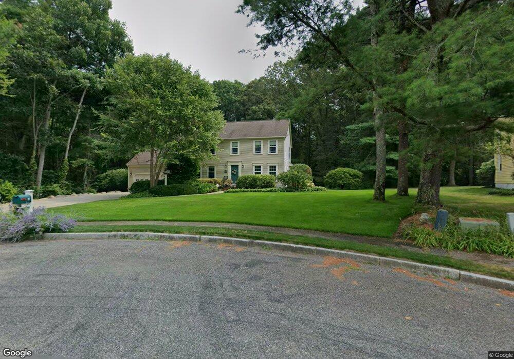
37 Erin Dr Mansfield, MA 02048
Estimated Value: $844,000 - $915,000
4
Beds
3
Baths
2,337
Sq Ft
$374/Sq Ft
Est. Value
About This Home
This home is located at 37 Erin Dr, Mansfield, MA 02048 and is currently estimated at $873,755, approximately $373 per square foot. 37 Erin Dr is a home located in Bristol County with nearby schools including Jordan/Jackson Elementary School, Everett W. Robinson Elementary School, and Harold L. Qualters Middle School.
Create a Home Valuation Report for This Property
The Home Valuation Report is an in-depth analysis detailing your home's value as well as a comparison with similar homes in the area
Home Values in the Area
Average Home Value in this Area
Tax History Compared to Growth
Tax History
| Year | Tax Paid | Tax Assessment Tax Assessment Total Assessment is a certain percentage of the fair market value that is determined by local assessors to be the total taxable value of land and additions on the property. | Land | Improvement |
|---|---|---|---|---|
| 2025 | $9,827 | $746,200 | $278,200 | $468,000 |
| 2024 | $9,697 | $718,300 | $290,200 | $428,100 |
| 2023 | $9,359 | $664,200 | $290,200 | $374,000 |
| 2022 | $8,985 | $592,300 | $268,600 | $323,700 |
| 2021 | $3,439 | $565,600 | $224,000 | $341,600 |
| 2020 | $8,549 | $556,600 | $224,000 | $332,600 |
| 2019 | $3,388 | $533,200 | $186,500 | $346,700 |
| 2018 | $7,094 | $518,400 | $177,900 | $340,500 |
| 2017 | $2,981 | $504,100 | $172,900 | $331,200 |
| 2016 | $7,281 | $472,500 | $164,600 | $307,900 |
| 2015 | $7,082 | $456,900 | $164,600 | $292,300 |
Source: Public Records
Map
Nearby Homes
- 711 Ware St
- 460 Ware St
- 442 Ware St
- 5 Ian Keats Dr
- 18 Millfarm Dr
- 0 Kensington Rd
- 24 Barberry Rd
- 18 Columbine Rd
- 4 Shadybrook Ln
- 631 East St Unit H102
- 631 East St Unit B102
- 631 East St Unit E101
- 0 Knollwood & 0 Rear Kensington
- 5 Pineview Terrace
- 22 S Lakeview Rd
- 1355-1357 East St
- 12 Wilson Place
- 24 Hawthorne Rd
- 1360 East St
- 245 Willow St