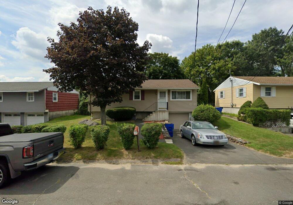
37 Fieldstream Dr Waterbury, CT 06704
Bucks Hill NeighborhoodEstimated Value: $297,000 - $355,000
3
Beds
2
Baths
1,040
Sq Ft
$308/Sq Ft
Est. Value
About This Home
This home is located at 37 Fieldstream Dr, Waterbury, CT 06704 and is currently estimated at $319,886, approximately $307 per square foot. 37 Fieldstream Dr is a home located in New Haven County with nearby schools including Bucks Hill Elementary School, North End Middle School, and Wilby High School.
Ownership History
Date
Name
Owned For
Owner Type
Purchase Details
Closed on
Feb 27, 1992
Sold by
Gregory Nicholas and Gregory Loretta
Bought by
Butler Jamie D
Current Estimated Value
Home Financials for this Owner
Home Financials are based on the most recent Mortgage that was taken out on this home.
Original Mortgage
$93,200
Interest Rate
8.38%
Mortgage Type
Purchase Money Mortgage
Purchase Details
Closed on
Dec 15, 1978
Bought by
Dean Willie and Dean Jamie D
Create a Home Valuation Report for This Property
The Home Valuation Report is an in-depth analysis detailing your home's value as well as a comparison with similar homes in the area
Home Values in the Area
Average Home Value in this Area
Purchase History
| Date | Buyer | Sale Price | Title Company |
|---|---|---|---|
| Butler Jamie D | $94,000 | -- | |
| Dean Willie | $35,000 | -- |
Source: Public Records
Mortgage History
| Date | Status | Borrower | Loan Amount |
|---|---|---|---|
| Closed | Dean Willie | $93,200 | |
| Previous Owner | Dean Willie | $54,000 | |
| Closed | Dean Willie | $4,000 |
Source: Public Records
Tax History Compared to Growth
Tax History
| Year | Tax Paid | Tax Assessment Tax Assessment Total Assessment is a certain percentage of the fair market value that is determined by local assessors to be the total taxable value of land and additions on the property. | Land | Improvement |
|---|---|---|---|---|
| 2025 | $6,285 | $139,720 | $23,870 | $115,850 |
| 2024 | $6,908 | $139,720 | $23,870 | $115,850 |
| 2023 | $7,571 | $139,720 | $23,870 | $115,850 |
| 2022 | $4,897 | $81,340 | $23,870 | $57,470 |
| 2021 | $4,897 | $81,340 | $23,870 | $57,470 |
| 2020 | $4,897 | $81,340 | $23,870 | $57,470 |
| 2019 | $4,897 | $81,340 | $23,870 | $57,470 |
| 2018 | $4,897 | $81,340 | $23,870 | $57,470 |
| 2017 | $5,148 | $85,500 | $23,870 | $61,630 |
| 2016 | $5,148 | $85,500 | $23,870 | $61,630 |
| 2015 | $4,854 | $83,370 | $23,870 | $59,500 |
| 2014 | $4,854 | $83,370 | $23,870 | $59,500 |
Source: Public Records
Map
Nearby Homes
- 45 Fieldstream Dr
- 8 Hayfield Rd
- 119 Lincolndale Dr
- 79 Fieldstone Rd
- 189 Fieldwood Rd
- 267 Fieldwood Rd
- 123 Chipper Rd
- 64 Deerwood Ln Unit 10
- 64 Deerwood Ln Unit 2
- 0 Grassy Hill Rd Unit 24070167
- 20 Society Hill Rd
- 701 Bucks Hill Rd
- 285 Sheffield St
- 15 Yorktown Ridge Unit Lot 2
- 00 Halperin Ct
- 16 Kingsley Ct Unit Lot 9
- 159 Yale St
- 36 Randall Place
- 0 Goff St
- 474 Chestnut Hill Ave
- 31 Fieldstream Dr
- 44 Fieldstream Dr
- 25 Fieldstream Dr
- 7 Brookfield Rd
- 51 Fieldstream Dr
- 15 Brookfield Rd
- 17 Fieldstream Dr
- 6 Brookfield Rd
- 24 Spread Oak Ln
- 1 Spread Oak Ln
- 23 Hayfield Rd
- 25 Brookfield Rd
- 252 Lincolndale Dr
- 18 Brookfield Rd
- 15 Spread Oak Ln
- 15 Spread Oak Ln Unit left
- 242 Lincolndale Dr
- 11 Fieldstream Dr
- 232 Lincolndale Dr
- 40 Spread Oak Ln