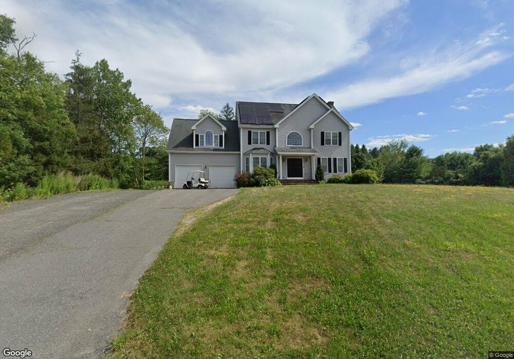
37 Francis Farm Rd Rehoboth, MA 02769
Estimated Value: $802,112 - $989,000
4
Beds
3
Baths
2,794
Sq Ft
$316/Sq Ft
Est. Value
About This Home
This home is located at 37 Francis Farm Rd, Rehoboth, MA 02769 and is currently estimated at $882,028, approximately $315 per square foot. 37 Francis Farm Rd is a home located in Bristol County with nearby schools including Dighton-Rehoboth Regional High School and Cedar Brook School.
Ownership History
Date
Name
Owned For
Owner Type
Purchase Details
Closed on
May 11, 2020
Sold by
Foley Kenneth J and Foley Linda K
Bought by
Foley Tracey and Foley Kevin J
Current Estimated Value
Purchase Details
Closed on
Apr 25, 2007
Sold by
Carvalho Builders Corp
Bought by
Foley Kenneth J and Foley Linda K
Home Financials for this Owner
Home Financials are based on the most recent Mortgage that was taken out on this home.
Original Mortgage
$460,000
Interest Rate
6.18%
Mortgage Type
Purchase Money Mortgage
Create a Home Valuation Report for This Property
The Home Valuation Report is an in-depth analysis detailing your home's value as well as a comparison with similar homes in the area
Home Values in the Area
Average Home Value in this Area
Purchase History
| Date | Buyer | Sale Price | Title Company |
|---|---|---|---|
| Foley Tracey | $540,000 | None Available | |
| Foley Kenneth J | $575,000 | -- |
Source: Public Records
Mortgage History
| Date | Status | Borrower | Loan Amount |
|---|---|---|---|
| Previous Owner | Foley Kenneth J | $460,000 |
Source: Public Records
Tax History Compared to Growth
Tax History
| Year | Tax Paid | Tax Assessment Tax Assessment Total Assessment is a certain percentage of the fair market value that is determined by local assessors to be the total taxable value of land and additions on the property. | Land | Improvement |
|---|---|---|---|---|
| 2025 | $76 | $685,900 | $176,600 | $509,300 |
| 2024 | $8,053 | $708,900 | $211,200 | $497,700 |
| 2023 | $7,153 | $642,800 | $206,800 | $436,000 |
| 2022 | $7,153 | $564,600 | $189,900 | $374,700 |
| 2021 | $6,997 | $528,500 | $173,300 | $355,200 |
| 2020 | $7,039 | $536,500 | $181,300 | $355,200 |
| 2018 | $6,014 | $502,400 | $172,800 | $329,600 |
| 2017 | $5,786 | $460,700 | $172,800 | $287,900 |
| 2016 | $5,690 | $468,300 | $180,400 | $287,900 |
| 2015 | $5,355 | $435,000 | $172,200 | $262,800 |
| 2014 | $5,308 | $426,700 | $163,900 | $262,800 |
Source: Public Records
Map
Nearby Homes
- 20 Taylor Dr
- 63 Moulton St
- 29 Moulton St
- 28 Bucklin Dr
- Lot 7 Muriel Way
- 225 Winthrop St
- 180 Moulton St
- 0 Winthrop St Unit 73180872
- 246 Winthrop St
- 134 Bay State Rd
- 0 Horton St Unit 73333337
- 2661 Horton St
- 8 Linden Ln
- 8 Linden Ln
- 133 Winthrop St
- 43 Williams St
- 24 New St
- 111 Summer St
- 105 Winthrop St
- 20 School St
- 41 Francis Farm Rd
- 32 Francis Farm Rd
- 40 Francis Farm Rd
- 43 Francis Farm Rd
- 15 Taylor Dr
- 16 Taylor Dr
- 28 Francis Farm Rd
- 151 County St
- 20 Francis Farm Rd
- 7 Taylor Dr
- 12 Taylor Dr
- 3 Taylor Dr
- 8 Taylor Dr
- 179 County St
- 15 Francis Farm Rd
- 4 Taylor Dr
- 11 Francis Farm Rd
- 117 County St
- 161 County St
- 7 Francis Farm Rd