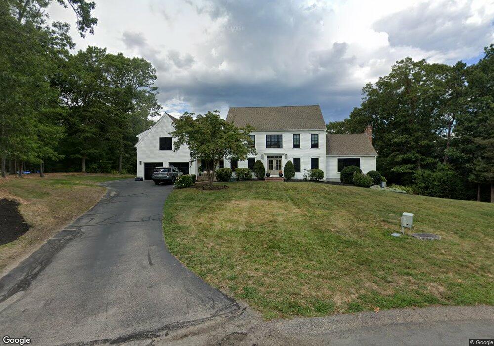
37 Franklin Rodgers Rd Hingham, MA 02043
Estimated Value: $1,937,000 - $2,318,000
4
Beds
3
Baths
3,687
Sq Ft
$580/Sq Ft
Est. Value
About This Home
This home is located at 37 Franklin Rodgers Rd, Hingham, MA 02043 and is currently estimated at $2,137,279, approximately $579 per square foot. 37 Franklin Rodgers Rd is a home located in Plymouth County with nearby schools including Plymouth River Elementary School, Hingham Middle School, and Hingham High School.
Ownership History
Date
Name
Owned For
Owner Type
Purchase Details
Closed on
May 15, 2018
Sold by
Donovan Thomas E and Donovan Eleanor
Bought by
Berte Stephen and Berte Andre
Current Estimated Value
Home Financials for this Owner
Home Financials are based on the most recent Mortgage that was taken out on this home.
Original Mortgage
$690,000
Outstanding Balance
$586,806
Interest Rate
3.88%
Mortgage Type
Unknown
Estimated Equity
$1,550,473
Create a Home Valuation Report for This Property
The Home Valuation Report is an in-depth analysis detailing your home's value as well as a comparison with similar homes in the area
Purchase History
| Date | Buyer | Sale Price | Title Company |
|---|---|---|---|
| Berte Stephen | $1,280,000 | -- |
Source: Public Records
Mortgage History
| Date | Status | Borrower | Loan Amount |
|---|---|---|---|
| Open | Berte Stephen | $690,000 |
Source: Public Records
Tax History Compared to Growth
Tax History
| Year | Tax Paid | Tax Assessment Tax Assessment Total Assessment is a certain percentage of the fair market value that is determined by local assessors to be the total taxable value of land and additions on the property. | Land | Improvement |
|---|---|---|---|---|
| 2025 | $19,655 | $1,838,600 | $653,900 | $1,184,700 |
| 2024 | $18,804 | $1,733,100 | $653,900 | $1,079,200 |
| 2023 | $15,991 | $1,599,100 | $653,900 | $945,200 |
| 2022 | $15,481 | $1,339,200 | $584,900 | $754,300 |
| 2021 | $6,277 | $1,256,400 | $562,400 | $694,000 |
| 2020 | $8,078 | $1,256,400 | $562,400 | $694,000 |
| 2019 | $14,262 | $1,207,600 | $562,400 | $645,200 |
| 2018 | $4,627 | $1,207,600 | $562,400 | $645,200 |
| 2017 | $0 | $1,148,100 | $582,000 | $566,100 |
| 2016 | $13,995 | $1,120,500 | $554,400 | $566,100 |
| 2015 | $13,708 | $1,094,000 | $527,900 | $566,100 |
Source: Public Records
Map
Nearby Homes
- 18 West St
- 16 Beal's Cove Rd Unit E
- 225 South St Unit 1
- 191 South St
- 246 North St
- 21 Hersey St
- 15 Lewis Ct
- 6 Brewer Way
- 7 Lewis Ct
- 109 Merryknoll Rd
- 19 Lantern Ln
- 132 Hms Stayner Dr Unit 132
- 30 Puritan Rd
- 425 East St
- 178 Hersey St
- 125 Halsted Dr Unit 125
- 251 Green St
- 216 East St
- 320 Green St
- 9 Cranberry Ln
- 34 Franklin Rodgers Rd
- 35 Franklin Rodgers Rd
- 32 Franklin Rodgers Rd
- 30 Franklin Rodgers Rd
- 33 Franklin Rodgers Rd
- 28 Franklin Rodgers Rd
- 31 Franklin Rodgers Rd
- 29 Franklin Rodgers Rd
- 24 Franklin Rodgers Rd
- 22 Franklin Rodgers Rd
- 20 Franklin Rodgers Rd
- 18 Franklin Rodgers Rd
- 23 Franklin Rodgers Rd
- 16 Franklin Rodgers Rd
- 21 Franklin Rodgers Rd
- 24 Isaac Sprague Dr
- 19 Franklin Rodgers Rd
- 14 Franklin Rodgers Rd
- 27 Isaac Sprague Dr
- 17 Franklin Rodgers Rd