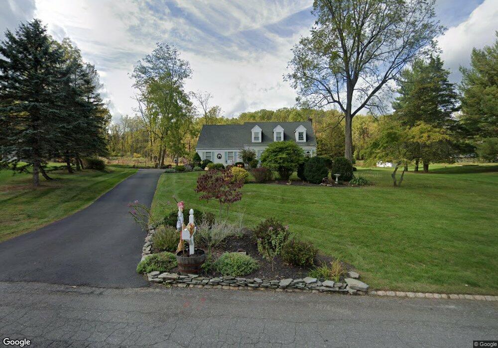
37 Honeyman Dr Flemington, NJ 08822
Estimated Value: $664,548 - $764,000
--
Bed
--
Bath
2,309
Sq Ft
$308/Sq Ft
Est. Value
About This Home
This home is located at 37 Honeyman Dr, Flemington, NJ 08822 and is currently estimated at $711,637, approximately $308 per square foot. 37 Honeyman Dr is a home located in Hunterdon County with nearby schools including Francis A. Desmares Elementary School, Reading Fleming Intermediate School, and J.P. Case Middle School.
Ownership History
Date
Name
Owned For
Owner Type
Purchase Details
Closed on
May 29, 2008
Sold by
Owens Kathryn and Norton Kathryn O
Bought by
Moore James M and Moore Carrie S
Current Estimated Value
Home Financials for this Owner
Home Financials are based on the most recent Mortgage that was taken out on this home.
Original Mortgage
$25,000
Outstanding Balance
$16,092
Interest Rate
6.11%
Mortgage Type
Credit Line Revolving
Estimated Equity
$695,545
Purchase Details
Closed on
Jun 25, 2005
Sold by
Sood Anup and Sood Cynthia K
Bought by
Norton Kathryn O
Home Financials for this Owner
Home Financials are based on the most recent Mortgage that was taken out on this home.
Original Mortgage
$140,000
Interest Rate
6.39%
Mortgage Type
Fannie Mae Freddie Mac
Purchase Details
Closed on
Mar 20, 1999
Sold by
Howard Stephen A
Bought by
Sood Anup and Sood Cynthia K
Create a Home Valuation Report for This Property
The Home Valuation Report is an in-depth analysis detailing your home's value as well as a comparison with similar homes in the area
Home Values in the Area
Average Home Value in this Area
Purchase History
| Date | Buyer | Sale Price | Title Company |
|---|---|---|---|
| Moore James M | $500,000 | None Available | |
| Norton Kathryn O | $490,000 | None Available | |
| Sood Anup | $280,000 | -- |
Source: Public Records
Mortgage History
| Date | Status | Borrower | Loan Amount |
|---|---|---|---|
| Open | Moore James M | $25,000 | |
| Open | Moore James M | $400,000 | |
| Previous Owner | Norton Kathryn O | $140,000 |
Source: Public Records
Tax History Compared to Growth
Tax History
| Year | Tax Paid | Tax Assessment Tax Assessment Total Assessment is a certain percentage of the fair market value that is determined by local assessors to be the total taxable value of land and additions on the property. | Land | Improvement |
|---|---|---|---|---|
| 2025 | $13,575 | $468,600 | $239,700 | $228,900 |
| 2024 | $12,765 | $468,600 | $239,700 | $228,900 |
| 2023 | $12,765 | $468,600 | $239,700 | $228,900 |
| 2022 | $12,441 | $468,600 | $239,700 | $228,900 |
| 2021 | $11,804 | $468,600 | $239,700 | $228,900 |
| 2020 | $12,048 | $468,600 | $239,700 | $228,900 |
| 2019 | $11,804 | $468,600 | $239,700 | $228,900 |
| 2018 | $11,659 | $468,600 | $239,700 | $228,900 |
| 2017 | $11,481 | $468,600 | $239,700 | $228,900 |
| 2016 | $11,275 | $468,600 | $239,700 | $228,900 |
| 2015 | $10,989 | $468,600 | $239,700 | $228,900 |
| 2014 | $10,843 | $468,600 | $239,700 | $228,900 |
Source: Public Records
Map
Nearby Homes
- 25 Haddenford Dr
- 6 W View Dr
- 12 Corcoran St
- 92 Park Ave
- 5 William Martin Way Unit 5
- 31 E Main St
- 0 Hardscrabble Hill Rd
- 81 Elwood Ave
- 110 Mine St
- 31 Cherryville Hollow Rd
- 8 Reasoner Ln
- 5 Morningside Ct
- 100 State Route 12
- 28 Old Clinton Rd
- 29 Royal Rd
- 5 Erin Place
- 23 Valley View Dr
- 57 Featherbed Ln
- 402 Clark Cir
- 15 Colts Ln