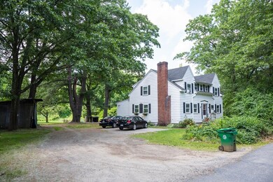
37 James Rd Ashland, MA 01721
Estimated payment $12,070/month
Highlights
- 14.81 Acre Lot
- Property is near public transit
- Jogging Path
- Ashland Middle School Rated A-
- No HOA
- Shops
About This Lot
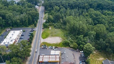
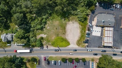
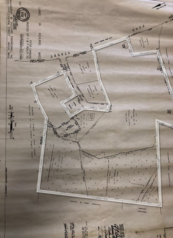
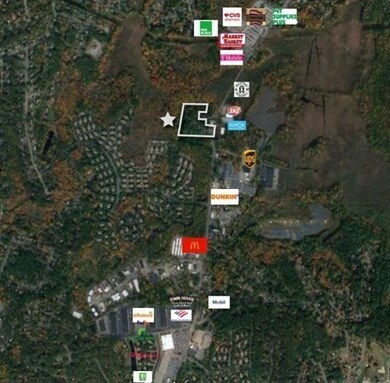
Address: 0 James Road Rear; 0 James Road Rear; 5 James Road; 15 James Road; 37 James Road, Ashland, MA (5 parcels total) Available Square Ft.: 14.81 Acres of Land for Sale Description: Last major land development opportunity along Route 126 in Ashland, MA! 14.81 acres of land (Approximately 9.51 developable acres) offering a wide variety of potential uses. Highway commercial zoning. Permitted uses include single-family residential lots; general retail; medical; office; restaurant; and more. Uses potentially allowable by appeal include multi-unit residential; senior residential facility; business with drive-through and more. (Confirmation of zoning responsibility of buyer.) Property features 242 feet of direct Route 126 frontage with curb cut. Ideally located on Route 126 in Ashland between Framingham and Holliston. In the heart of commercial sector featuring Market Basket and Shaw’s Plazas, McDonalds, Dunkin’ Donuts and other major retailers. 15,000 Average Daily Traffic Count.
Listing Agent
Jonathan Gordon
Gordon Real Estate Listed on: 07/06/2021
Property Details
Property Type
- Land
Est. Annual Taxes
- $13,976
Lot Details
- 14.81 Acre Lot
- Level Lot
- Property is zoned HC
Additional Features
- Property is near public transit
- Electricity To Lot Line
Listing and Financial Details
- Assessor Parcel Number 3296100
Community Details
Recreation
- Jogging Path
Additional Features
- No Home Owners Association
- Shops
Map
Home Values in the Area
Average Home Value in this Area
Tax History
| Year | Tax Paid | Tax Assessment Tax Assessment Total Assessment is a certain percentage of the fair market value that is determined by local assessors to be the total taxable value of land and additions on the property. | Land | Improvement |
|---|---|---|---|---|
| 2025 | $8,263 | $647,100 | $485,500 | $161,600 |
| 2024 | $8,074 | $609,800 | $462,500 | $147,300 |
| 2023 | $7,404 | $537,700 | $421,100 | $116,600 |
| 2022 | $7,386 | $465,100 | $361,100 | $104,000 |
| 2021 | $11,380 | $437,400 | $353,100 | $84,300 |
| 2020 | $6,494 | $419,200 | $348,200 | $71,000 |
| 2019 | $6,615 | $406,300 | $304,200 | $102,100 |
| 2018 | $10,711 | $390,800 | $296,300 | $94,500 |
| 2017 | $6,428 | $384,900 | $295,100 | $89,800 |
| 2016 | $6,378 | $375,200 | $295,100 | $80,100 |
| 2015 | $6,263 | $362,000 | $283,100 | $78,900 |
| 2014 | $6,297 | $362,100 | $343,200 | $18,900 |
Property History
| Date | Event | Price | List to Sale | Price per Sq Ft |
|---|---|---|---|---|
| 11/02/2023 11/02/23 | Pending | -- | -- | -- |
| 05/08/2023 05/08/23 | Price Changed | $2,100,000 | 0.0% | -- |
| 05/08/2023 05/08/23 | For Sale | $2,100,000 | +16.7% | -- |
| 12/14/2022 12/14/22 | Off Market | $1,800,000 | -- | -- |
| 12/05/2022 12/05/22 | For Sale | $1,800,000 | 0.0% | -- |
| 08/30/2021 08/30/21 | Pending | -- | -- | -- |
| 07/06/2021 07/06/21 | For Sale | $1,800,000 | -- | -- |
Purchase History
| Date | Type | Sale Price | Title Company |
|---|---|---|---|
| Deed | -- | -- |
Source: MLS Property Information Network (MLS PIN)
MLS Number: 72860551
APN: ASHL-000022-000013
- 158 Algonquin Trail
- 45 Half Crown Cir
- 343 Captain Eames Cir Unit 38-C
- 102 Captain Eames Cir
- 9 Adams Rd
- 373 Eliot St
- 1 Adams Rd
- 2 Adams Rd Unit 2
- 363 Eliot St
- 146 E Union St
- 67 Spyglass Hill Dr
- 63 Trailside Way Unit 63
- 306 Trailside Way
- 277 Meeting House Path
- 26 Meeting House Path Unit 26
- 74 Meeting House Path
- 638 Main St
- 69 Gilbert St
- 131 Mellen St Unit 3B
- 8 Raymond Way

