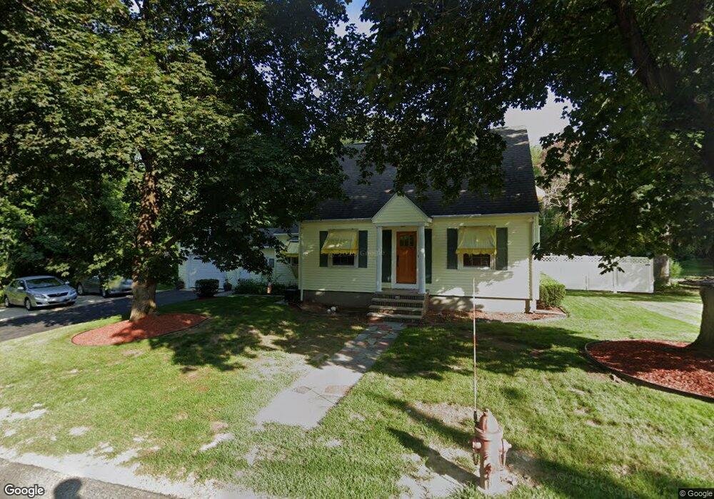
37 Kay St Cumberland, RI 02864
Cumberland Hill NeighborhoodEstimated Value: $497,000 - $542,000
2
Beds
2
Baths
1,614
Sq Ft
$321/Sq Ft
Est. Value
About This Home
This home is located at 37 Kay St, Cumberland, RI 02864 and is currently estimated at $518,784, approximately $321 per square foot. 37 Kay St is a home located in Providence County with nearby schools including John J. McLaughlin Cumberland Hill School, North Cumberland Middle School, and Cumberland High School.
Ownership History
Date
Name
Owned For
Owner Type
Purchase Details
Closed on
Aug 31, 1998
Sold by
Delisle Henry and Delisle Lily
Bought by
Mandeville Joseph A and Mandeville Karen
Current Estimated Value
Home Financials for this Owner
Home Financials are based on the most recent Mortgage that was taken out on this home.
Original Mortgage
$107,600
Interest Rate
6.9%
Mortgage Type
Purchase Money Mortgage
Create a Home Valuation Report for This Property
The Home Valuation Report is an in-depth analysis detailing your home's value as well as a comparison with similar homes in the area
Home Values in the Area
Average Home Value in this Area
Purchase History
| Date | Buyer | Sale Price | Title Company |
|---|---|---|---|
| Mandeville Joseph A | $134,500 | -- |
Source: Public Records
Mortgage History
| Date | Status | Borrower | Loan Amount |
|---|---|---|---|
| Closed | Mandeville Joseph A | $96,500 | |
| Closed | Mandeville Joseph A | $127,900 | |
| Closed | Mandeville Joseph A | $107,600 |
Source: Public Records
Tax History Compared to Growth
Tax History
| Year | Tax Paid | Tax Assessment Tax Assessment Total Assessment is a certain percentage of the fair market value that is determined by local assessors to be the total taxable value of land and additions on the property. | Land | Improvement |
|---|---|---|---|---|
| 2025 | $4,734 | $385,800 | $154,900 | $230,900 |
| 2024 | $4,610 | $385,800 | $154,900 | $230,900 |
| 2023 | $4,483 | $385,800 | $154,900 | $230,900 |
| 2022 | $4,242 | $283,000 | $110,700 | $172,300 |
| 2021 | $4,171 | $283,000 | $110,700 | $172,300 |
| 2020 | $4,053 | $283,000 | $110,700 | $172,300 |
| 2019 | $3,921 | $246,900 | $93,200 | $153,700 |
| 2018 | $3,807 | $246,900 | $93,200 | $153,700 |
| 2017 | $3,755 | $246,900 | $93,200 | $153,700 |
| 2016 | $3,517 | $205,900 | $93,200 | $112,700 |
| 2015 | $3,517 | $205,900 | $93,200 | $112,700 |
| 2014 | $3,517 | $205,900 | $93,200 | $112,700 |
| 2013 | $3,918 | $248,300 | $93,200 | $155,100 |
Source: Public Records
Map
Nearby Homes
- 78 George St
- 6 Rolling Acres Dr
- 2894 Mendon Rd
- 2970 Mendon Rd Unit 84
- 2970 Mendon Rd Unit 101
- 2970 Mendon Rd Unit 154
- 22 Jackson St
- 28 Cadoret Dr
- 41 Mount Pleasant View Ave
- 2 Angle St Unit 5
- 70 Chestnut St
- 40 Warren Ave
- 7 Cathedral Ct
- 140 Main St
- 400 New River Rd Unit 211
- 400 New River Rd Unit 603
- 23 Plant St
- 18 Division St
- 96 Evergreen St
- 13 Plant St