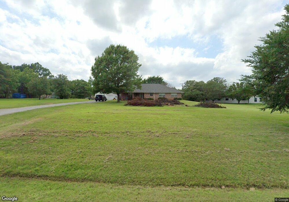
37 Lariat Dr Denison, TX 75021
Estimated Value: $346,762 - $367,000
3
Beds
2
Baths
1,727
Sq Ft
$207/Sq Ft
Est. Value
About This Home
This home is located at 37 Lariat Dr, Denison, TX 75021 and is currently estimated at $356,881, approximately $206 per square foot. 37 Lariat Dr is a home located in Grayson County with nearby schools including Lamar Elementary School, Scott Middle School, and Denison High School.
Ownership History
Date
Name
Owned For
Owner Type
Purchase Details
Closed on
Sep 23, 2020
Sold by
Green Jeremy W and Green Michelle
Bought by
Southern Travis Carl and Southern Nikki Denise
Current Estimated Value
Home Financials for this Owner
Home Financials are based on the most recent Mortgage that was taken out on this home.
Original Mortgage
$252,345
Outstanding Balance
$223,939
Interest Rate
2.9%
Mortgage Type
FHA
Estimated Equity
$132,942
Purchase Details
Closed on
Feb 9, 2012
Sold by
Green Harold K and Green Mary Beth
Bought by
Green Jeremy M
Home Financials for this Owner
Home Financials are based on the most recent Mortgage that was taken out on this home.
Original Mortgage
$65,000
Interest Rate
4%
Mortgage Type
Seller Take Back
Create a Home Valuation Report for This Property
The Home Valuation Report is an in-depth analysis detailing your home's value as well as a comparison with similar homes in the area
Home Values in the Area
Average Home Value in this Area
Purchase History
| Date | Buyer | Sale Price | Title Company |
|---|---|---|---|
| Southern Travis Carl | -- | Grayson County Title | |
| Green Jeremy M | -- | None Available |
Source: Public Records
Mortgage History
| Date | Status | Borrower | Loan Amount |
|---|---|---|---|
| Open | Southern Travis Carl | $252,345 | |
| Previous Owner | Green Jeremy M | $65,000 |
Source: Public Records
Tax History
| Year | Tax Paid | Tax Assessment Tax Assessment Total Assessment is a certain percentage of the fair market value that is determined by local assessors to be the total taxable value of land and additions on the property. | Land | Improvement |
|---|---|---|---|---|
| 2025 | $4,077 | $365,012 | $137,520 | $227,492 |
| 2024 | $5,442 | $336,994 | $107,640 | $229,354 |
| 2023 | $3,801 | $320,285 | $0 | $0 |
| 2022 | $5,031 | $291,168 | $0 | $0 |
| 2021 | $4,963 | $264,698 | $52,920 | $211,778 |
| 2020 | $4,077 | $204,777 | $31,320 | $173,457 |
| 2019 | $4,348 | $204,730 | $31,320 | $173,410 |
| 2018 | $4,025 | $187,491 | $31,320 | $156,171 |
| 2017 | $3,814 | $176,529 | $26,640 | $149,889 |
| 2016 | $3,620 | $178,792 | $22,140 | $156,652 |
Source: Public Records
Map
Nearby Homes
- 199 Chaparral Estates Dr
- 21 Chaparral Estates Dr
- 230 Frosty Hollow Rd
- TBD N Highway 69
- TBD Johnson Rd
- 1382 US Highway 69
- 246 Karen Dr
- TBD Cross Timber Estates Dr
- 413 Rolling Acres Rd
- 492 Richerson Rd
- 40 Cumberland Cir
- 1747 Desvoignes Rd
- 1838 Richerson Rd
- 732 E Bullock St
- TBD Ledbetter Ln
- 721 E Bullock St
- Vacant Land Ledbetter Ln
- 66 Shady Woods Ln
- 1912 E Texas St
- 1846 Richerson Rd
- 223 Chaparral Estates Dr
- 67 Lariat Dr
- 155 Lariat Dr
- 232 Chaparral Estates Dr
- 24 Lariat Dr
- 203 Lariat Dr
- 147 Chaparral Estates Dr
- 126 Lariat Dr
- 20 Silver Spur Dr
- 279 Lariat Dr
- 280 Lariat Dr
- 2265 Us Highway 69
- 101 Chaparral Estates Dr
- 79 Silver Spur Dr
- 50 Silver Spur Dr
- 230 Lariat Dr
- 2128 Us Highway 69
- 49 Tumbleweed Trail
- 2220 Us Highway 69
- 2184 Us Highway 69
Your Personal Tour Guide
Ask me questions while you tour the home.