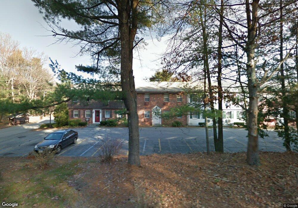
37 Liberty Square Rd Unit A Boxborough, MA 01719
Estimated Value: $168,000 - $221,500
1
Bed
1
Bath
468
Sq Ft
$419/Sq Ft
Est. Value
About This Home
This home is located at 37 Liberty Square Rd Unit A, Boxborough, MA 01719 and is currently estimated at $196,167, approximately $419 per square foot. 37 Liberty Square Rd Unit A is a home located in Middlesex County with nearby schools including Acton-Boxborough Regional High School.
Ownership History
Date
Name
Owned For
Owner Type
Purchase Details
Closed on
Jun 24, 2025
Sold by
Custance Howard E and Custance Phyllis H
Bought by
Custance Phyllis H
Current Estimated Value
Purchase Details
Closed on
Jul 9, 2018
Sold by
Thomas P Keane
Bought by
Ferguson Alice
Home Financials for this Owner
Home Financials are based on the most recent Mortgage that was taken out on this home.
Original Mortgage
$81,375
Interest Rate
4.52%
Purchase Details
Closed on
Jan 27, 1983
Bought by
Custance Howard E and Custance Phyllis H
Create a Home Valuation Report for This Property
The Home Valuation Report is an in-depth analysis detailing your home's value as well as a comparison with similar homes in the area
Home Values in the Area
Average Home Value in this Area
Purchase History
| Date | Buyer | Sale Price | Title Company |
|---|---|---|---|
| Custance Phyllis H | -- | None Available | |
| Custance Phyllis H | -- | None Available | |
| Ferguson Alice | $100 | -- | |
| Custance Howard E | $33,900 | -- |
Source: Public Records
Mortgage History
| Date | Status | Borrower | Loan Amount |
|---|---|---|---|
| Previous Owner | Custance Howard E | $81,375 | |
| Previous Owner | Custance Howard E | -- |
Source: Public Records
Tax History Compared to Growth
Tax History
| Year | Tax Paid | Tax Assessment Tax Assessment Total Assessment is a certain percentage of the fair market value that is determined by local assessors to be the total taxable value of land and additions on the property. | Land | Improvement |
|---|---|---|---|---|
| 2025 | $2,572 | $169,900 | $0 | $169,900 |
| 2024 | $2,313 | $154,300 | $0 | $154,300 |
| 2023 | $2,316 | $149,200 | $0 | $149,200 |
| 2022 | $1,883 | $108,100 | $0 | $108,100 |
| 2020 | $1,807 | $108,100 | $0 | $108,100 |
| 2019 | $1,566 | $95,400 | $0 | $95,400 |
| 2018 | $1,284 | $78,100 | $0 | $78,100 |
| 2017 | $1,113 | $66,200 | $0 | $66,200 |
| 2016 | $1,013 | $61,900 | $0 | $61,900 |
| 2015 | $994 | $59,700 | $0 | $59,700 |
| 2014 | $1,077 | $60,900 | $0 | $60,900 |
Source: Public Records
Map
Nearby Homes
- 134 Russet Ln
- 68 Macintosh Ln
- 96 Cedarwood Rd
- 5 Elm St Unit 1
- 9 Elm St Unit 1
- 777 Depot Rd
- 285 Central St Unit 285
- 31 Mohawk Dr
- 92 Willow St Unit 3
- 92 Willow St Unit 2
- 90 Willow St Unit 1
- 12 Olde Lantern Rd
- 89 Windsor Ave
- 3 Heather Hill Rd
- 4,7,8 Crestwood Ln
- 4 Huron Rd
- 139 Picnic St
- 62 Waite Rd
- 1155 Burroughs Rd
- 207 Boxboro Rd
- 37 Liberty Square Rd Unit D
- 37 Liberty Square Rd Unit C
- 37 Liberty Square Rd Unit B
- 37 Liberty Square Rd
- 37 Liberty Square Rd Unit 37D
- 45 Liberty Square Rd Unit D
- 45 Liberty Square Rd Unit C
- 45 Liberty Square Rd Unit B
- 45 Liberty Square Rd Unit A
- 43 Liberty Square Rd Unit D
- 43 Liberty Square Rd Unit C
- 43 Liberty Square Rd Unit B
- 43 Liberty Square Rd Unit A
- 41 Liberty Square Rd Unit D
- 41 Liberty Square Rd Unit C
- 41 Liberty Square Rd Unit B
- 41 Liberty Square Rd Unit A
- 39 Liberty Square Rd Unit D
- 39 Liberty Square Rd Unit C
- 39 Liberty Square Rd Unit B