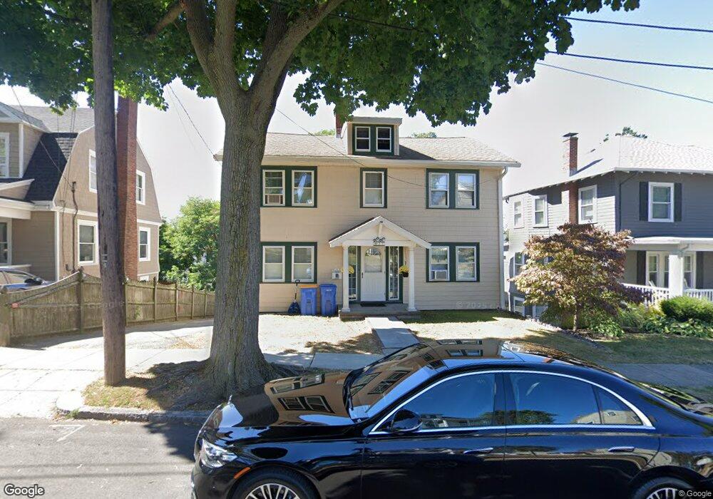
37 Loring Rd Winthrop, MA 02152
Court Park NeighborhoodEstimated Value: $841,000 - $896,000
3
Beds
1
Bath
1,700
Sq Ft
$512/Sq Ft
Est. Value
About This Home
This home is located at 37 Loring Rd, Winthrop, MA 02152 and is currently estimated at $870,648, approximately $512 per square foot. 37 Loring Rd is a home located in Suffolk County with nearby schools including William P. Gorman/Fort Banks Elementary School, Arthur T. Cummings Elementary School, and Winthrop Middle School.
Ownership History
Date
Name
Owned For
Owner Type
Purchase Details
Closed on
Oct 16, 2018
Sold by
Wyatt John A and Wyatt Rose L
Bought by
Gamble Sandra A and Thain James F
Current Estimated Value
Purchase Details
Closed on
Feb 13, 1992
Sold by
Laliberte Margaret E and Kelly John T
Bought by
Wyatt John A and Wyatt Rose L
Create a Home Valuation Report for This Property
The Home Valuation Report is an in-depth analysis detailing your home's value as well as a comparison with similar homes in the area
Home Values in the Area
Average Home Value in this Area
Purchase History
| Date | Buyer | Sale Price | Title Company |
|---|---|---|---|
| Gamble Sandra A | -- | -- | |
| Wyatt John A | $168,000 | -- |
Source: Public Records
Mortgage History
| Date | Status | Borrower | Loan Amount |
|---|---|---|---|
| Previous Owner | Wyatt John A | $120,000 | |
| Previous Owner | Wyatt John A | $130,000 | |
| Previous Owner | Wyatt John A | $40,000 | |
| Previous Owner | Wyatt John A | $20,000 |
Source: Public Records
Tax History Compared to Growth
Tax History
| Year | Tax Paid | Tax Assessment Tax Assessment Total Assessment is a certain percentage of the fair market value that is determined by local assessors to be the total taxable value of land and additions on the property. | Land | Improvement |
|---|---|---|---|---|
| 2025 | $8,103 | $785,200 | $438,200 | $347,000 |
| 2024 | $7,894 | $757,600 | $421,200 | $336,400 |
| 2023 | $7,509 | $701,800 | $385,500 | $316,300 |
| 2022 | $7,165 | $609,300 | $344,300 | $265,000 |
| 2021 | $7,157 | $564,400 | $307,400 | $257,000 |
| 2020 | $7,123 | $564,400 | $307,400 | $257,000 |
| 2019 | $7,022 | $532,800 | $283,300 | $249,500 |
| 2018 | $6,712 | $474,000 | $243,200 | $230,800 |
| 2017 | $6,425 | $445,900 | $231,900 | $214,000 |
| 2016 | $6,246 | $406,400 | $201,700 | $204,700 |
| 2015 | $5,663 | $394,900 | $195,800 | $199,100 |
| 2014 | $5,506 | $353,400 | $150,600 | $202,800 |
Source: Public Records
Map
Nearby Homes
- 44 Birch Rd
- 66 Lowell Rd
- 62 Lowell Rd
- 191 Court Rd Unit 3
- 105 Circuit Rd
- 380 Pleasant St
- 41 Sargent St
- 60 Waldemar Ave
- 55 Johnson Ave Unit 1
- 136 Pauline St
- 35 Somerset Ave Unit 6
- 70 Edgehill Rd
- 40 Cottage Park Rd
- 191 Cottage Park Rd
- 170 Cottage Park Rd
- 10 Somerset Ave Unit 307
- 10 Somerset Ave Unit 304
- 10 Somerset Ave Unit 309
- 10 Somerset Ave Unit 308
- 10 Somerset Ave Unit 206