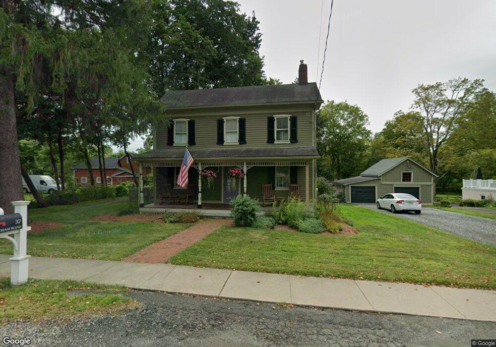
37 Mendham Rd Gladstone, NJ 07934
Estimated Value: $676,680 - $844,000
Studio
--
Bath
1,668
Sq Ft
$447/Sq Ft
Est. Value
About This Home
This home is located at 37 Mendham Rd, Gladstone, NJ 07934 and is currently estimated at $744,920, approximately $446 per square foot. 37 Mendham Rd is a home located in Somerset County with nearby schools including Bedwell Elementary School, Bernardsville Middle School, and Bernards High School.
Ownership History
Date
Name
Owned For
Owner Type
Purchase Details
Closed on
Aug 5, 2005
Sold by
Matthews Diane
Bought by
Nickerson Todd W
Current Estimated Value
Home Financials for this Owner
Home Financials are based on the most recent Mortgage that was taken out on this home.
Original Mortgage
$56,000
Outstanding Balance
$29,418
Interest Rate
5.66%
Mortgage Type
Credit Line Revolving
Estimated Equity
$715,502
Purchase Details
Closed on
Apr 1, 1992
Sold by
Merullo Joseph A and Merullo Joannen
Bought by
Matthews Diane
Create a Home Valuation Report for This Property
The Home Valuation Report is an in-depth analysis detailing your home's value as well as a comparison with similar homes in the area
Home Values in the Area
Average Home Value in this Area
Purchase History
| Date | Buyer | Sale Price | Title Company |
|---|---|---|---|
| Nickerson Todd W | $560,000 | -- | |
| Nickerson Todd W | $560,000 | None Available | |
| Matthews Diane | $240,000 | -- |
Source: Public Records
Mortgage History
| Date | Status | Borrower | Loan Amount |
|---|---|---|---|
| Open | Nickerson Todd W | $56,000 | |
| Open | Nickerson Todd W | $448,000 | |
| Closed | Nickerson Todd W | $448,000 |
Source: Public Records
Tax History
| Year | Tax Paid | Tax Assessment Tax Assessment Total Assessment is a certain percentage of the fair market value that is determined by local assessors to be the total taxable value of land and additions on the property. | Land | Improvement |
|---|---|---|---|---|
| 2025 | $8,689 | $553,000 | $305,600 | $247,400 |
| 2024 | $8,689 | $509,000 | $281,100 | $227,900 |
Source: Public Records
Map
Nearby Homes
Your Personal Tour Guide
Ask me questions while you tour the home.