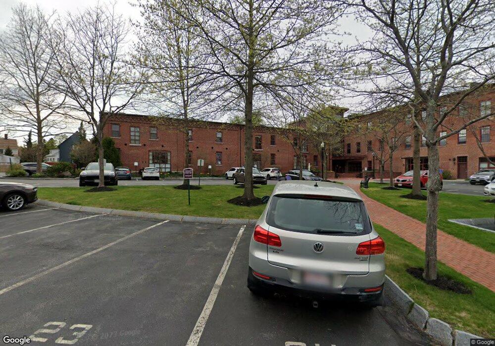
37 Millyard, Unit 310 Amesbury, MA 01913
Estimated Value: $328,339 - $387,000
1
Bed
1
Bath
692
Sq Ft
$521/Sq Ft
Est. Value
About This Home
This home is located at 37 Millyard Unit 310, Amesbury, MA 01913 and is currently estimated at $360,835, approximately $521 per square foot. 37 Millyard Unit 310 is a home located in Essex County with nearby schools including Amesbury High School and Amesbury Seventh-Day Adventist School.
Ownership History
Date
Name
Owned For
Owner Type
Purchase Details
Closed on
Nov 20, 2015
Sold by
Hancock Joan M
Bought by
37 Millyard 14-310 Rt and Dionne Richard
Current Estimated Value
Purchase Details
Closed on
Jul 23, 2004
Sold by
Carriage Lofts Llc
Bought by
Balfour 4Th William A
Home Financials for this Owner
Home Financials are based on the most recent Mortgage that was taken out on this home.
Original Mortgage
$166,500
Interest Rate
6.28%
Mortgage Type
Purchase Money Mortgage
Create a Home Valuation Report for This Property
The Home Valuation Report is an in-depth analysis detailing your home's value as well as a comparison with similar homes in the area
Home Values in the Area
Average Home Value in this Area
Purchase History
| Date | Buyer | Sale Price | Title Company |
|---|---|---|---|
| 37 Millyard 14-310 Rt | -- | -- | |
| Balfour 4Th William A | $185,000 | -- |
Source: Public Records
Mortgage History
| Date | Status | Borrower | Loan Amount |
|---|---|---|---|
| Previous Owner | Balfour 4Th William A | $166,500 |
Source: Public Records
Tax History
| Year | Tax Paid | Tax Assessment Tax Assessment Total Assessment is a certain percentage of the fair market value that is determined by local assessors to be the total taxable value of land and additions on the property. | Land | Improvement |
|---|---|---|---|---|
| 2025 | $5,228 | $341,700 | $0 | $341,700 |
| 2024 | $5,405 | $345,600 | $0 | $345,600 |
| 2023 | $4,395 | $269,000 | $0 | $269,000 |
| 2022 | $4,302 | $243,200 | $0 | $243,200 |
| 2021 | $4,037 | $221,200 | $0 | $221,200 |
| 2020 | $3,800 | $221,200 | $0 | $221,200 |
| 2019 | $3,531 | $192,200 | $0 | $192,200 |
| 2018 | $3,352 | $176,500 | $0 | $176,500 |
| 2017 | $3,276 | $164,200 | $0 | $164,200 |
| 2016 | $3,143 | $155,000 | $0 | $155,000 |
| 2015 | $3,110 | $151,400 | $0 | $151,400 |
| 2014 | $2,649 | $126,300 | $0 | $126,300 |
Source: Public Records
About This Building
Map
Nearby Homes
- 4 Clark St
- 37 Powow St
- 3 Tremont Ave Unit A
- 48 Orchard St
- 97 Elm St
- 25 Cedar St Unit 4
- 101 Market St Unit B
- 105 Market St Unit B
- 1 Hillside Ave Unit 3
- 4 Greenwood St
- 21 Congress St
- 21 River St
- 149 Market St
- 253 Main St
- 1 Brown Ave Unit 1-25
- 25 Whittier Meadows Dr
- 382 Main St
- 82 Monroe St
- 20 Mason Ct
- 47 Cutter Ln Unit 47
- 37 Millyard Unit 107
- 37 Millyard Unit 106
- 37 Millyard Unit 309
- 37 Millyard Unit 308
- 37 Millyard Unit 307
- 37 Millyard Unit 306
- 37 Millyard Unit 305
- 37 Millyard Unit 304
- 37 Millyard Unit 303
- 37 Millyard Unit 302
- 37 Millyard Unit 301
- 37 Millyard Unit 210
- 37 Millyard Unit 209
- 37 Millyard Unit 208
- 37 Millyard Unit 207
- 37 Millyard Unit 205
- 37 Millyard Unit 203
- 37 Millyard Unit 202
- 37 Millyard Unit 201
- 37 Millyard Unit 14-203
Your Personal Tour Guide
Ask me questions while you tour the home.