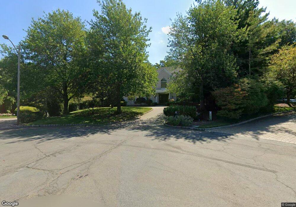
37 Mountain Ridge Dr Livingston, NJ 07039
Estimated Value: $2,491,000 - $3,428,000
--
Bed
--
Bath
5,960
Sq Ft
$507/Sq Ft
Est. Value
About This Home
This home is located at 37 Mountain Ridge Dr, Livingston, NJ 07039 and is currently estimated at $3,019,414, approximately $506 per square foot. 37 Mountain Ridge Dr is a home located in Essex County with nearby schools including Livingston Sr High School, Aquinas Academy, and Mount Carmel Guild High School.
Ownership History
Date
Name
Owned For
Owner Type
Purchase Details
Closed on
Apr 25, 2007
Sold by
Bukantz Carol
Bought by
Ende Philip and Ende Sylvia
Current Estimated Value
Home Financials for this Owner
Home Financials are based on the most recent Mortgage that was taken out on this home.
Original Mortgage
$925,000
Outstanding Balance
$547,843
Interest Rate
5.87%
Mortgage Type
Adjustable Rate Mortgage/ARM
Estimated Equity
$2,471,571
Create a Home Valuation Report for This Property
The Home Valuation Report is an in-depth analysis detailing your home's value as well as a comparison with similar homes in the area
Home Values in the Area
Average Home Value in this Area
Purchase History
| Date | Buyer | Sale Price | Title Company |
|---|---|---|---|
| Ende Philip | $1,925,000 | -- |
Source: Public Records
Mortgage History
| Date | Status | Borrower | Loan Amount |
|---|---|---|---|
| Open | Ende Philip | $925,000 |
Source: Public Records
Tax History Compared to Growth
Tax History
| Year | Tax Paid | Tax Assessment Tax Assessment Total Assessment is a certain percentage of the fair market value that is determined by local assessors to be the total taxable value of land and additions on the property. | Land | Improvement |
|---|---|---|---|---|
| 2025 | $49,219 | $2,075,000 | $657,100 | $1,417,900 |
| 2024 | $49,219 | $2,075,000 | $657,100 | $1,417,900 |
| 2022 | $48,410 | $2,075,000 | $657,100 | $1,417,900 |
| 2021 | $48,016 | $2,075,000 | $657,100 | $1,417,900 |
| 2020 | $49,126 | $2,163,200 | $657,100 | $1,506,100 |
| 2019 | $50,601 | $1,934,300 | $717,400 | $1,216,900 |
| 2018 | $49,924 | $1,934,300 | $717,400 | $1,216,900 |
| 2017 | $49,267 | $1,934,300 | $717,400 | $1,216,900 |
| 2016 | $48,358 | $1,934,300 | $717,400 | $1,216,900 |
| 2015 | $47,642 | $1,934,300 | $717,400 | $1,216,900 |
| 2014 | $46,094 | $1,934,300 | $717,400 | $1,216,900 |
Source: Public Records
Map
Nearby Homes
- 12 Chelsea Dr
- 76 Springbrook Rd
- 28 Kearney Terrace
- 11 Shadowlawn Dr
- 319 E Mount Pleasant Ave
- 39 Westmount Dr
- 153 E Cedar St
- 7 Rosedale Terrace
- 22 Tilden Ct
- 19 Tilden Ct
- 94 E Cedar St
- 26 Crestmont Rd
- 22 Brookside Place
- 29 Crestmont Rd
- 82 W Oakwood Ave
- 4 Sheffield Ct
- 11 Rale Terrace
- 267 E Cedar St
- 106 Falcon Rd
- 15 Stone Dr
- 35 Mountain Ridge Dr
- 34 Mountain Ridge Dr
- 33 Mountain Ridge Dr
- 32 Mountain Ridge Dr
- 5 Stonehedge Terrace
- 87 Shrewsbury Dr
- 31 Mountain Ridge Dr
- 85 Shrewsbury Dr
- 8 Stonehedge Terrace
- 32 Chelsea Dr
- 28 Mountain Ridge Dr
- 7 Stonehedge Terrace
- 81 Shrewsbury Dr
- 79 Shrewsbury Dr
- 10 Stonehedge Terrace
- 29 Mountain Ridge Dr
- 26 Mountain Ridge Dr
- 34 Chelsea Dr
- 9 Stonehedge Terrace
- 77 Shrewsbury Dr