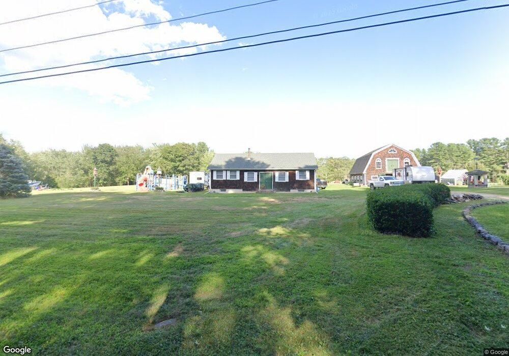
37 Mt Kineo Rd Kennebunkport, ME 04046
Estimated Value: $490,000 - $692,000
1
Bed
1
Bath
1,232
Sq Ft
$459/Sq Ft
Est. Value
About This Home
This home is located at 37 Mt Kineo Rd, Kennebunkport, ME 04046 and is currently estimated at $565,973, approximately $459 per square foot. 37 Mt Kineo Rd is a home with nearby schools including Kennebunk High School and School Around Us.
Create a Home Valuation Report for This Property
The Home Valuation Report is an in-depth analysis detailing your home's value as well as a comparison with similar homes in the area
Home Values in the Area
Average Home Value in this Area
Tax History Compared to Growth
Tax History
| Year | Tax Paid | Tax Assessment Tax Assessment Total Assessment is a certain percentage of the fair market value that is determined by local assessors to be the total taxable value of land and additions on the property. | Land | Improvement |
|---|---|---|---|---|
| 2025 | $2,903 | $421,900 | $245,400 | $176,500 |
| 2024 | $2,742 | $421,900 | $245,400 | $176,500 |
| 2023 | $2,637 | $421,900 | $245,400 | $176,500 |
| 2022 | $2,522 | $420,400 | $245,400 | $175,000 |
| 2021 | $2,568 | $267,500 | $131,100 | $136,400 |
| 2020 | $2,528 | $267,500 | $131,100 | $136,400 |
| 2019 | $2,528 | $267,500 | $131,100 | $136,400 |
| 2018 | $2,343 | $267,500 | $131,100 | $136,400 |
| 2017 | $2,299 | $264,300 | $131,100 | $133,200 |
| 2016 | $2,188 | $264,300 | $131,100 | $133,200 |
| 2015 | $1,958 | $264,300 | $131,100 | $133,200 |
| 2014 | $2,017 | $264,300 | $131,100 | $133,200 |
Source: Public Records
Map
Nearby Homes
- 38 Mt Kineo Rd
- 43 Mt Kineo Rd
- 31 Mt Kineo Rd
- 32 Mt Kineo Rd
- 12 Scargo Way
- 53 Log Cabin Rd
- 56 Mt Kineo Rd
- 21 Mt Kineo Rd
- 15 Scargo Way
- 20 Mt Kineo Rd
- 16 Scargo Way
- 65 Log Cabin Rd
- 61 Log Cabin Rd
- 15R Fairfield Hill Rd
- 17 Mt Kineo Rd
- 8 Granite Heights Rd
- 14 Mt Kineo Rd
- 0 Granite Heights
- 56 Log Cabin Rd
- 58 Log Cabin Rd