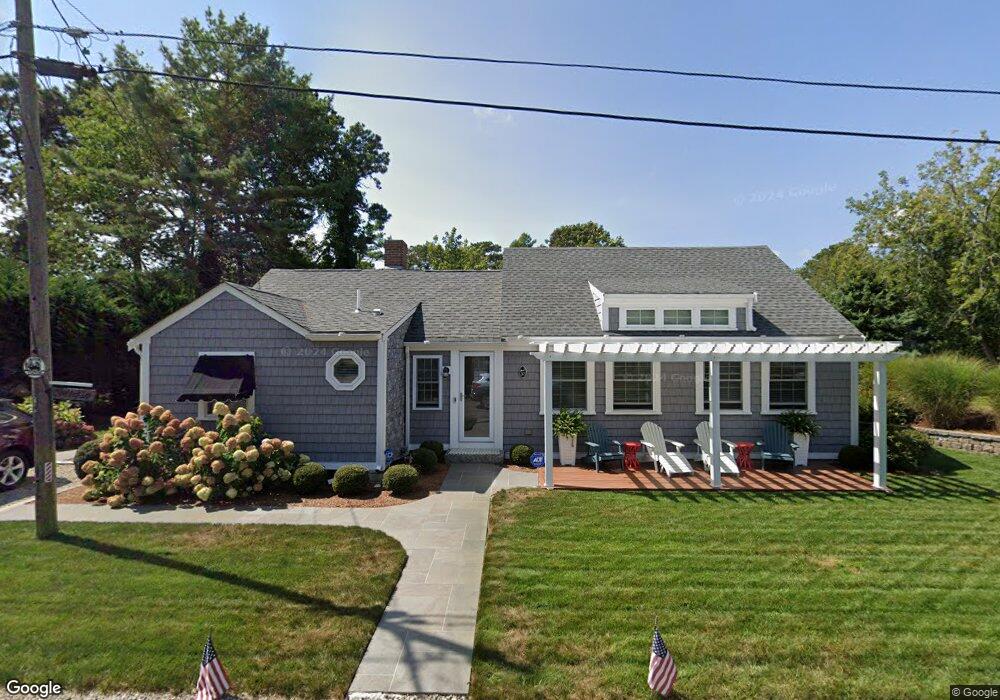
37 Myrtle Rd Dennis Port, MA 02639
Dennis Port NeighborhoodEstimated Value: $578,000 - $737,000
3
Beds
1
Bath
1,001
Sq Ft
$654/Sq Ft
Est. Value
About This Home
This home is located at 37 Myrtle Rd, Dennis Port, MA 02639 and is currently estimated at $654,777, approximately $654 per square foot. 37 Myrtle Rd is a home located in Barnstable County with nearby schools including Dennis-Yarmouth Regional High School and St. Pius X. School.
Ownership History
Date
Name
Owned For
Owner Type
Purchase Details
Closed on
May 20, 1994
Sold by
Rotondo Moseph M and Rotondo Helen J
Bought by
Nunberg N Robert and Nunberg Elizabeth J
Current Estimated Value
Home Financials for this Owner
Home Financials are based on the most recent Mortgage that was taken out on this home.
Original Mortgage
$89,600
Interest Rate
8.44%
Mortgage Type
Purchase Money Mortgage
Create a Home Valuation Report for This Property
The Home Valuation Report is an in-depth analysis detailing your home's value as well as a comparison with similar homes in the area
Home Values in the Area
Average Home Value in this Area
Purchase History
| Date | Buyer | Sale Price | Title Company |
|---|---|---|---|
| Nunberg N Robert | $112,000 | -- |
Source: Public Records
Mortgage History
| Date | Status | Borrower | Loan Amount |
|---|---|---|---|
| Open | Nunberg N Robert | $84,000 | |
| Closed | Nunberg N Robert | $89,600 |
Source: Public Records
Tax History Compared to Growth
Tax History
| Year | Tax Paid | Tax Assessment Tax Assessment Total Assessment is a certain percentage of the fair market value that is determined by local assessors to be the total taxable value of land and additions on the property. | Land | Improvement |
|---|---|---|---|---|
| 2025 | $2,792 | $644,900 | $308,700 | $336,200 |
| 2024 | $2,645 | $602,500 | $296,900 | $305,600 |
| 2023 | $2,558 | $547,800 | $269,900 | $277,900 |
| 2022 | $2,337 | $417,400 | $212,700 | $204,700 |
| 2021 | $2,223 | $368,700 | $208,600 | $160,100 |
| 2020 | $2,194 | $359,700 | $208,600 | $151,100 |
| 2019 | $2,201 | $356,700 | $222,000 | $134,700 |
| 2018 | $2,225 | $350,900 | $211,300 | $139,600 |
| 2017 | $2,056 | $334,300 | $194,700 | $139,600 |
| 2016 | $1,976 | $302,600 | $183,500 | $119,100 |
| 2015 | $1,937 | $302,600 | $183,500 | $119,100 |
| 2014 | $1,828 | $287,900 | $172,400 | $115,500 |
Source: Public Records
Map
Nearby Homes
- 37-A Beach Hills Rd
- 22 Ferncliff Rd
- 37 Beach Hills Rd
- 102 Sea St
- 262 Old Wharf Rd Unit 67
- 262 Old Wharf Rd Unit 5
- 262 Old Wharf Rd Unit 5
- 262 Old Wharf Rd Unit 20
- 262 Old Wharf Rd Unit 87
- 241 Old Wharf Rd Unit 82
- 241 Old Wharf Rd Unit 127
- 241 Old Wharf Rd Unit 90
- 402 Old Wharf Rd
- 402 Old Wharf Rd
- 405 Old Wharf Rd Unit B204
- 405 Old Wharf Rd Unit B204
- 217 Old Wharf Rd Unit 64
- 31 Easy St
- 9 Chase Ave Unit 6
- 11 Ocean Park W
- 246 Shad Hole Rd
- 250 Shad Hole Rd
- 9 Arbor Way
- 38 Myrtle Rd
- 42 Myrtle Rd
- 36 Myrtle Rd
- 244 Shad Hole Rd
- 244 Shad Hole Rd Unit 3
- 244 Shad Hole Rd Unit 1-2-3
- 244 Shad Hole Rd Unit 1-3
- 254 Shad Hole Rd
- 32 Myrtle Rd
- 44 Myrtle Rd
- 39 Ferncliff Rd
- 43 Ferncliff Rd
- 35 Ferncliff Rd
- 60 Ferncliff Rd
- 27 Myrtle Rd
- 245 Shad Hole Rd
- 24 Laurel Rd