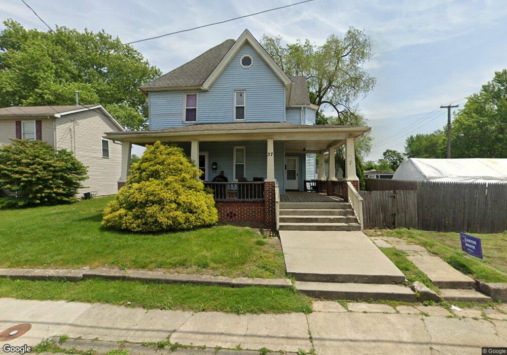
37 N Broad St Penns Grove, NJ 08069
Estimated Value: $122,000 - $224,000
--
Bed
--
Bath
1,666
Sq Ft
$109/Sq Ft
Est. Value
About This Home
This home is located at 37 N Broad St, Penns Grove, NJ 08069 and is currently estimated at $181,655, approximately $109 per square foot. 37 N Broad St is a home located in Salem County with nearby schools including Lafayette-Pershing Elementary School, Field Street Elementary School, and Paul W. Carleton Elementary School.
Ownership History
Date
Name
Owned For
Owner Type
Purchase Details
Closed on
Jan 19, 2007
Sold by
Spinelli Jean
Bought by
Taylor Mike
Current Estimated Value
Purchase Details
Closed on
Jul 15, 2005
Sold by
Mason Eric L and Mason Dawn A
Bought by
Spinelli Jean M
Home Financials for this Owner
Home Financials are based on the most recent Mortgage that was taken out on this home.
Original Mortgage
$105,000
Interest Rate
5.67%
Mortgage Type
Fannie Mae Freddie Mac
Purchase Details
Closed on
Jun 27, 2002
Sold by
Brolley John and Brolley Karen
Bought by
Mason Eric L and Mason Dawn A
Home Financials for this Owner
Home Financials are based on the most recent Mortgage that was taken out on this home.
Original Mortgage
$56,950
Interest Rate
6.92%
Create a Home Valuation Report for This Property
The Home Valuation Report is an in-depth analysis detailing your home's value as well as a comparison with similar homes in the area
Home Values in the Area
Average Home Value in this Area
Purchase History
| Date | Buyer | Sale Price | Title Company |
|---|---|---|---|
| Taylor Mike | $165,000 | -- | |
| Spinelli Jean M | $85,000 | -- | |
| Mason Eric L | $67,000 | West Jersey Title Agency |
Source: Public Records
Mortgage History
| Date | Status | Borrower | Loan Amount |
|---|---|---|---|
| Previous Owner | Spinelli Jean M | $105,000 | |
| Previous Owner | Mason Eric L | $56,950 |
Source: Public Records
Tax History Compared to Growth
Tax History
| Year | Tax Paid | Tax Assessment Tax Assessment Total Assessment is a certain percentage of the fair market value that is determined by local assessors to be the total taxable value of land and additions on the property. | Land | Improvement |
|---|---|---|---|---|
| 2025 | $5,014 | $90,400 | $14,800 | $75,600 |
| 2024 | $4,845 | $90,400 | $14,800 | $75,600 |
| 2023 | $4,845 | $90,400 | $14,800 | $75,600 |
| 2022 | $4,671 | $90,400 | $14,800 | $75,600 |
| 2021 | $4,469 | $90,400 | $14,800 | $75,600 |
| 2020 | $4,528 | $90,400 | $14,800 | $75,600 |
| 2019 | $4,547 | $90,400 | $14,800 | $75,600 |
| 2018 | $5,397 | $110,000 | $19,700 | $90,300 |
| 2017 | $5,416 | $133,800 | $19,700 | $114,100 |
| 2016 | $5,212 | $133,800 | $19,700 | $114,100 |
| 2015 | $4,992 | $133,800 | $19,700 | $114,100 |
| 2014 | $4,937 | $133,800 | $19,700 | $114,100 |
Source: Public Records
Map
Nearby Homes
- 6 W Griffith St
- 18 Pearl St
- 3 Naylor Ave
- 31 Elvin Ave
- 78 W Harmony St
- 0 Cumberland Ave
- 113 N Broad St
- 35 Franklin St
- 88 Railroad Ave
- 0 Lincoln Avenue & Cumberland
- 80 S Broad St
- 27 E Line St
- 54 W Pitman St
- 59 61 Broad St
- 15 Walnut St
- 34 38 Cumberland Ave
- 71 Poplar St
- 106 S Broad St
- 39 41 Cumberland Ave
- 85 State St
- 39 N Broad St Unit 41
- 43 N Broad St Unit 45
- 5 E Harmony St
- 49 N Broad St
- 7 E Harmony St
- 46 N Broad St
- 48 N Broad St
- 50 N Broad St
- 18 Broad St
- 57 N Broad St
- 13 E Griffith St
- 2 W Griffith St
- 9 E Griffith St
- 11 N Broad St
- 11 E Griffith St
- 4 W Griffith St
- 14 N Broad St
- 14 N Broad St
- 24 E Harmony St
- 15 E Griffith St