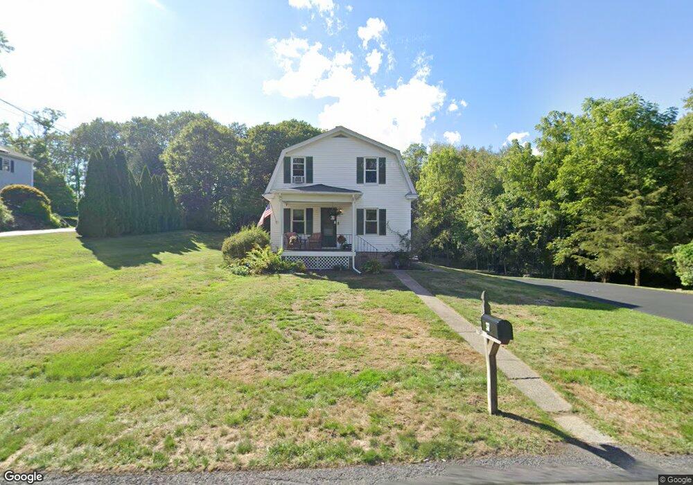
37 Newport Ave Attleboro, MA 02703
Estimated Value: $486,806 - $519,000
3
Beds
1
Bath
1,200
Sq Ft
$413/Sq Ft
Est. Value
About This Home
This home is located at 37 Newport Ave, Attleboro, MA 02703 and is currently estimated at $495,452, approximately $412 per square foot. 37 Newport Ave is a home located in Bristol County with nearby schools including A. Irvin Studley Elementary School, Robert J. Coelho Middle School, and Attleboro High School.
Ownership History
Date
Name
Owned For
Owner Type
Purchase Details
Closed on
Jan 21, 2025
Sold by
Harrison Brian
Bought by
Brian M Harrison Ret and Harrison
Current Estimated Value
Purchase Details
Closed on
Jan 9, 2017
Sold by
County Street Realty C
Bought by
White Michael and White Debra
Purchase Details
Closed on
Sep 3, 2009
Sold by
Harrison Brian and Harrison Brenda Adams
Bought by
Harrison Brian
Purchase Details
Closed on
Jun 11, 2004
Sold by
Barrows Peter J and Barrows Karen D
Bought by
Harrison Brian and Adams Brenda
Home Financials for this Owner
Home Financials are based on the most recent Mortgage that was taken out on this home.
Original Mortgage
$252,700
Interest Rate
5.99%
Mortgage Type
Purchase Money Mortgage
Purchase Details
Closed on
Jan 25, 2002
Sold by
County St Rlty
Bought by
Durkee Timothy M and Durkee Terry S
Home Financials for this Owner
Home Financials are based on the most recent Mortgage that was taken out on this home.
Original Mortgage
$270,952
Interest Rate
7.08%
Mortgage Type
Purchase Money Mortgage
Purchase Details
Closed on
Feb 21, 2001
Sold by
County Street Rlty Cor
Bought by
Barrows Peter J and Pratt Karen D
Home Financials for this Owner
Home Financials are based on the most recent Mortgage that was taken out on this home.
Original Mortgage
$145,950
Interest Rate
6.89%
Mortgage Type
Purchase Money Mortgage
Purchase Details
Closed on
Jan 24, 2001
Sold by
Rando Realty Trust and Rando Joseph D
Bought by
County Street Rty Corp
Home Financials for this Owner
Home Financials are based on the most recent Mortgage that was taken out on this home.
Original Mortgage
$145,950
Interest Rate
6.89%
Mortgage Type
Purchase Money Mortgage
Purchase Details
Closed on
Sep 20, 2000
Sold by
Michalik Phyllis and Thomas Richard W
Bought by
County Street Rlty
Home Financials for this Owner
Home Financials are based on the most recent Mortgage that was taken out on this home.
Original Mortgage
$204,000
Interest Rate
8%
Mortgage Type
Purchase Money Mortgage
Create a Home Valuation Report for This Property
The Home Valuation Report is an in-depth analysis detailing your home's value as well as a comparison with similar homes in the area
Home Values in the Area
Average Home Value in this Area
Purchase History
| Date | Buyer | Sale Price | Title Company |
|---|---|---|---|
| Brian M Harrison Ret | -- | None Available | |
| White Michael | $85,000 | -- | |
| Harrison Brian | -- | -- | |
| Harrison Brian | $263,000 | -- | |
| Durkee Timothy M | $338,690 | -- | |
| Barrows Peter J | $156,950 | -- | |
| County Street Rty Corp | $5,000 | -- | |
| County Street Rlty | $239,900 | -- |
Source: Public Records
Mortgage History
| Date | Status | Borrower | Loan Amount |
|---|---|---|---|
| Previous Owner | Harrison Brian | $252,700 | |
| Previous Owner | County Street Rlty | $270,952 | |
| Previous Owner | County Street Rlty | $145,950 | |
| Previous Owner | County Street Rlty | $204,000 |
Source: Public Records
Tax History Compared to Growth
Tax History
| Year | Tax Paid | Tax Assessment Tax Assessment Total Assessment is a certain percentage of the fair market value that is determined by local assessors to be the total taxable value of land and additions on the property. | Land | Improvement |
|---|---|---|---|---|
| 2025 | $5,124 | $408,300 | $180,700 | $227,600 |
| 2024 | $4,870 | $382,600 | $163,300 | $219,300 |
| 2023 | $4,623 | $337,700 | $164,900 | $172,800 |
| 2022 | $4,589 | $317,600 | $157,500 | $160,100 |
| 2021 | $4,403 | $297,500 | $151,700 | $145,800 |
| 2020 | $4,265 | $292,900 | $145,100 | $147,800 |
| 2019 | $3,973 | $280,600 | $142,500 | $138,100 |
| 2018 | $4,125 | $277,200 | $138,500 | $138,700 |
| 2017 | $3,835 | $263,600 | $135,100 | $128,500 |
| 2016 | $3,741 | $252,400 | $126,800 | $125,600 |
| 2015 | $3,735 | $253,900 | $126,800 | $127,100 |
| 2014 | $3,592 | $241,900 | $121,300 | $120,600 |
Source: Public Records
Map
Nearby Homes
- 338 Newport Ave
- 135 Cumberland Ave
- 23 Cumberland Ave
- 176 Read St
- 0 Middle St
- 543 Newport Ave
- 15 Arline Dr
- 31 Paine Rd
- 155 May St
- 59 Samuel Way
- 11 Howarth Ave
- 27 Killarney Way
- 181 Paine Rd
- 64 Highland Ave Unit A
- 64 Highland Ave Unit B
- 660 Thacher St Unit 1402
- 101 South Ave Unit 803
- 0 Mendon Rd
- 130 Zoar Ave
- 1 Frederick a Nittel Dr
- 80 Newport Ave
- 78 Newport Ave
- 39A Newport Ave
- 39B Newport Ave
- 39 Newport Ave
- 1 Logans Run Unit Lot 1
- 1 Logans Run
- 54 Newport Ave
- 3 Logans Run Unit lot 3
- 100 Newport Ave
- 31 Newport Ave
- 41 Newport Ave
- 52R Newport Ave
- 52 Newport Ave
- 16 Logans Run
- 39 Newport Ave
- 84 Newport Ave
- 24 Logans Run
- 45 Newport Ave
- 25 Newport Ave