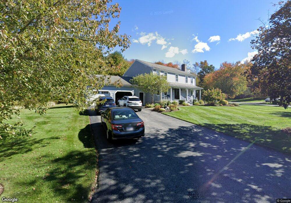
37 Nichols St Rehoboth, MA 02769
Estimated Value: $652,391 - $1,015,000
3
Beds
3
Baths
2,240
Sq Ft
$349/Sq Ft
Est. Value
About This Home
This home is located at 37 Nichols St, Rehoboth, MA 02769 and is currently estimated at $782,348, approximately $349 per square foot. 37 Nichols St is a home located in Bristol County with nearby schools including Dighton-Rehoboth Regional High School and Highlander Charter Middle and High School.
Ownership History
Date
Name
Owned For
Owner Type
Purchase Details
Closed on
Feb 28, 2025
Sold by
Goff Robert S and Goff Marilyn
Bought by
Goff Income-Only Ft and Sor
Current Estimated Value
Purchase Details
Closed on
Sep 7, 1995
Sold by
Ferreira Frank
Bought by
Goff Frank S and Goff Marilyn
Home Financials for this Owner
Home Financials are based on the most recent Mortgage that was taken out on this home.
Original Mortgage
$226,100
Interest Rate
7.8%
Mortgage Type
Purchase Money Mortgage
Create a Home Valuation Report for This Property
The Home Valuation Report is an in-depth analysis detailing your home's value as well as a comparison with similar homes in the area
Home Values in the Area
Average Home Value in this Area
Purchase History
| Date | Buyer | Sale Price | Title Company |
|---|---|---|---|
| Goff Income-Only Ft | -- | None Available | |
| Goff Income-Only Ft | -- | None Available | |
| Goff Frank S | $239,900 | -- | |
| Goff Frank S | $239,900 | -- |
Source: Public Records
Mortgage History
| Date | Status | Borrower | Loan Amount |
|---|---|---|---|
| Previous Owner | Goff Frank S | $136,000 | |
| Previous Owner | Goff Frank S | $165,000 | |
| Previous Owner | Goff Frank S | $226,100 |
Source: Public Records
Tax History Compared to Growth
Tax History
| Year | Tax Paid | Tax Assessment Tax Assessment Total Assessment is a certain percentage of the fair market value that is determined by local assessors to be the total taxable value of land and additions on the property. | Land | Improvement |
|---|---|---|---|---|
| 2025 | $5,655 | $507,200 | $174,500 | $332,700 |
| 2024 | $6,161 | $542,300 | $209,100 | $333,200 |
| 2023 | $5,792 | $500,200 | $204,700 | $295,500 |
| 2022 | $5,598 | $441,800 | $187,800 | $254,000 |
| 2021 | $9,958 | $406,700 | $171,200 | $235,500 |
| 2020 | $6,887 | $417,400 | $179,200 | $238,200 |
| 2018 | $4,693 | $392,100 | $170,700 | $221,400 |
| 2017 | $9,279 | $357,900 | $170,700 | $187,200 |
| 2016 | $4,441 | $365,500 | $178,300 | $187,200 |
| 2015 | $4,173 | $339,000 | $170,100 | $168,900 |
| 2014 | $4,114 | $330,700 | $161,800 | $168,900 |
Source: Public Records
Map
Nearby Homes
- 267 Chestnut St
- 36 Columbine Rd
- 92 Martin St
- 198 Brook St
- 75 Martin St
- 129 Cameron Way
- 3a Johnnies Way
- 3b Johnnies Way
- 39 Peckham St
- 3 Johnnies Way
- 32 Providence St
- 7 Johnnies Way
- 120 Plain St
- 42 Linden Ln
- 17 Sassafras Rd
- 14 Deborah Ann Dr Unit 41
- 1 Cedarbrook Unit A
- 16 Martin St
- 127 Mason St
- 8 Linden Ln
- 15 Greenwood Dr
- 38 Nichols St
- 42 Nichols St
- 33 Nichols St
- 10 Greenwood Dr
- 34 Nichols St
- 9 Greenwood Dr
- 46 Nichols St
- 5 Greenwood Dr
- 29 Nichols St
- 30 Nichols St
- 74 Pleasant St
- 25 Nichols St
- 26 Nichols St
- 82 Pleasant St
- 70 Pleasant St
- 88 Pleasant St
- 88 Pleasant St Unit 1
- 88 Pleasant St Unit single
- 1 Aspen Way