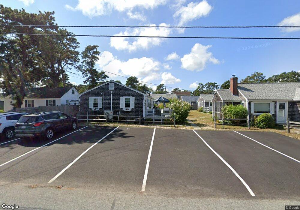
37 Ocean Dr Unit 7 Dennis Port, MA 02639
Dennis Port NeighborhoodEstimated Value: $389,000 - $457,664
3
Beds
1
Bath
650
Sq Ft
$656/Sq Ft
Est. Value
About This Home
This home is located at 37 Ocean Dr Unit 7, Dennis Port, MA 02639 and is currently estimated at $426,416, approximately $656 per square foot. 37 Ocean Dr Unit 7 is a home located in Barnstable County with nearby schools including Dennis-Yarmouth Regional High School and St. Pius X. School.
Ownership History
Date
Name
Owned For
Owner Type
Purchase Details
Closed on
Sep 16, 1997
Sold by
Godleski Jay E and Hebard William G
Bought by
Fannon William J and Fannon Janet L
Current Estimated Value
Home Financials for this Owner
Home Financials are based on the most recent Mortgage that was taken out on this home.
Original Mortgage
$40,000
Outstanding Balance
$6,112
Interest Rate
7.31%
Mortgage Type
Purchase Money Mortgage
Estimated Equity
$420,304
Create a Home Valuation Report for This Property
The Home Valuation Report is an in-depth analysis detailing your home's value as well as a comparison with similar homes in the area
Home Values in the Area
Average Home Value in this Area
Purchase History
| Date | Buyer | Sale Price | Title Company |
|---|---|---|---|
| Fannon William J | $62,750 | -- |
Source: Public Records
Mortgage History
| Date | Status | Borrower | Loan Amount |
|---|---|---|---|
| Open | Fannon William J | $40,000 |
Source: Public Records
Tax History Compared to Growth
Tax History
| Year | Tax Paid | Tax Assessment Tax Assessment Total Assessment is a certain percentage of the fair market value that is determined by local assessors to be the total taxable value of land and additions on the property. | Land | Improvement |
|---|---|---|---|---|
| 2025 | $1,504 | $347,400 | $0 | $347,400 |
| 2024 | $1,420 | $323,400 | $0 | $323,400 |
| 2023 | $1,108 | $237,200 | $0 | $237,200 |
| 2022 | $1,076 | $192,100 | $0 | $192,100 |
| 2021 | $1,076 | $178,400 | $0 | $178,400 |
| 2020 | $1,057 | $173,200 | $0 | $173,200 |
| 2019 | $1,029 | $166,800 | $0 | $166,800 |
| 2018 | $4,449 | $159,200 | $0 | $159,200 |
| 2017 | $979 | $159,200 | $0 | $159,200 |
| 2016 | $1,053 | $161,300 | $0 | $161,300 |
| 2015 | $1,032 | $161,300 | $0 | $161,300 |
| 2014 | $1,122 | $176,700 | $0 | $176,700 |
Source: Public Records
Map
Nearby Homes
- 37 Ocean Dr Unit 2
- 64 Beaten Rd
- 112 Old Wharf Rd Unit E4
- 112 Old Wharf Rd Unit E1
- 120 Old Wharf Rd Unit 11
- 154 Old Wharf Rd Unit 26
- 154 Old Wharf Rd Unit 14
- 80 Michaels Ave
- 217 Old Wharf Rd Unit 64
- 241 Old Wharf Rd Unit 82
- 241 Old Wharf Rd Unit 127
- 241 Old Wharf Rd Unit 90
- 6 Baker Way
- 31 Easy St
- 262 Old Wharf Rd Unit 67
- 262 Old Wharf Rd Unit 5
- 262 Old Wharf Rd Unit 5
- 262 Old Wharf Rd Unit 20
- 262 Old Wharf Rd Unit 87
- 37 Beach Hills Rd
- 37 Ocean Dr Unit 6
- 37 Ocean Dr Unit 5
- 37 Ocean Dr Unit 4
- 37 Ocean Dr Unit 3
- 37 Ocean Dr Unit 1
- 37 Ocean Dr
- 39 Ocean Dr Unit 1
- 39 Ocean Dr Unit 3
- 39 Ocean Dr Unit 4
- 39 Ocean Dr Unit 6
- 43 Ocean Dr
- 33 Ocean Dr
- 30 Shirley Ave
- 30 Shirley Ave
- 28 Shirley Ave
- 32 Shirley Ave
- 26 Shirley Ave
- 0 Shirley Ave
- 31 Ocean Dr
- 45 Ocean Dr