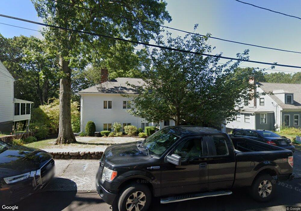
37 Parkside Cir Braintree, MA 02184
North Braintree NeighborhoodEstimated Value: $973,205 - $1,122,000
4
Beds
4
Baths
2,999
Sq Ft
$340/Sq Ft
Est. Value
About This Home
This home is located at 37 Parkside Cir, Braintree, MA 02184 and is currently estimated at $1,021,051, approximately $340 per square foot. 37 Parkside Cir is a home located in Norfolk County with nearby schools including Braintree High School, Step Ahead Kindergarten, and Meeting House Montessori School.
Ownership History
Date
Name
Owned For
Owner Type
Purchase Details
Closed on
Oct 29, 2004
Sold by
Jjb Rt
Bought by
Wadland Jennifer A and Wadland Robert A
Current Estimated Value
Home Financials for this Owner
Home Financials are based on the most recent Mortgage that was taken out on this home.
Original Mortgage
$490,500
Outstanding Balance
$240,732
Interest Rate
5.74%
Mortgage Type
Purchase Money Mortgage
Estimated Equity
$780,319
Purchase Details
Closed on
Mar 23, 1989
Sold by
Preston Norman T
Bought by
Jamali Teymour
Home Financials for this Owner
Home Financials are based on the most recent Mortgage that was taken out on this home.
Original Mortgage
$216,000
Interest Rate
10.49%
Mortgage Type
Purchase Money Mortgage
Create a Home Valuation Report for This Property
The Home Valuation Report is an in-depth analysis detailing your home's value as well as a comparison with similar homes in the area
Home Values in the Area
Average Home Value in this Area
Purchase History
| Date | Buyer | Sale Price | Title Company |
|---|---|---|---|
| Wadland Jennifer A | $635,000 | -- | |
| Wadland Jennifer A | $635,000 | -- | |
| Jamali Teymour | $240,000 | -- |
Source: Public Records
Mortgage History
| Date | Status | Borrower | Loan Amount |
|---|---|---|---|
| Open | Wadland Jennifer A | $490,500 | |
| Closed | Wadland Jennifer A | $490,500 | |
| Previous Owner | Jamali Teymour | $188,750 | |
| Previous Owner | Jamali Teymour | $216,000 |
Source: Public Records
Tax History
| Year | Tax Paid | Tax Assessment Tax Assessment Total Assessment is a certain percentage of the fair market value that is determined by local assessors to be the total taxable value of land and additions on the property. | Land | Improvement |
|---|---|---|---|---|
| 2025 | $8,098 | $811,400 | $392,200 | $419,200 |
| 2024 | $7,247 | $764,400 | $350,100 | $414,300 |
| 2023 | $7,017 | $719,000 | $317,500 | $401,500 |
| 2022 | $6,782 | $681,600 | $280,100 | $401,500 |
| 2021 | $6,477 | $651,000 | $280,100 | $370,900 |
| 2020 | $6,088 | $617,400 | $246,500 | $370,900 |
| 2019 | $6,075 | $602,100 | $246,500 | $355,600 |
| 2018 | $5,949 | $564,400 | $224,100 | $340,300 |
| 2017 | $5,802 | $540,200 | $224,100 | $316,100 |
| 2016 | $5,674 | $516,800 | $201,700 | $315,100 |
| 2015 | $5,594 | $505,300 | $201,700 | $303,600 |
| 2014 | $5,142 | $450,300 | $167,100 | $283,200 |
Source: Public Records
Map
Nearby Homes
- 6 Oak St
- 15 Calvin St
- 29 Joseph Rd
- 63 Dickerman Ln
- 491 Washington St Unit 1
- 7 Del's Way
- 20 Blossom Rd
- 47 Addison St
- 30 Church St Unit 4
- 5 Woodsum Dr Unit 12
- 20 Vine St
- 9 Independence Ave Unit 307
- 18 Royal Lake Dr Unit 3
- 17 White Rd
- 50 Cleveland Ave
- 6 Franklin St
- 342 Elm St
- 36 Chestnut Ave
- 21 Totman St Unit 205
- 21 Totman St Unit 404
- 31 Parkside Cir
- 43 Parkside Cir
- 44 Parkside Cir
- 29 Parkside Cir
- 7 Gale Ave
- 7 Gale Ave Unit Single fam
- 28 Parkside Cir
- 11 Gale Ave
- 49 Parkside Cir
- 25 Gale Ave
- 58 Parkside Cir
- 53 Parkside Cir
- 27 Parkside Cir
- 16 Parkside Cir
- 59 Parkside Cir
- 6 Gale Ave
- 31 Gale Ave
- 62 Parkside Cir
- 36 Rita Rd
- 21 Parkside Cir
Your Personal Tour Guide
Ask me questions while you tour the home.