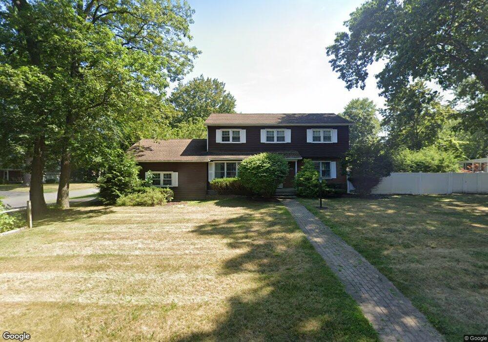
37 Pheasant Ln Delmar, NY 12054
Estimated Value: $480,000 - $562,000
4
Beds
3
Baths
2,226
Sq Ft
$234/Sq Ft
Est. Value
About This Home
This home is located at 37 Pheasant Ln, Delmar, NY 12054 and is currently estimated at $521,373, approximately $234 per square foot. 37 Pheasant Ln is a home located in Albany County with nearby schools including St. Thomas the Apostle School and Mt. Moriah Academy.
Ownership History
Date
Name
Owned For
Owner Type
Purchase Details
Closed on
Jun 15, 2011
Sold by
Haase William S and Haase Martha C
Bought by
Grisaru Elizabeth and Greenberg Debra
Current Estimated Value
Home Financials for this Owner
Home Financials are based on the most recent Mortgage that was taken out on this home.
Original Mortgage
$225,000
Interest Rate
4.63%
Create a Home Valuation Report for This Property
The Home Valuation Report is an in-depth analysis detailing your home's value as well as a comparison with similar homes in the area
Home Values in the Area
Average Home Value in this Area
Purchase History
| Date | Buyer | Sale Price | Title Company |
|---|---|---|---|
| Grisaru Elizabeth | $285,000 | Stewart Title Insurance Co |
Source: Public Records
Mortgage History
| Date | Status | Borrower | Loan Amount |
|---|---|---|---|
| Open | Grisaru Elizabeth | $199,300 | |
| Closed | Grisaru Elizabeth | $225,000 | |
| Previous Owner | Haase William S | $65,000 | |
| Previous Owner | Haase William S | $115,000 |
Source: Public Records
Tax History
| Year | Tax Paid | Tax Assessment Tax Assessment Total Assessment is a certain percentage of the fair market value that is determined by local assessors to be the total taxable value of land and additions on the property. | Land | Improvement |
|---|---|---|---|---|
| 2024 | $9,554 | $290,400 | $63,000 | $227,400 |
| 2023 | $9,301 | $290,400 | $63,000 | $227,400 |
| 2022 | $9,105 | $290,400 | $63,000 | $227,400 |
| 2021 | $9,168 | $290,400 | $63,000 | $227,400 |
| 2020 | $9,117 | $290,400 | $63,000 | $227,400 |
| 2019 | $7,905 | $290,400 | $63,000 | $227,400 |
| 2018 | $8,331 | $290,400 | $63,000 | $227,400 |
| 2017 | $8,191 | $290,400 | $63,000 | $227,400 |
| 2016 | $8,191 | $290,400 | $63,000 | $227,400 |
| 2015 | -- | $290,400 | $63,000 | $227,400 |
| 2014 | -- | $285,000 | $63,000 | $222,000 |
Source: Public Records
Map
Nearby Homes
- 23 Woodmont Dr
- 8 Wedge Rd
- 17 Camden Cir
- 24 Bain Dr
- 44 Kendall Dr
- 43 Harrison Ave
- 264 Kenwood Ave
- 8 Malden Ln
- 525 Kenwood Ave
- 77 Somerset Dr
- 468 Elm Ave
- 3 Groesbeck Place
- 102 Brightonwood Rd
- 8 Sherbrook Dr
- 193 Bender Ln
- 234 (Parcel 2) Bender Ln
- 39 Constitution Dr
- 505 Elm Ave
- 51 Peel St
- L16 Oakwood Place
- 35 Woodstream Dr
- 33 Pheasant Ln
- 38 Pheasant Ln
- 39 Woodstream Dr
- 27 Pheasant Ln
- 36 Pheasant Ln
- 32 Woodstream Dr
- 34 Woodstream Dr
- 28 Woodstream Dr
- 32 Pheasant Ln
- 49 Woodstream Dr
- 38 Woodstream Dr
- 24 Woodstream Dr
- 45 Woodstream Dr
- 23 Pheasant Ln
- 19 Woodstream Dr
- 30 Pheasant Ln
- 20 Woodstream Dr
- 42 Woodstream Dr
- 3 Catherine St
Your Personal Tour Guide
Ask me questions while you tour the home.